
(Read a personal description of Backblaze here.)
(7/8/06-)
On this page are pictures and descriptions from 7/14/06 - 7/17/06. Click on any picture or panorama for an ENORMOUS version. Click here to go to the homepage and get a description of what this is all about.
(Read
a personal
description of Backblaze here.)
At about noon on 7/14/06, I left Tonasket, Washington, drove to Nighthawk, Washington, then north across the border into Canada. Here I am at the border crossing Chopaka, Canada. Taking this photo got me in a little trouble with the border guard, but he let me keep the photo.
This is a huge lake in Canada (probably small by Canadian standards). This lake was along Canada highway 97, and is called Okanagan Lake. This photo is just south of where I stopped for the night in Kelowna, Canada on my motorcycle trip through Canada.
On the morning of 7/15/06, I was planning on going West. But at breakfast I met a couple of local motorcyclists who recommended a good motorcycle loop that starts in Kelowna and goes East on Canada Highway 6 through the Needles Ferry, and then north on Canada Highway 23 up to the Galena Bay Ferry, up through the town of Revelstoke, then back West on the Trans Canadian Highway (Canada Highway 1). I did this loop on 7/15/06, ending up staying in the town of Kamloops, Canada. Below is a map labeled "A", "B", "C", "D", "E" for the general route. This took me about 7 hours of motorcycle driving time (a total of 8 and a half hours including lunch and coffee breaks).
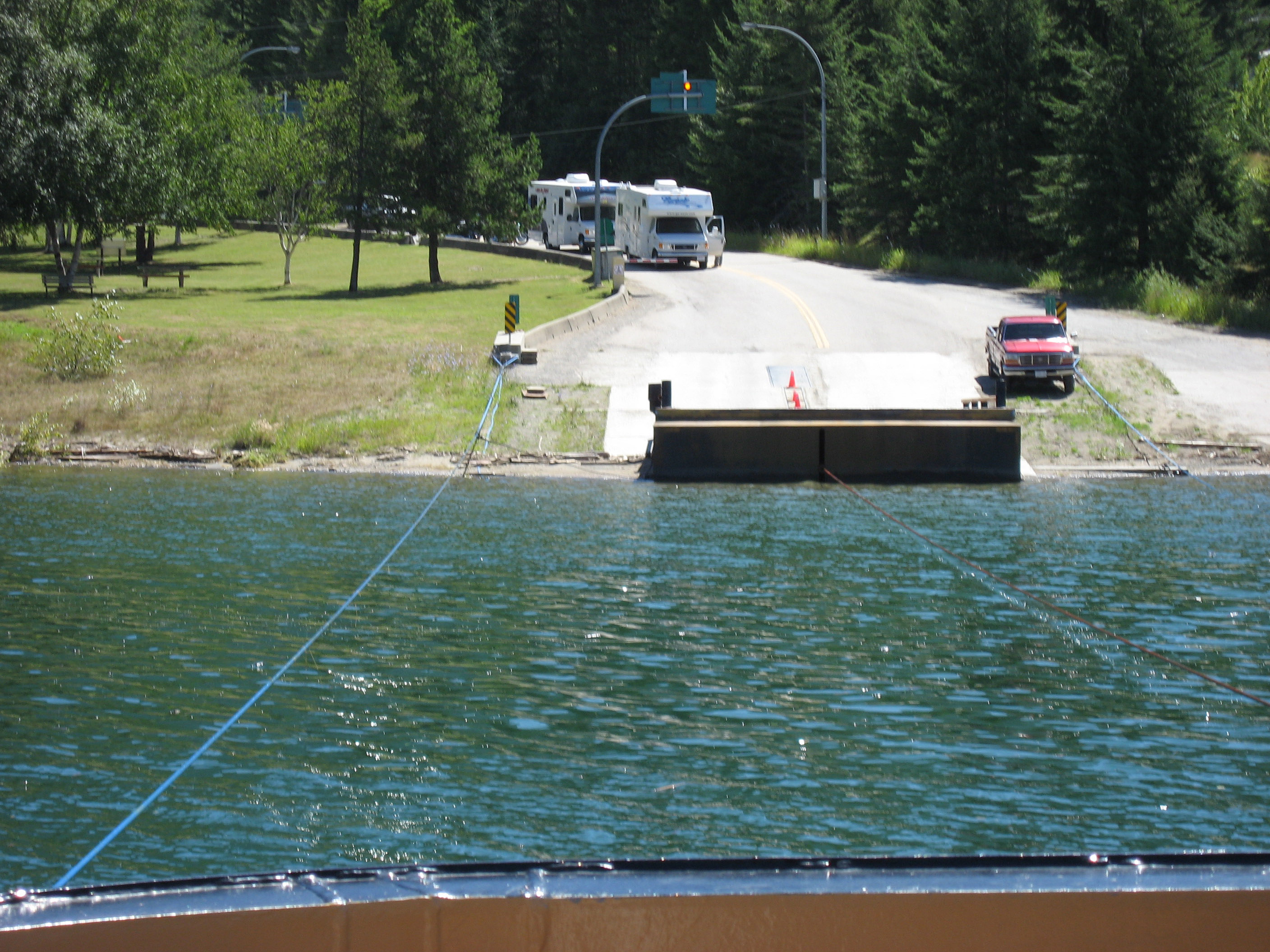
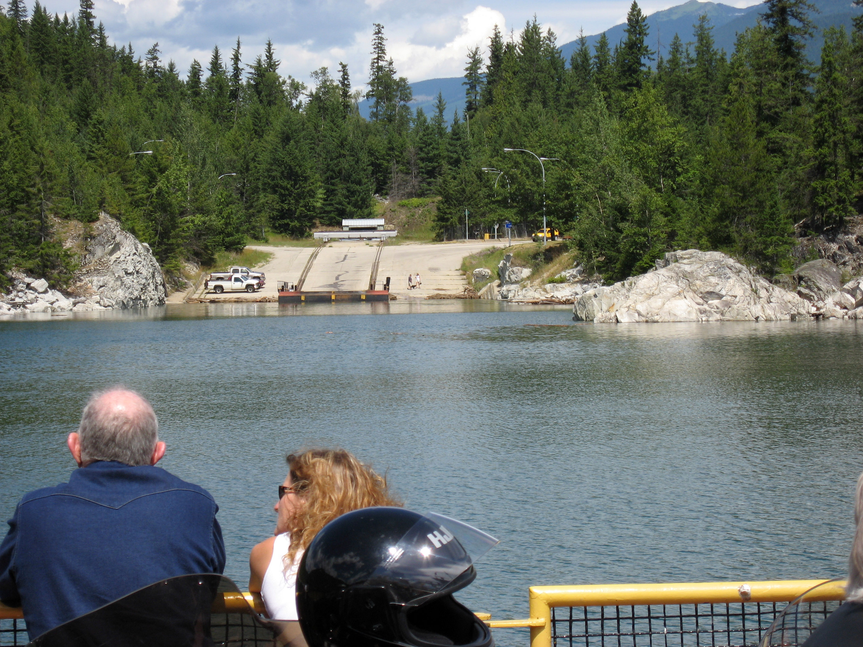
Here I am at the Needles Ferry in British Columbia, Canada, waiting for the ferry.
This is the empty Needles Ferry dock in British Columbia, Canada. Notice the views and the weather, the whole ride is along these lakes, and the roads are beautifully maintained, and there are some SPECTACULAR motorcycle roads between Kelowna and the Needles Ferry, all scenic, high speed swooshing turns.
My ST1300 on the ferry. They always let the motorcycles go to the front of the ferry. We then have nothing but an hour of open road ahead of us with no cars to block our way.

Different picture of the Needles Ferry (mid-way across the lake) in British Columbia, Canada. You can see the other motorcyclists in front.
What a day, what a view!
The Needles Ferry is not free-floating, there is a fixed line across the lake that guides it. I would think any other boats would run into this line? This is a photo over the side of the ferry to see the pulley.
You can see the ferry guide lines on the side as we pull up on the far side of Needles Ferry in British Columbia, Canada.
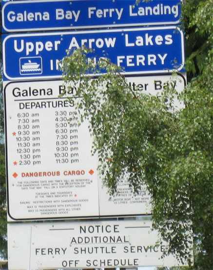
After a RIPPING hour later with no traffic, here I am waiting at the next ferry, the Galena Bay Ferry in British Columbia, Canada.
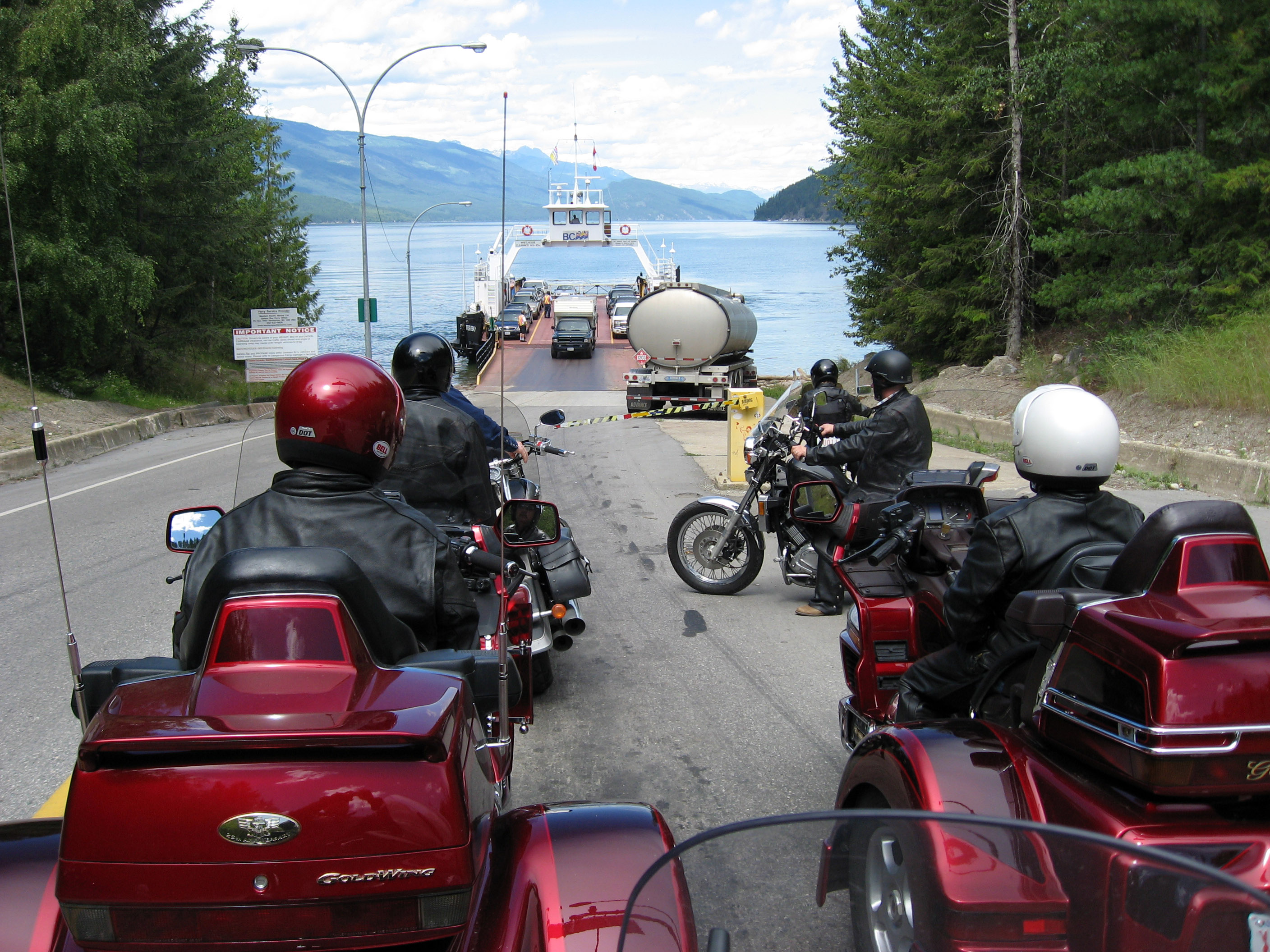
The Galena Bay Ferry in British Columbia, Canada has just pulled up, all the motorcycles are about to board first.
Here is the crowd of motorcycles, mid-lake on the Galena Bay Ferry in British Columbia, Canada. Notice the "Trike" in the foreground. It is a modified Honda Goldwing with a 1500 cc engine made into a "Trike" (3 wheeled motorcycle) by a company called Lehman.
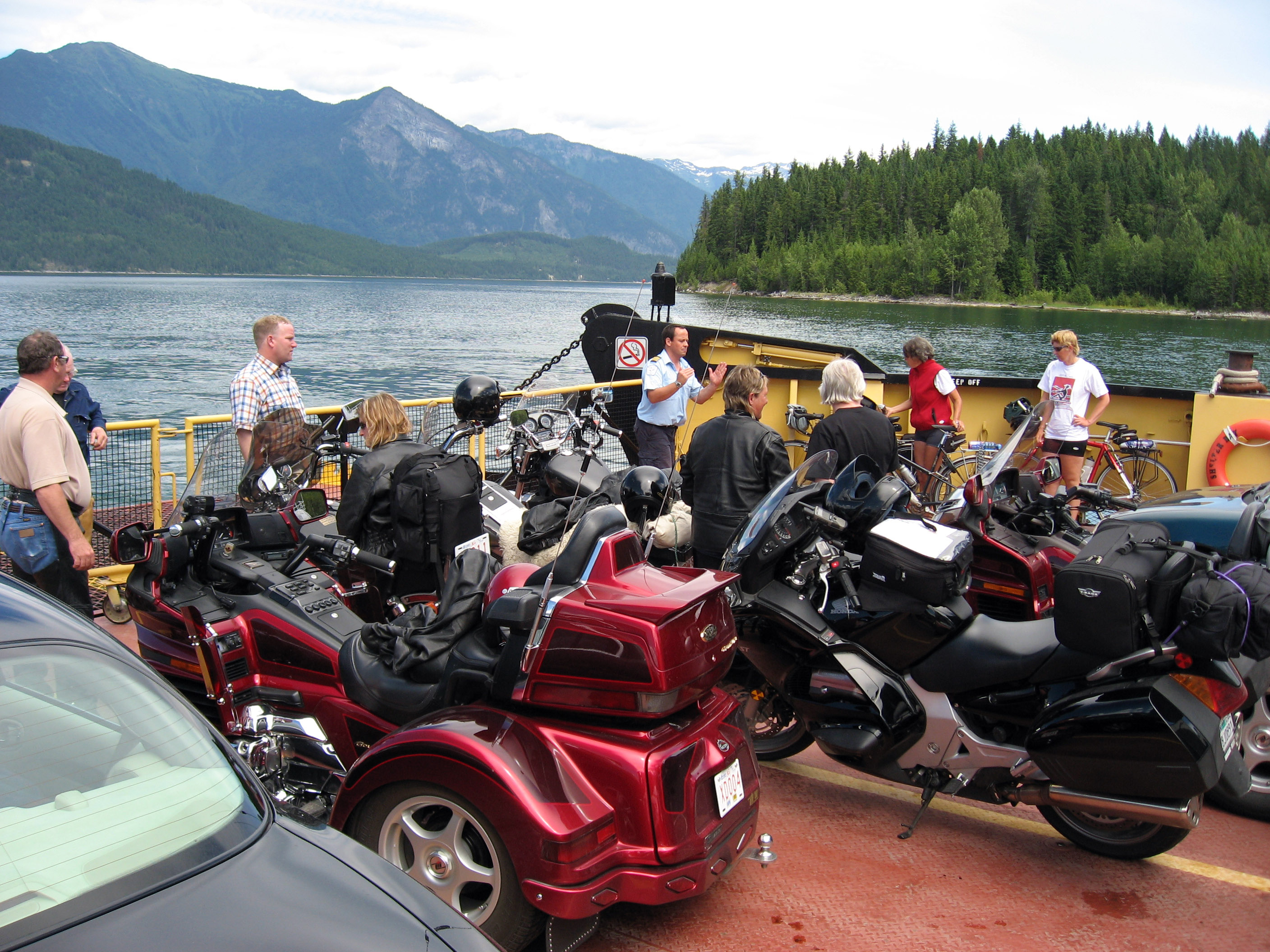
My Honda ST1300 is sitting between two of the Lehman Goldwing Trikes.
A close up of this Lehman Goldwing Trike.
Another close up of this Lehman Goldwing Trike. Click on any of these photos to get a much larger version.
Panorama of the view, mid-lake on the Galena Bay Ferry in British Columbia, Canada.
Here we are pulling up to the far side on the Galena Bay Ferry in British Columbia, Canada.
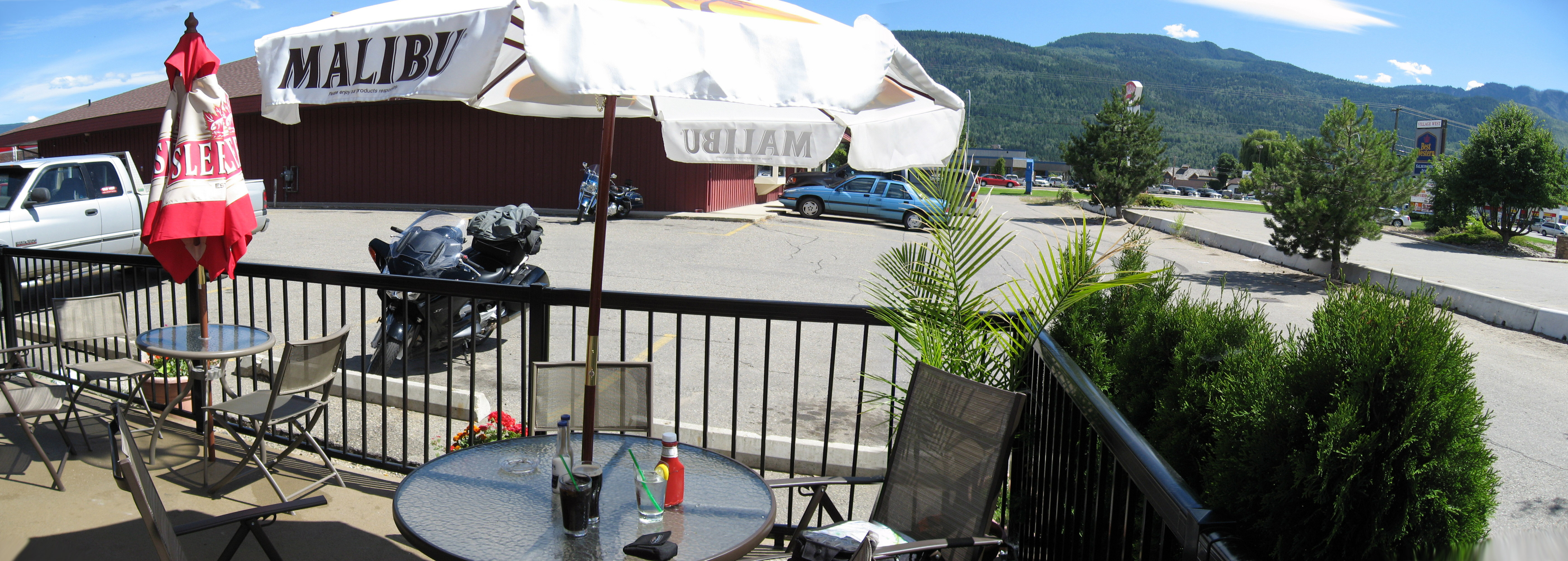
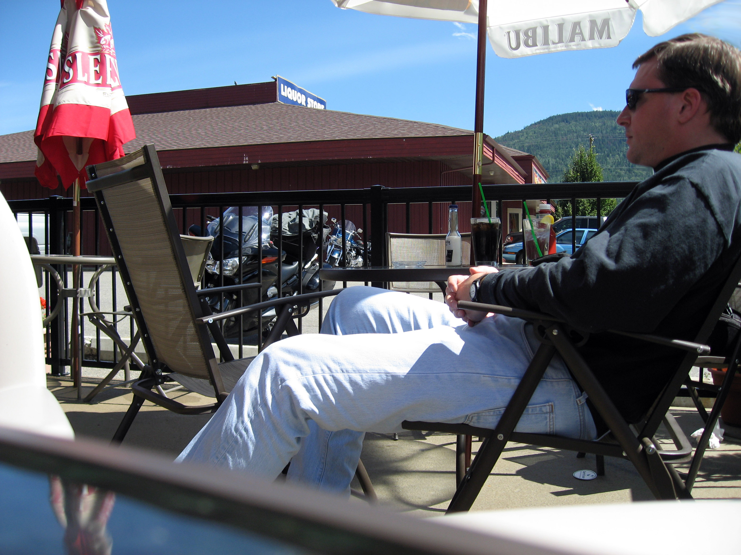
A couple hours later, I broke for a late lunch at Salmon Arm, a small town in British Columbia, Canada (marked on the map above as "D"). It is almost 3pm at this point (I left at 8:30am). This is a picture of my table outside, with my motorcycle behind it.
I took this self portrait with the "timer" feature on my camera.
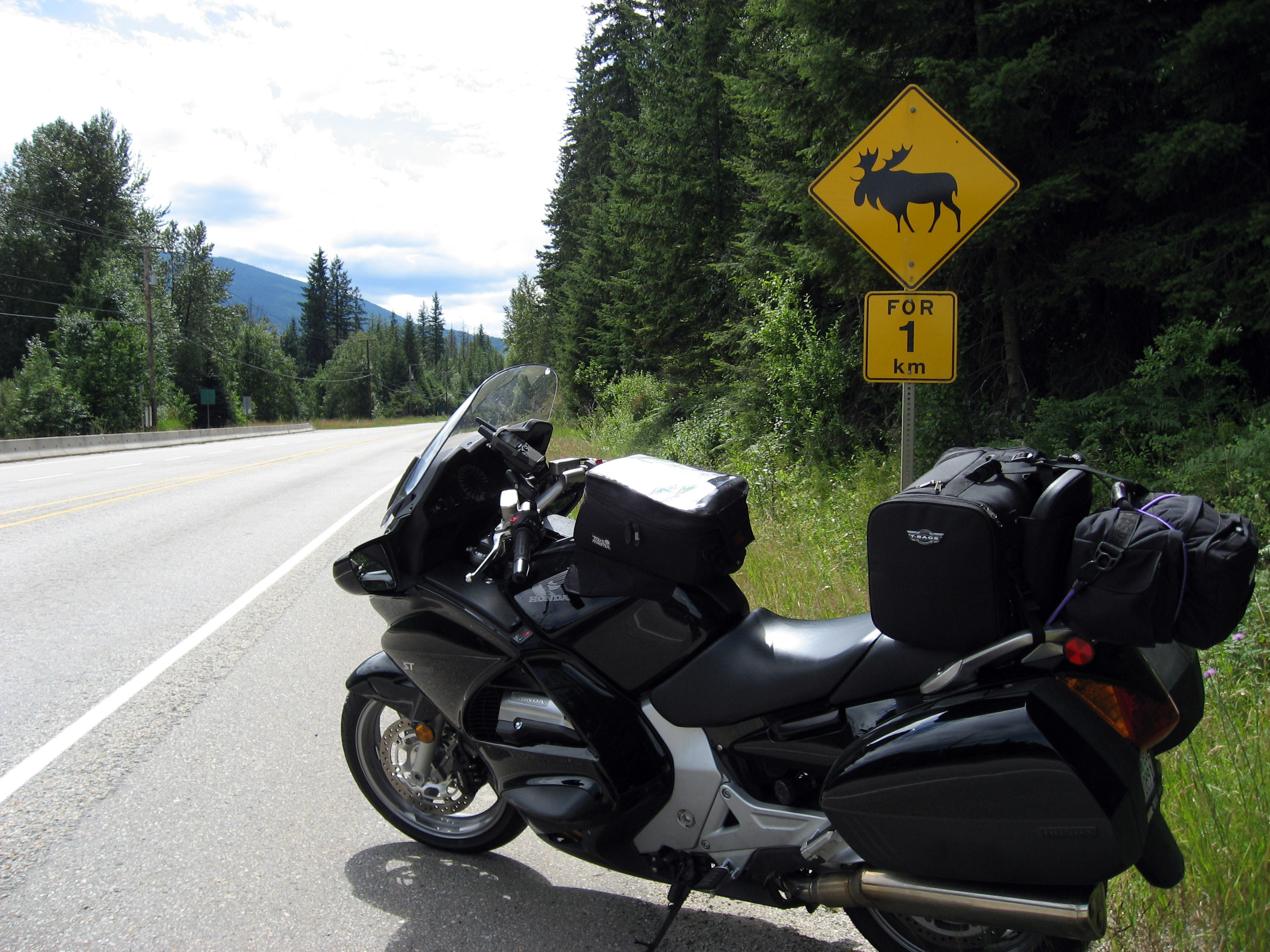
A little while down the road, I saw this sign. You don't see a "Beware of Moose" sign in California much.
On the morning of 7/16/06, I got up super early in Kamloops and did a HUGE 14 hour motorcycle ride first south on Canada Highway 5A almost to the US border, then north all the way to Jasper, Alberta, Canada. Below is a map showing the route as "A - Kamloops", "B - Hope", "C - Lillooet", "D - 100 Mile House", "E - Valemount", "F - Jasper".
The motorcycle ride on Highway 5A south from Kamloops, British Columbia, Canada through to Hope, British Columbia, Canada has these big sweeping turns and small rolling hills, a little through farms and some by small lakes (small by British Columbia standards). You can basically set your cruise control on 75 mph and never take it off, none of the turns are sharp or that exciting. There are a couple of more fun sections right at the bottom of the curve before you get to Hope (see "B" on the map above). Below is a typical panorama from motorcycling Highway 5A south of Kamloops, British Columbia, Canada.
A little while later I took the side smaller road Canada Highway 12 to Lillooet (see "C" on the map above). It was a fun little road, no emergency lane, a nice break from the big sweeping highways. Below is a picture.
Below is the town of Lillooet, British Columbia, Canada. If you click on this to zoom in, you will see the train tracks that go by half way up between the river and the town on the plateau. This is also where the "Sea To Sky Road" (Canada Highway 99 from Vancouver) ends or joins with the road I'm on (Highway 12). I'd like to take that turn down to Vancouver sometime.
Just past Lillooet on Canada Highway 12. You can see the roads I just drove up above and to the right of the motorcycle. These are still fast roads, but not as well repaired and there are some ups and downs that make it very fun and interesting. I probably saw 5 cars total the whole hour and a half I spent on this road.
Below is the same photo as above, but zoomed in to see the road I just drove up. The tunnel on the left is for the train.
I ate a late lunch at "100 Mile House" which is a small town marked "D" on the map above on Highway 97.
From "100 Mile House" I took Highway 24 East to Clearwater, then Canada Highway 1 (Trans-Canadian Highway) up to Valemount (marked "E" on the map above). Below is a random scense from Highway 24.
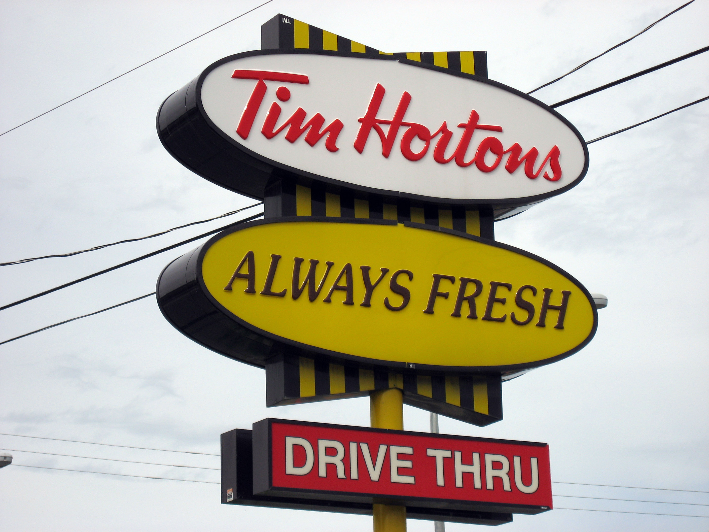
Ok, all across Canada are these "Tim Horton Drive Thru" places, they look like a McDonalds or something. I had never heard of them. Since I'm on a motorcycle a "Drive Thru" food pickup doesn't make much sense, but I'll walk through it sometime just to see why it is so successful in Canada. Seriously, they are EVERYWHERE, more popular than Subway or McDonalds in Canada.
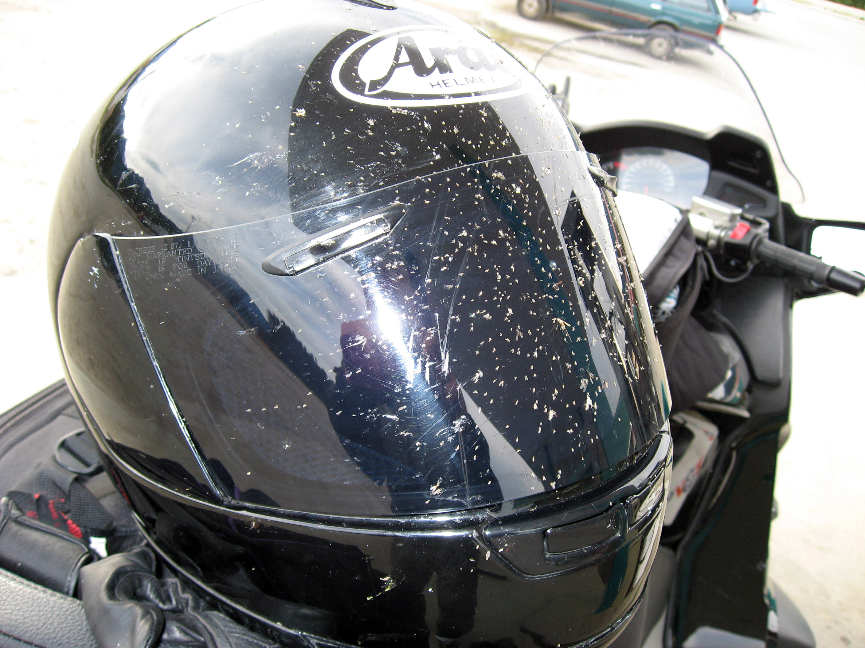
At dusk I stopped for gas and to change my shield visor from tinted (to shield bright sun) to clear (for dusk and lower light conditions). Below is a picture of how many bugs I picked up in a couple hours of driving a motorcycle in Canada at dusk.
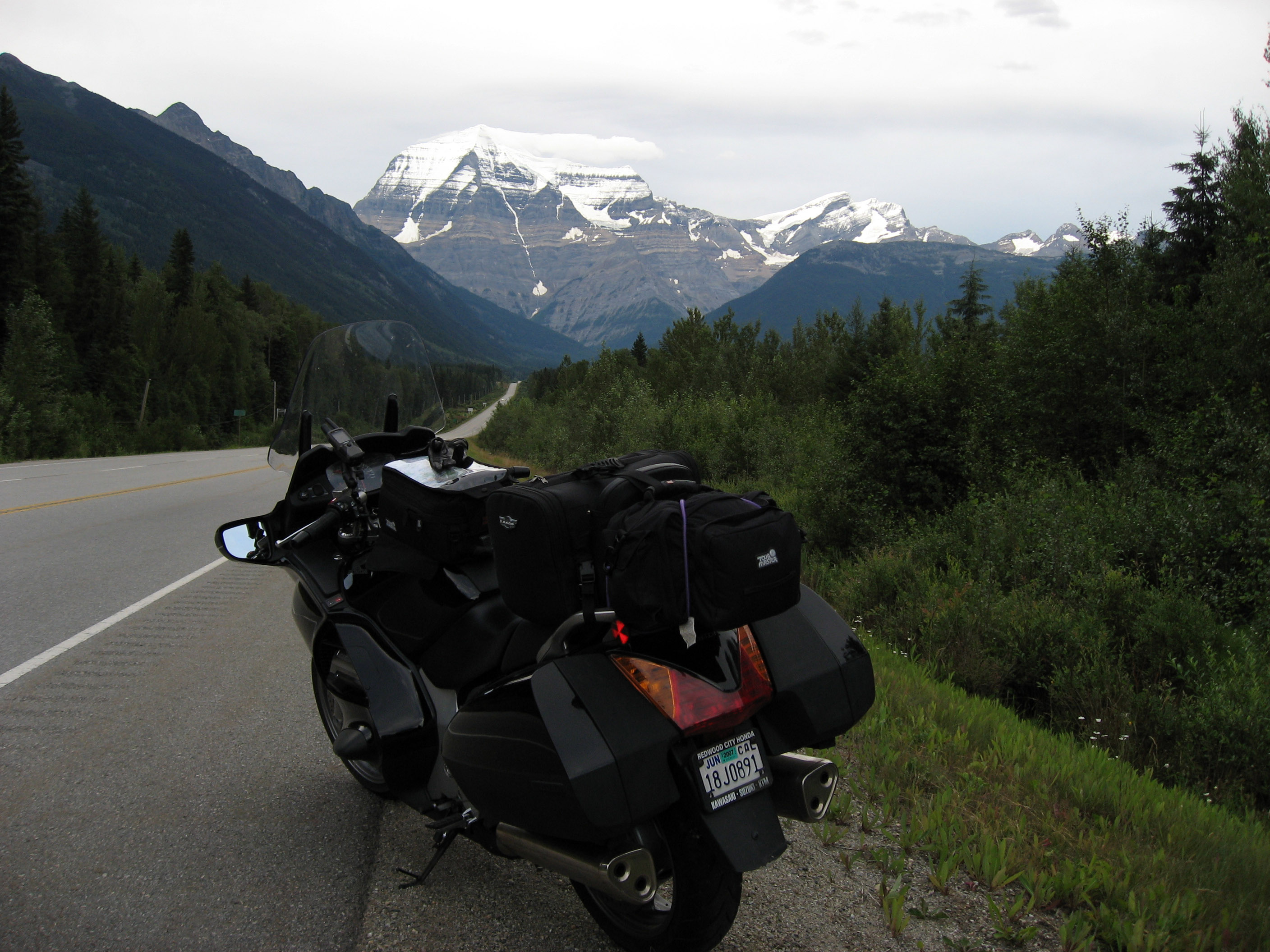
The next ride is from Valemount over the continental divide over into Jasper, Alberta, Canada. This was a short 1 hour cruise. The roads are pretty straight and normal, but the scenery and wildlife were pretty amazing. In the distance as the sun goes down you can see Canada's Mount Robson lit up with snow on the peaks. I think this is the highest point for miles around.
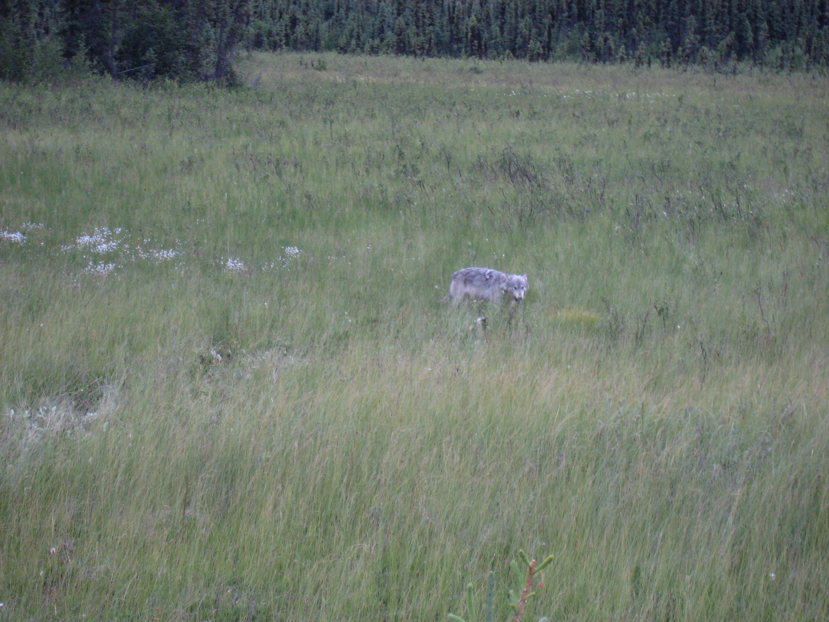
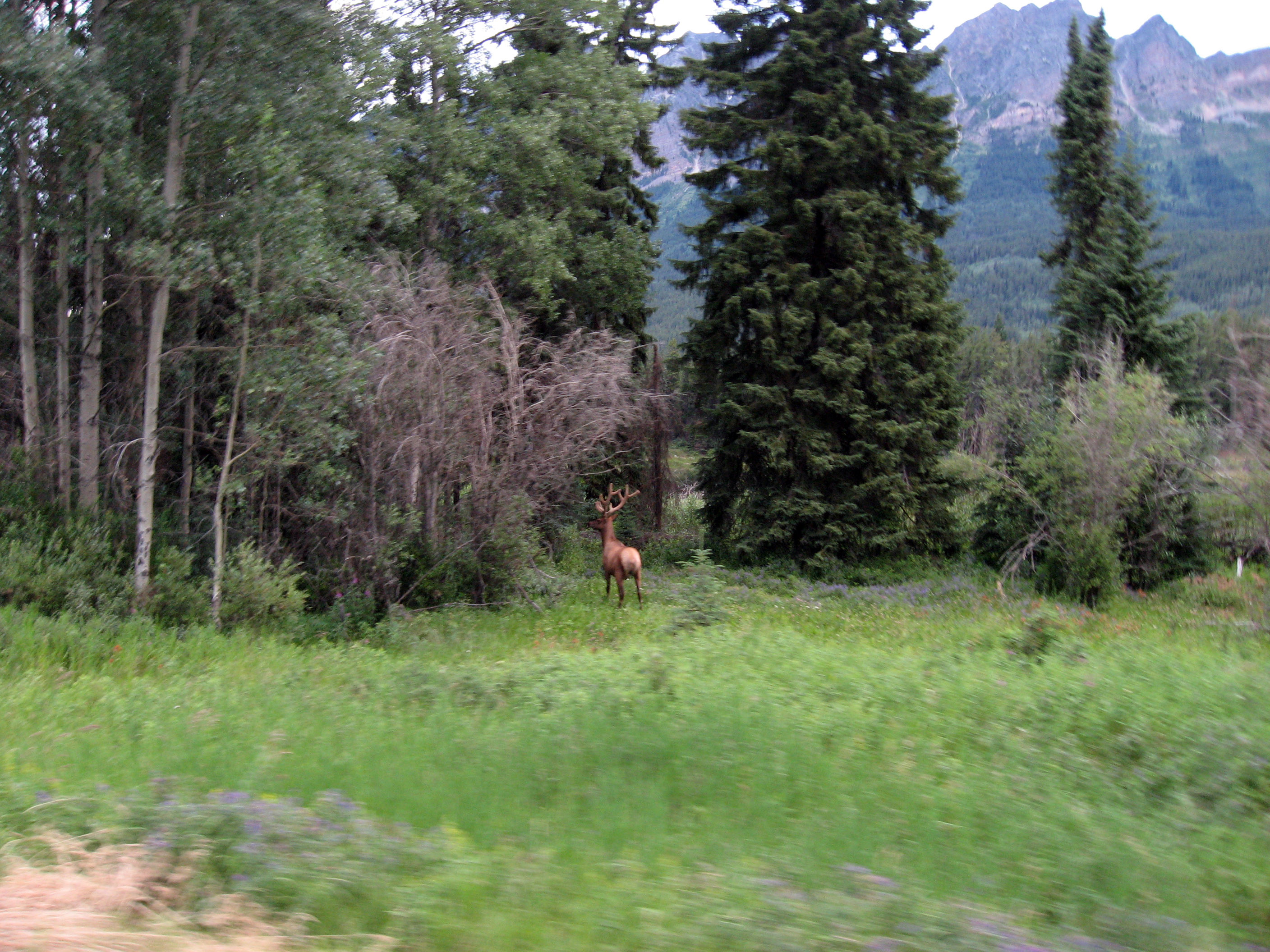
Cruising down the road I see this guy (a wolf?) walking next to the highway. This is the maximum zoom my camera does, if he got any closer I was going to gun the motorcycle and get the heck outta there. :-)
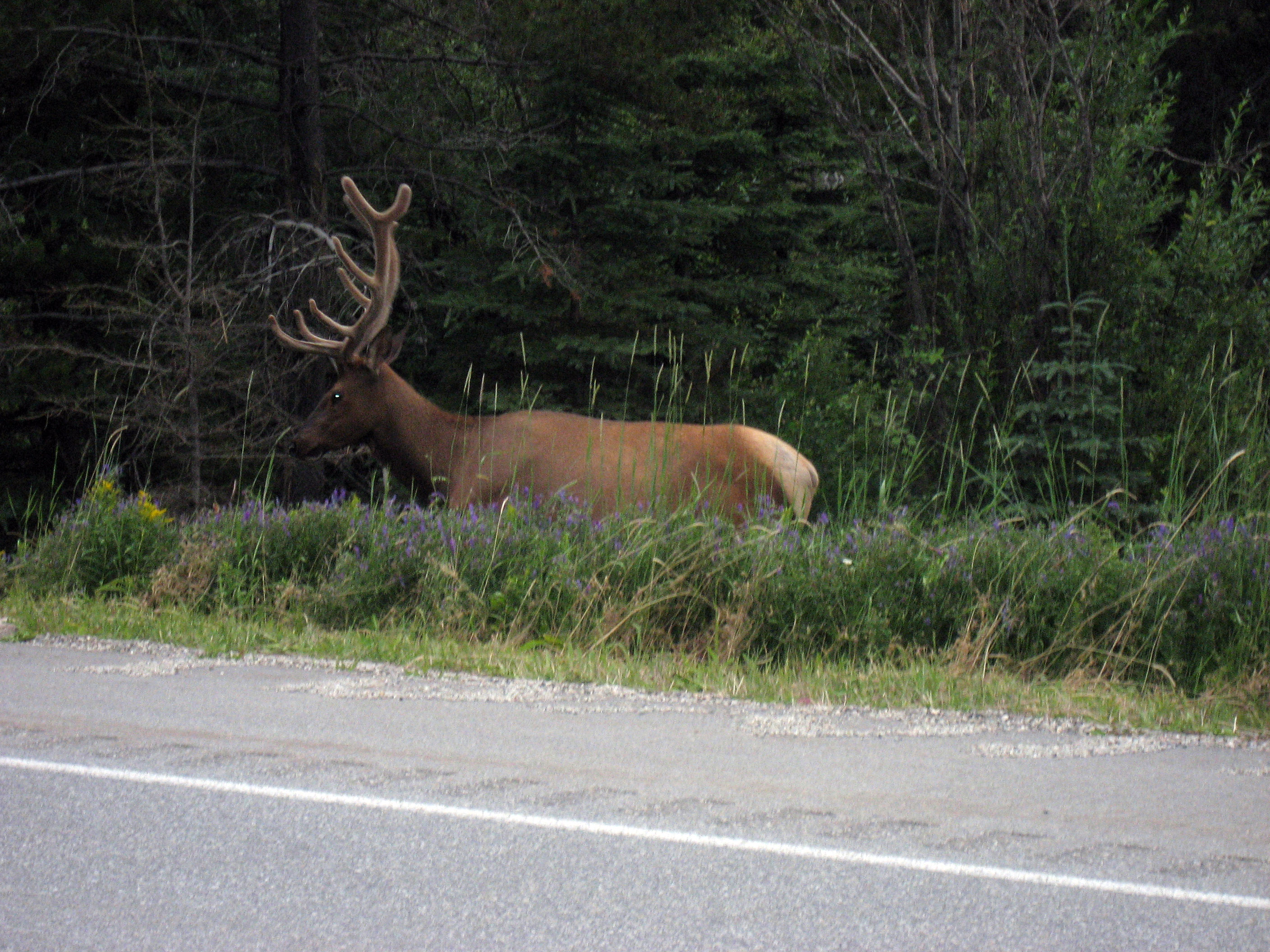
And 5 minutes later, there were 3 or 4 bull elk wandering around on BOTH sides of the highway, not far from Jasper, Alberta, Canada. At this point I decided they weighed as much as my motorcycle and I would slow down a bit. Look at the rack on this bull elk.
When my flash went off, he looked up, so I took another picture.
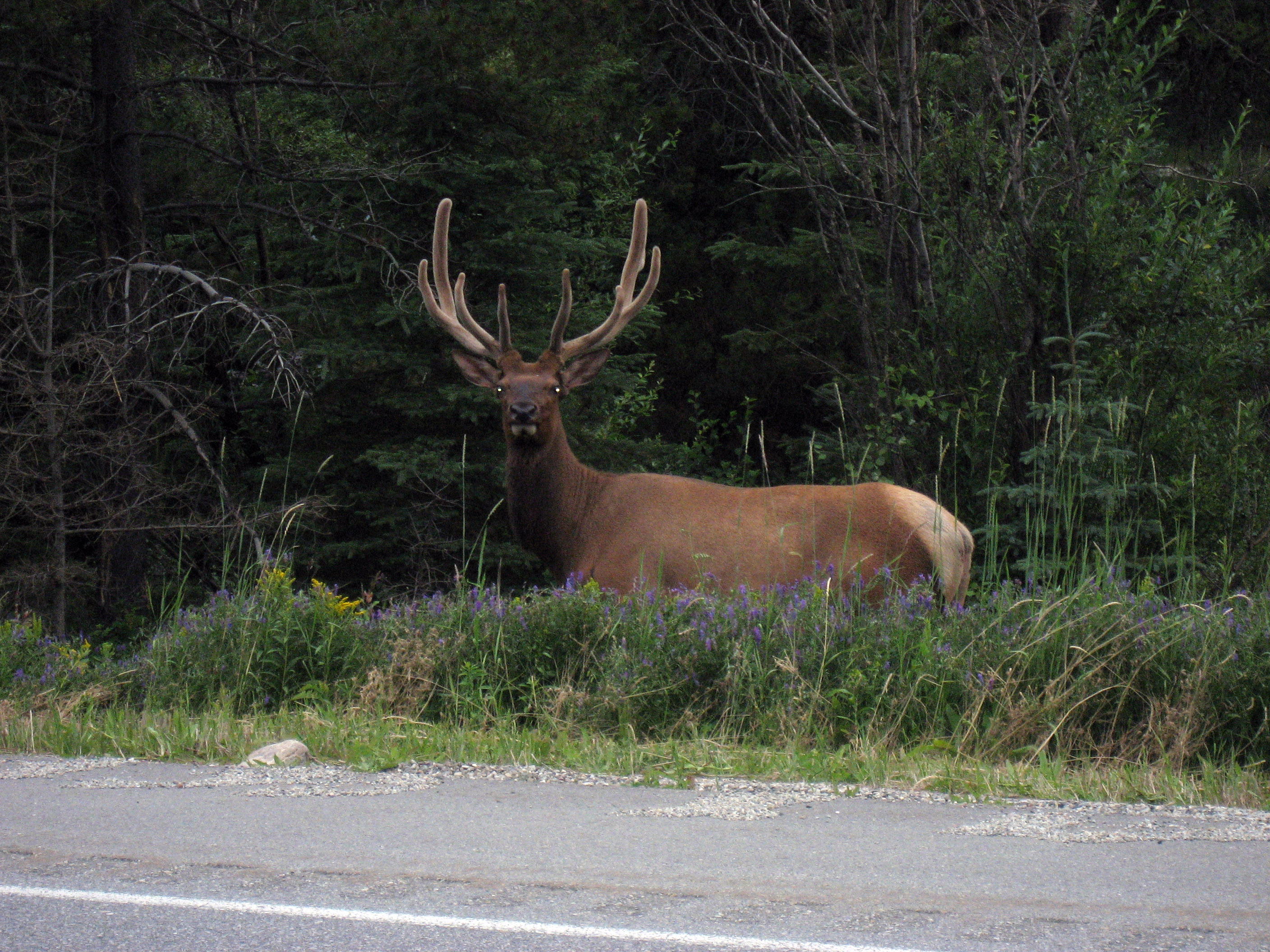
And that chased him off.
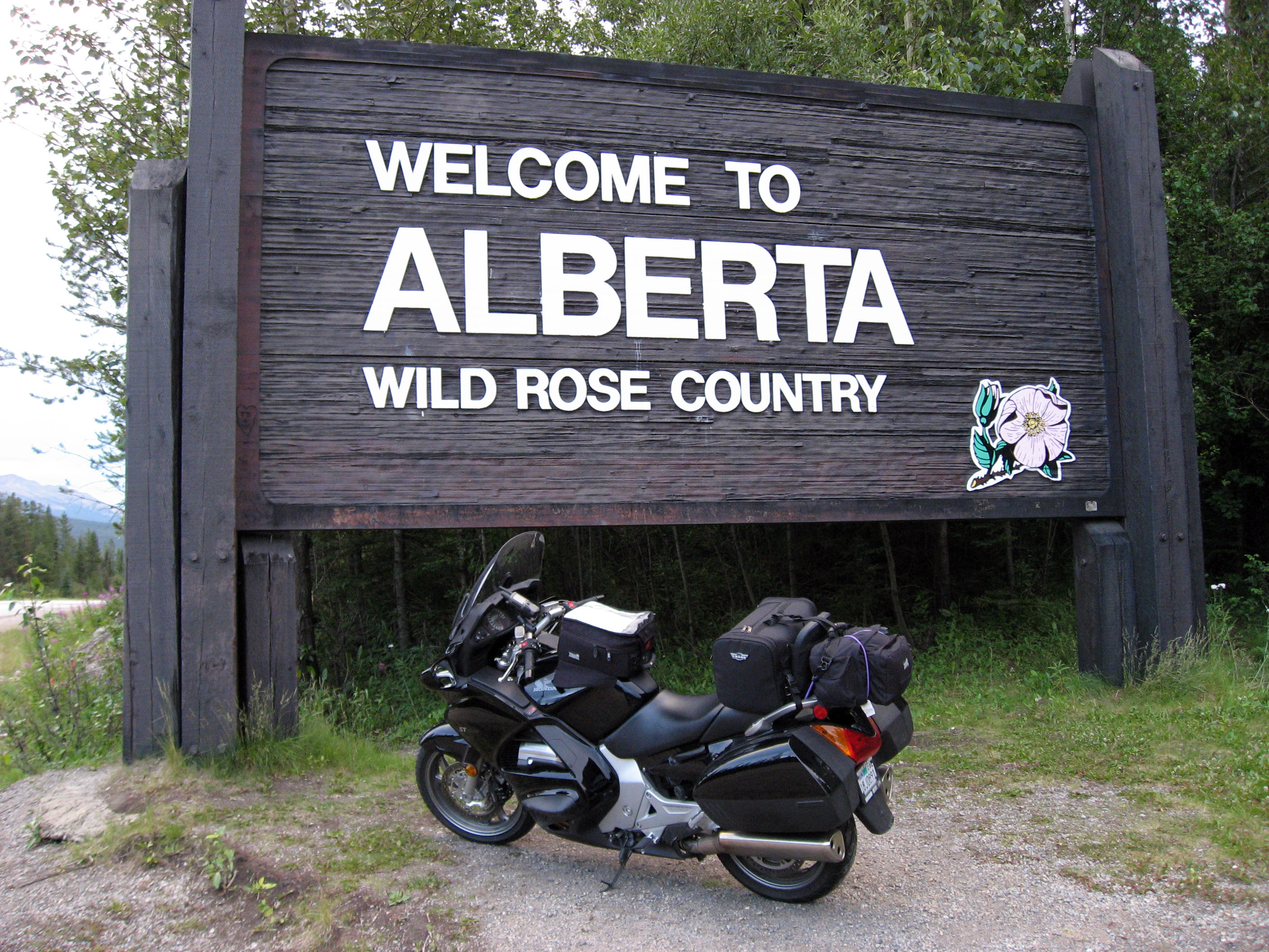
Entering Alberta!
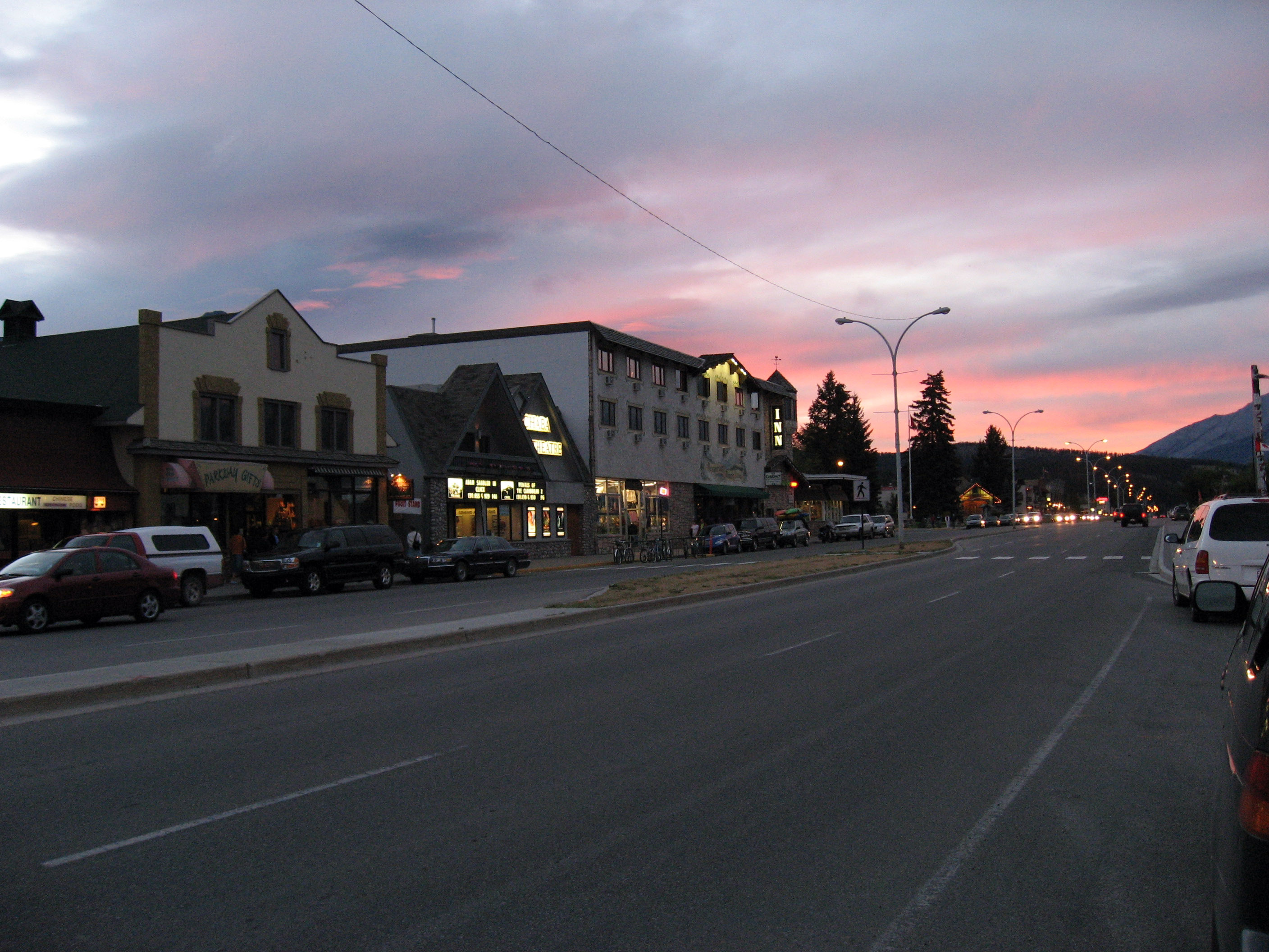
I pulled into Jasper, Alberta, Canada on my motorcycle as the sun went down after a 14 hour motorcycle day. Here is main street at 9:30pm.
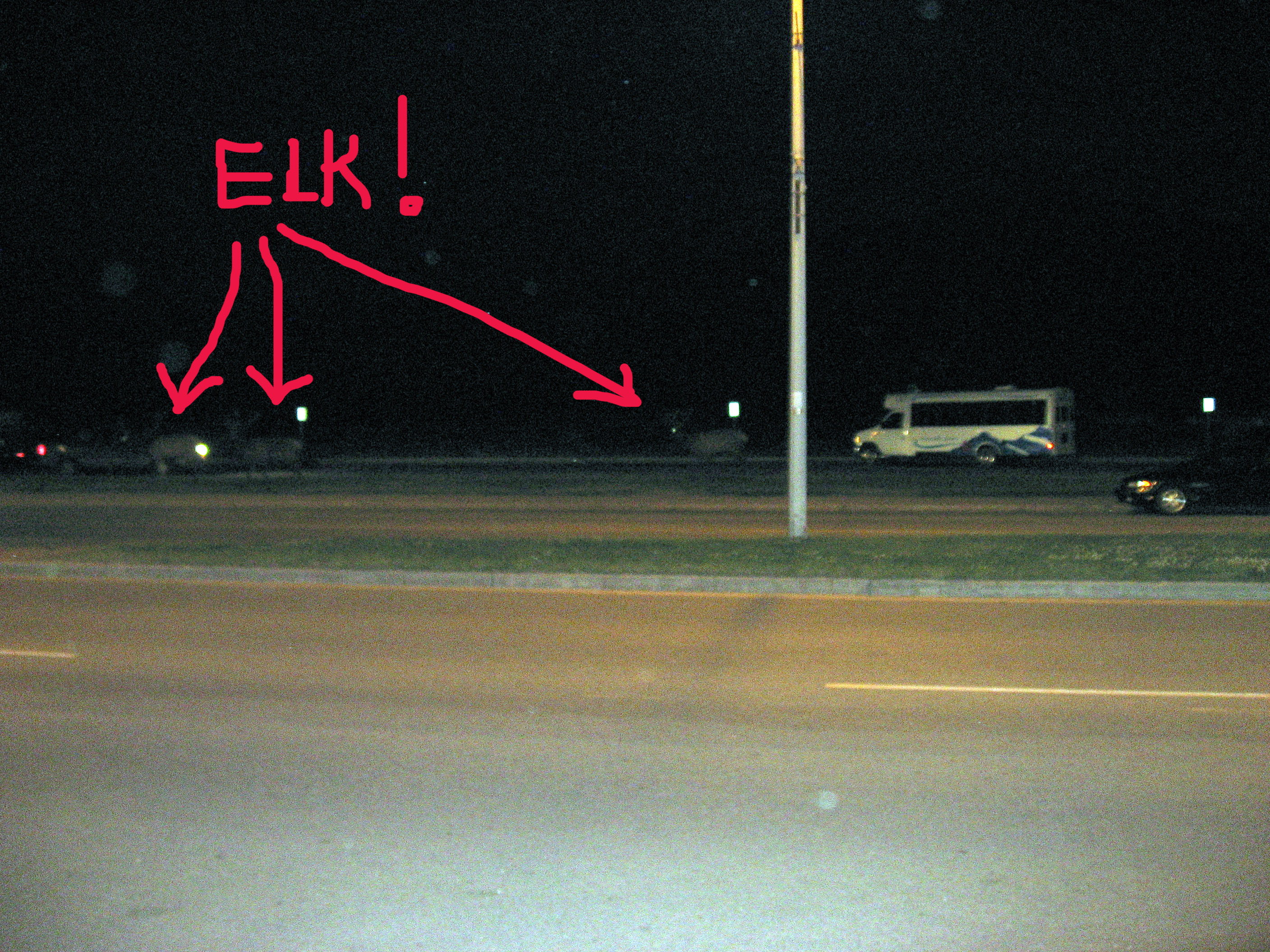
After I parked my motorcycle and checked into my hotel, these 3 elk wandered by on main street in Jasper, Alberta, Canada as I was unloading. The light was really bad for a picture, so I point them out in red below.
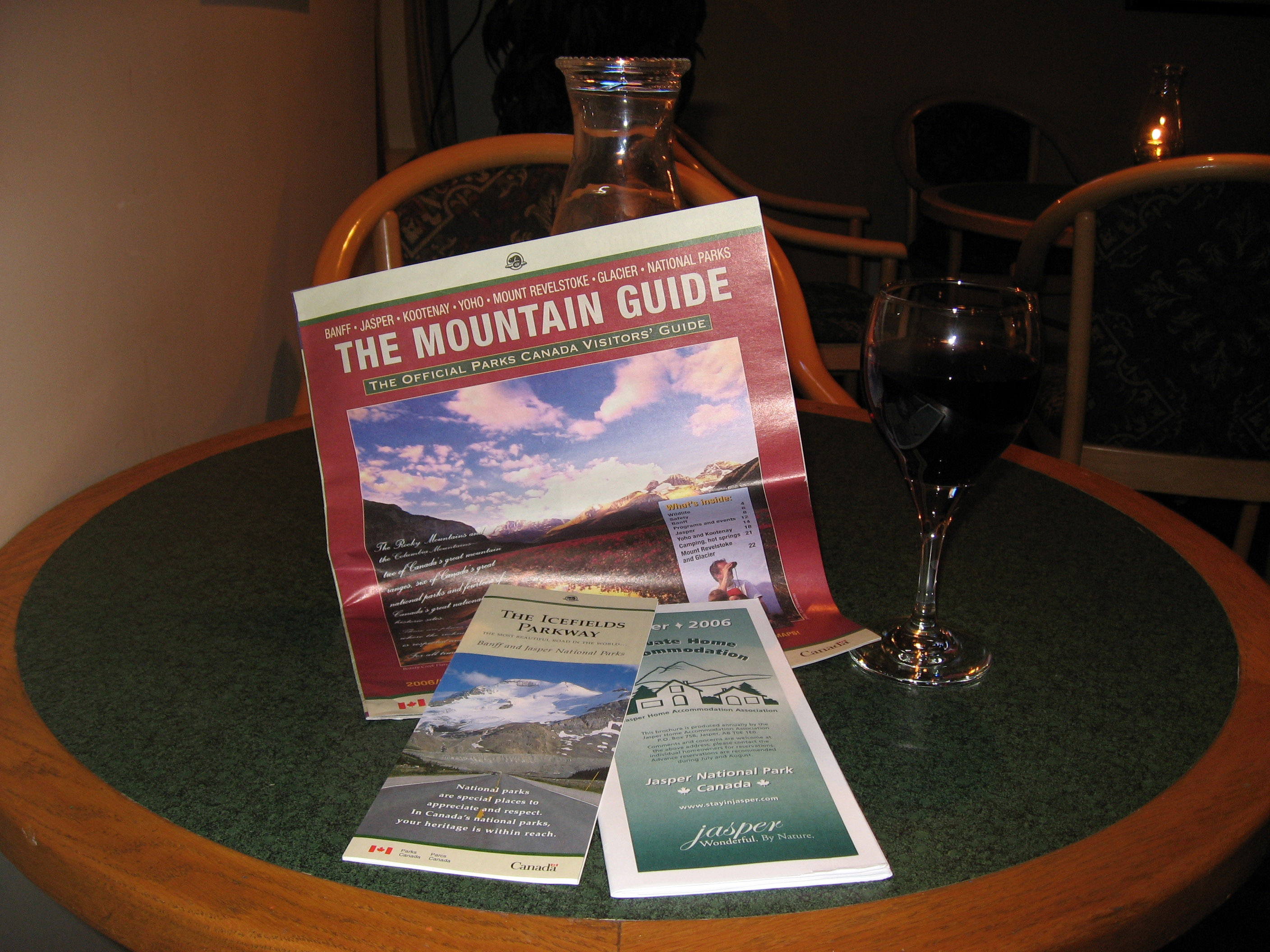
Ahhh, after a BIG day, a glass of wine and some local reading material in the hotel bar. I stayed in the Amethyst Lodge, which is on main street downtown and has wireless internet access so I could update these pages.
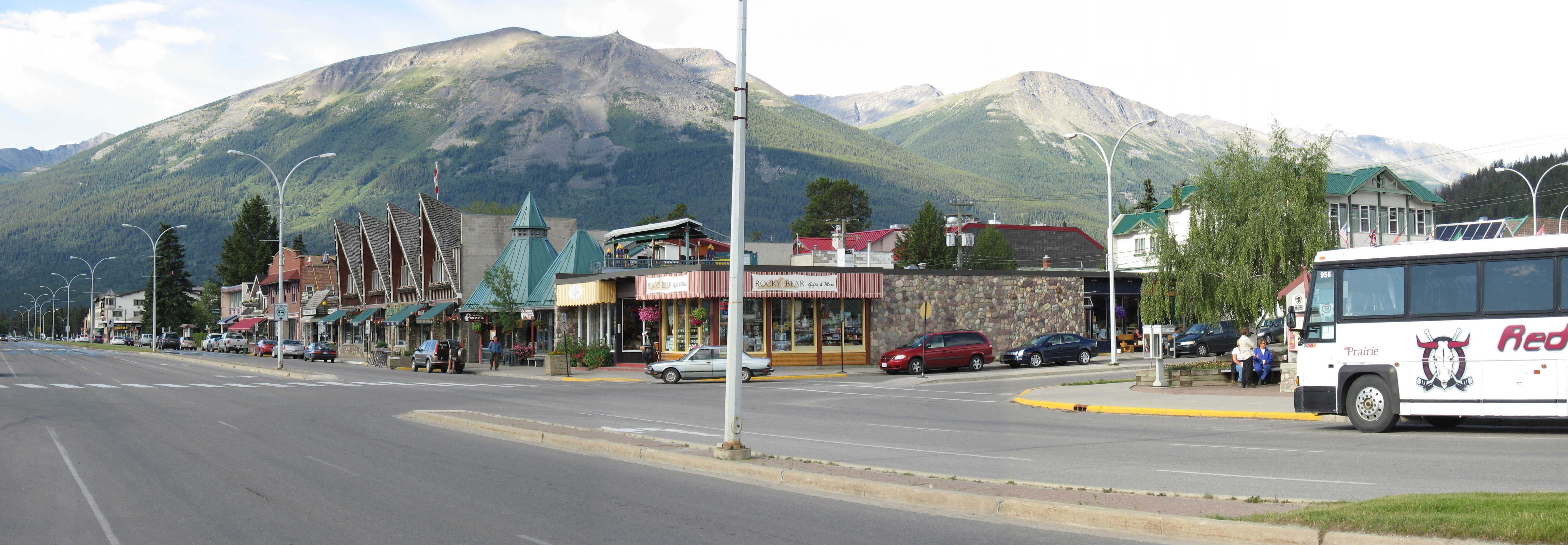
The next morning before breakfast, this is a section of Main Street in Jasper, Alberta, Canada. Very cute little town with spectacular views all around.
On the morning of 7/17/06, I did the light motorcycle drive (but very very pretty and famous) "Canada 93 Icefield Parkway" first going from Jasper to Lake Louise, then onto Calgary. Below is a map showing the route as "A - Jasper", "B - Lake Louise", "C - Calgary".
A picture of the sign as you head into the Canada 93 Icefield Parkway out of Jasper, Alberta, Canada.
My first mishap of the trip! After 3,500 miles with the GPS riding along nicely, I hit a medium size pothole and it bounced right out of the holder and hit the road at 70 mph. When I went and picked it back up, it was scuffed up, but nothing broke (!!) and it still works. Below we see the "after" picture with the scratches and the electrical tape I immediately put on it to avoid losing it again.
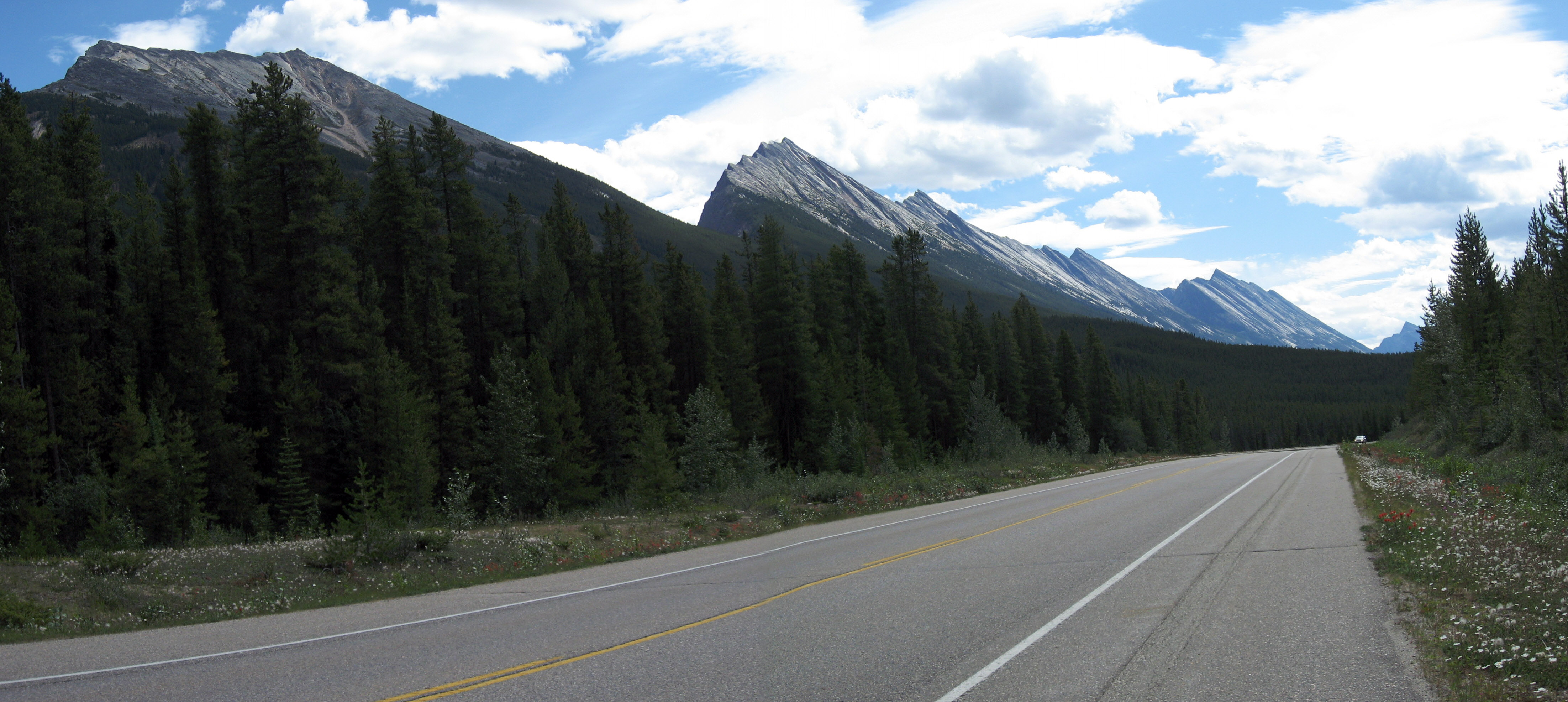
As long as I was stopped, I took a picture of where I happened to be when the GPS fell off. This is what the Ice Field Parkway looks like most of the way.
Check out the row of mountains to the left of the road (Click on the picture below to get a larger version). They are completely flat at a 45 degree angle jutted straight out of the earth. We are on the continental divide here, it looks like I've found the edge of a tectonic plate. :-)
A little way onward, here is Mt Kitchener at 3,505m (11,500 feet).
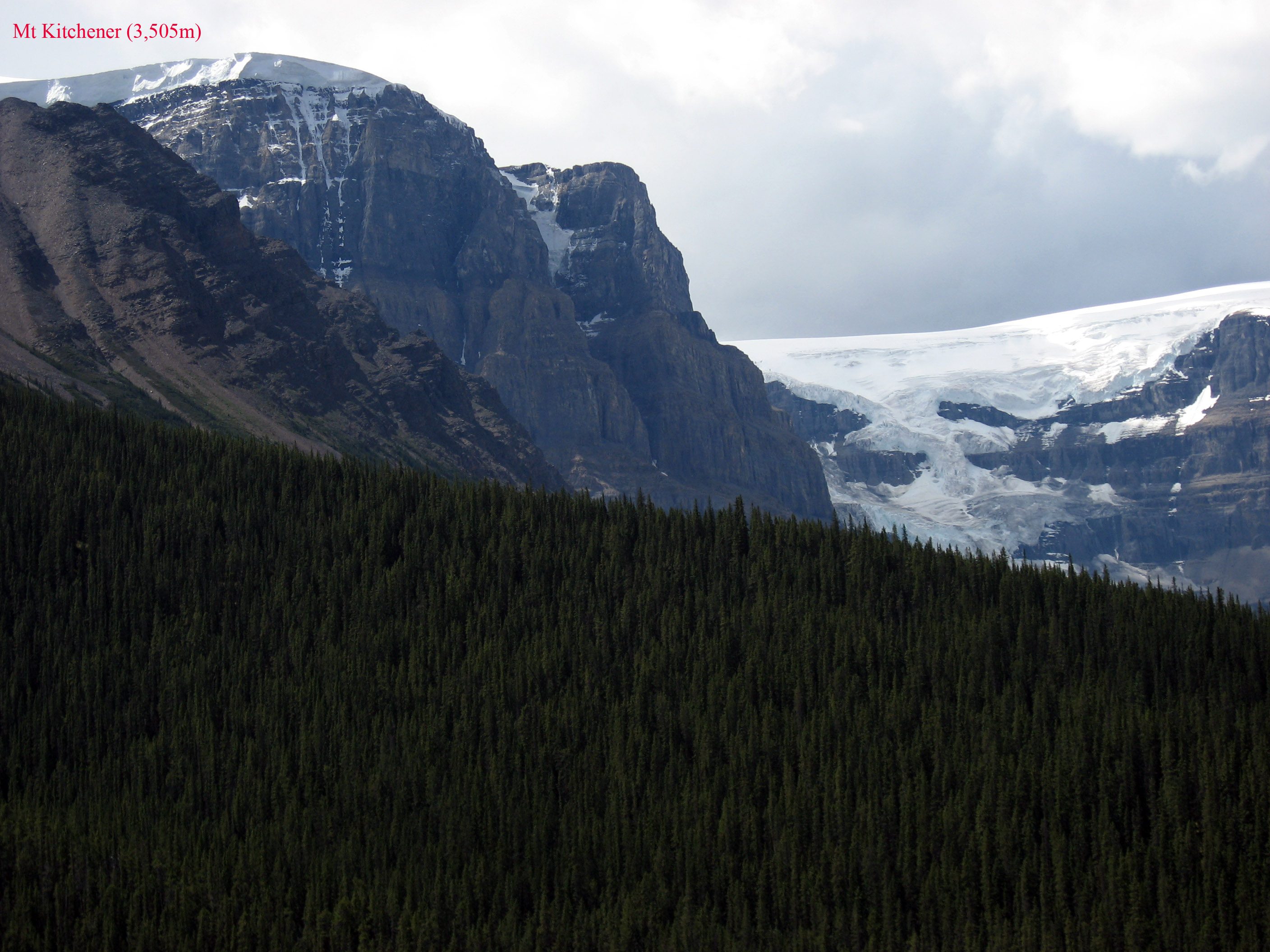
And to the right of Mt Kitchener a little there are glaciers and snow.
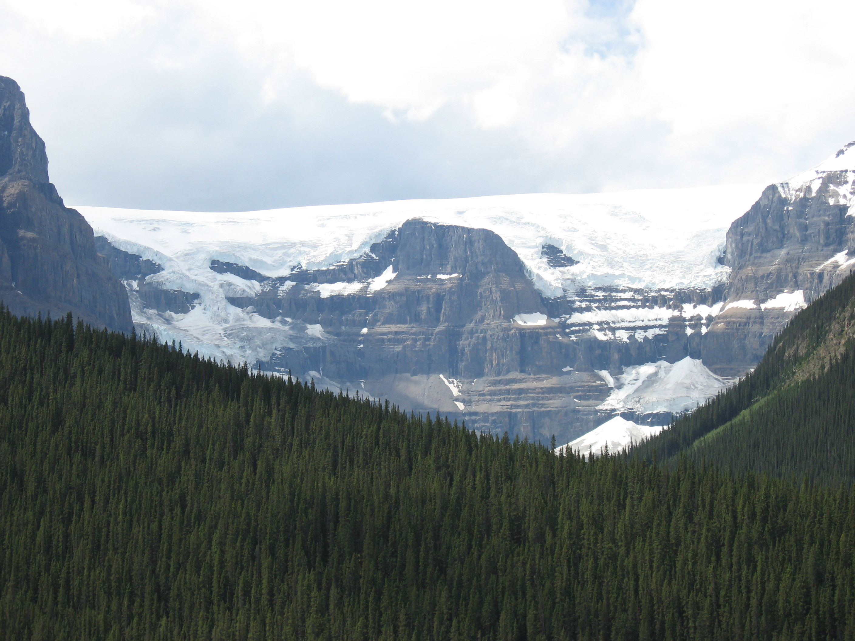
Nice valley, snow in the distance.
Without the motorcycle I can zoom in on the same picture as above.
Along the way, a bunch of people were stopped watching these Mountain goats, first wander around in the road, then run right up the side of that cliff you see.
Below is the most zoomed in picture I could get. Look at how scruffy the mountain goat is, they were all shedding their winter coats it seems.
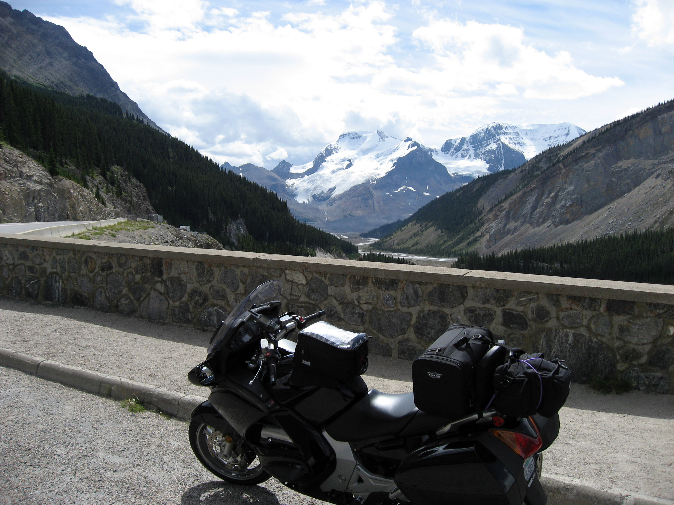
In the lower right of this picture is the Athabasca Glacier. A few pictures down I went for a small hike up onto it.

Same view as previous, just a wider shot to show some more of the mountains.
The start of the hike up to the Athabasca Glacier in Canada.
As we get to the top of the little hill, here is a picture of the glacier's edge. The public can walk onto the first little part (up to the first crevasse).
The marker indicating where the glacier was in 1992. It has been receding in recent years.
Standing on the glacier looking up at it.
I took the next few pictures of the little signs posted around the Athabasca Glacier in Canada just to be able to read them later. :-) Skip them unless you find it interesting. Click on the sign to zoom in if you cannot read the text here.
More signs signs posted around the Athabasca Glacier in Canada.
More signs signs posted around the Athabasca Glacier in Canada.
Standing on the Athabasca Glacier in Canada looking back down the hill at all the people wandering around on it.
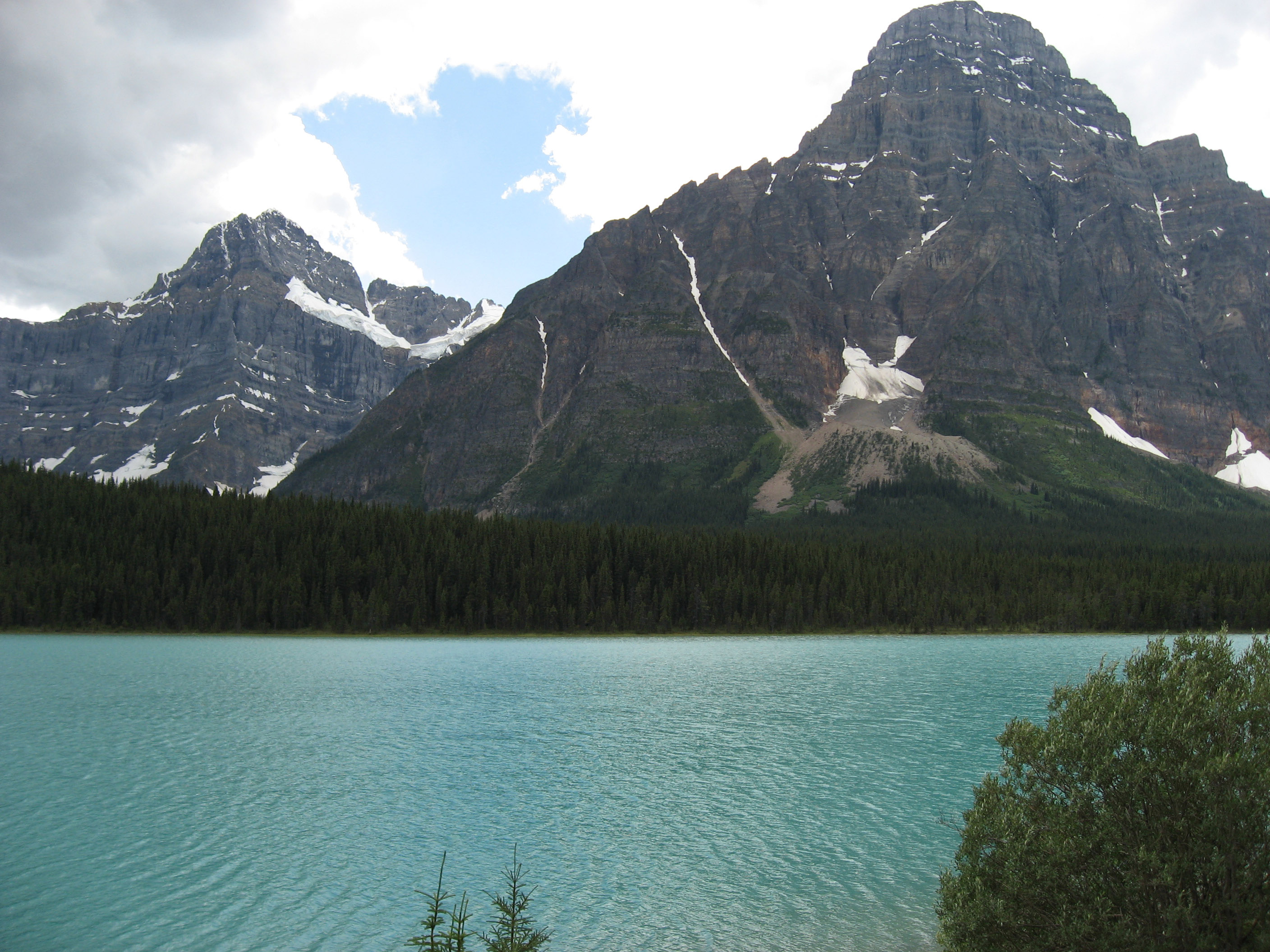
Back on the motorcycle down the road a little, I saw several of these BRILLIANT colorful blue/green/turquoise lakes. I cannot seem to capture the right colors with the pictures, but they are very pretty. The color is caused by all the minerals in the water, which come from runoff from the glaciers. The minerals come from the glaciers grinding up the rocks into a fine powder as they flow along.
Another attempt to capture the beautiful lakes (not very good attempt).
A little way down the highway is Lake Louise, Canada. Here is the sign at the parking lot to the lake. (If you cannot read it, and care, just click on the picture below to get a larger version).
More sign about Lake Louise, Canada.
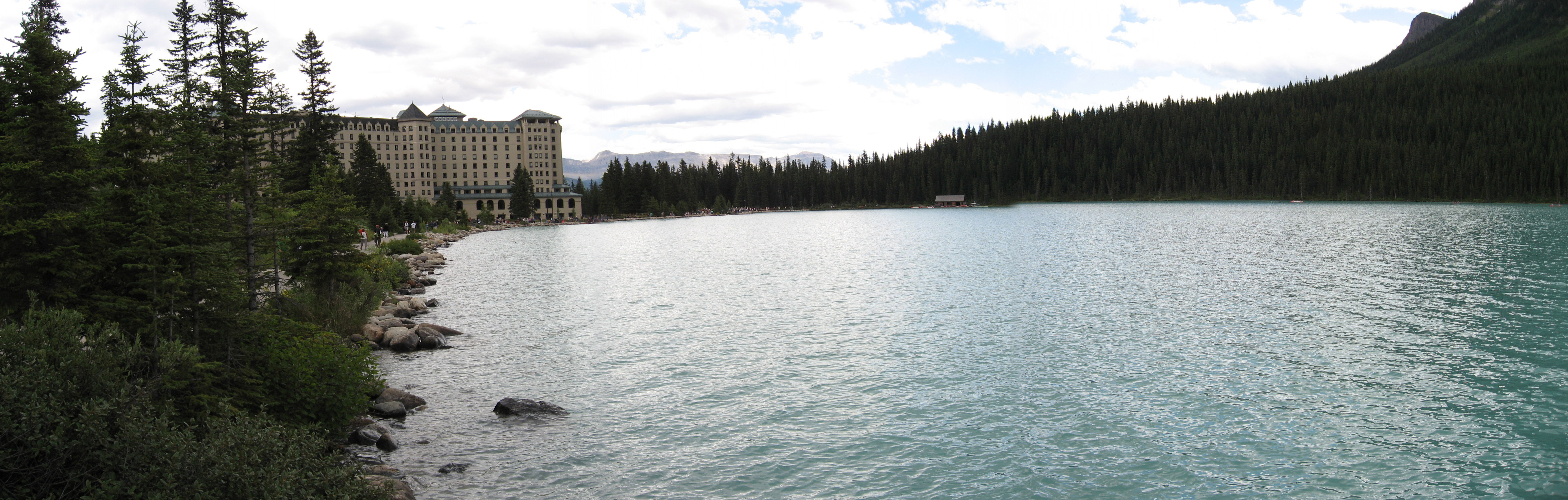
I have visited Lake Louise before during the winter. Click here for information about Banff, Canada and pictures from skiing in this area. Below is the summer version. Again there is that beautiful blue/green/turquoise water I have trouble capturing with the camera.
Lake Louise again.
I walked around the lake a ways and took this picture of the big lodge.
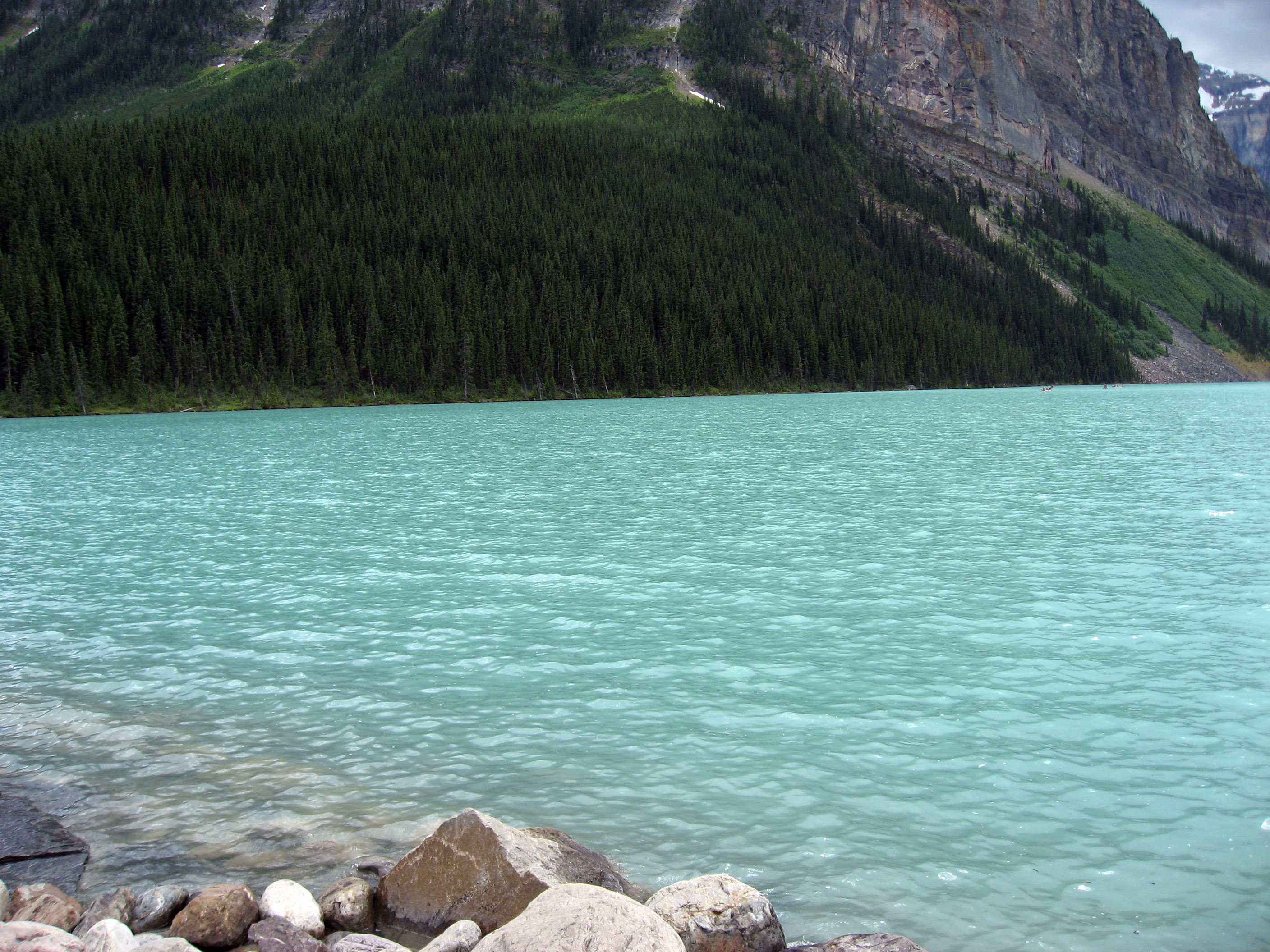
Final picture, I think you can kind of see the pretty blue/green/turquoise water in this picture, but trust me, it's much better in person. :-)
Click Here for Next Set Of Pictures
Return to 2006 Canada Motorcycle Trip