(9/05/06 - 9/13/06)
![]()
This webpage, and all of http://www.ski-epic.com are yours to enjoy. Feel free to use any pictures found here for any purpose you like, with or without credit. I grant you full rights, for free, forever, to do anything you want, including redistribute the pictures with or without any credit to me. This isn't my job, it's just my vacation website. Enjoy!

(Read
a personal
description of Backblaze here.)
END OF NEW ADDITION -> now on to the original site ->
On this page are pictures and descriptions from 9/05/06 - 9/13/06. Click on any picture or panorama for an ENORMOUS version. Click here to go to the homepage and get a description of what this is all about.
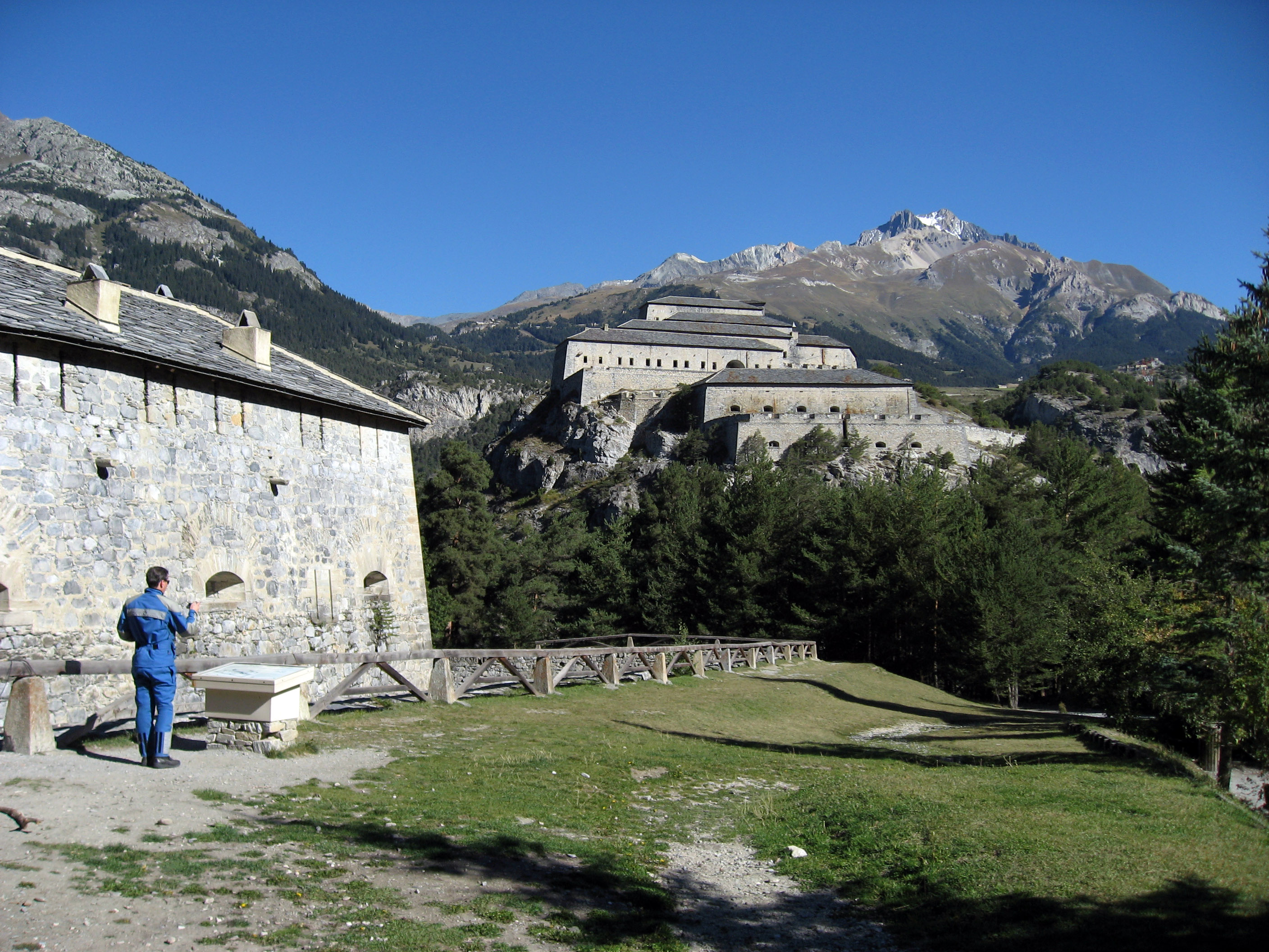
On Tuesday, 9/5/06 we drove from Valloire, France to Cogne, Italy. Below is a random guardhouse from the 1700s we passed that looked interesting.
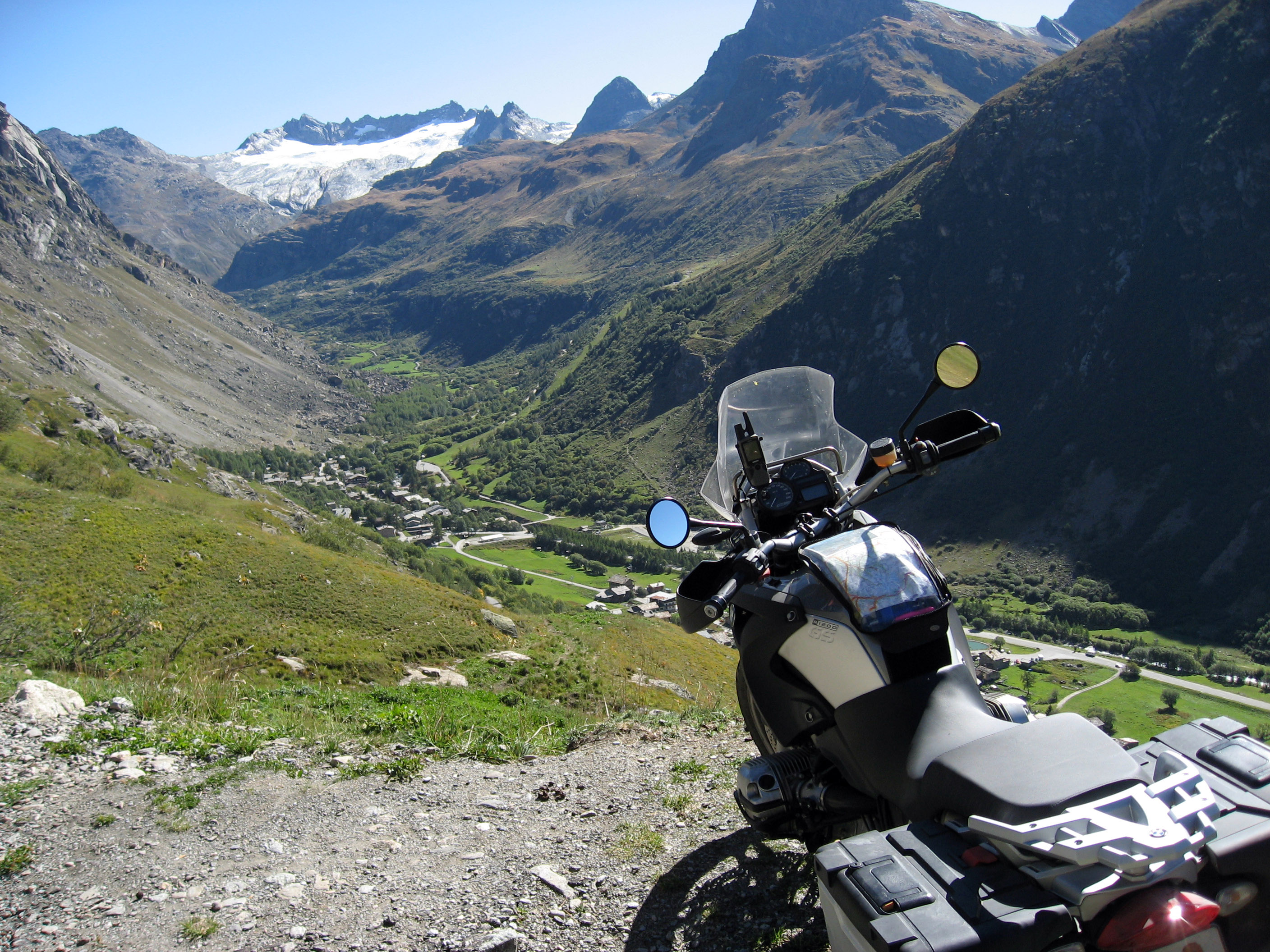
We just started the climb out of the valley up to Col de L'iseran, France when we stopped at this outcropping to take some pictures. I parked my 2006 BMW R1200GS precariously on this cliff, that's BrianB on the right.
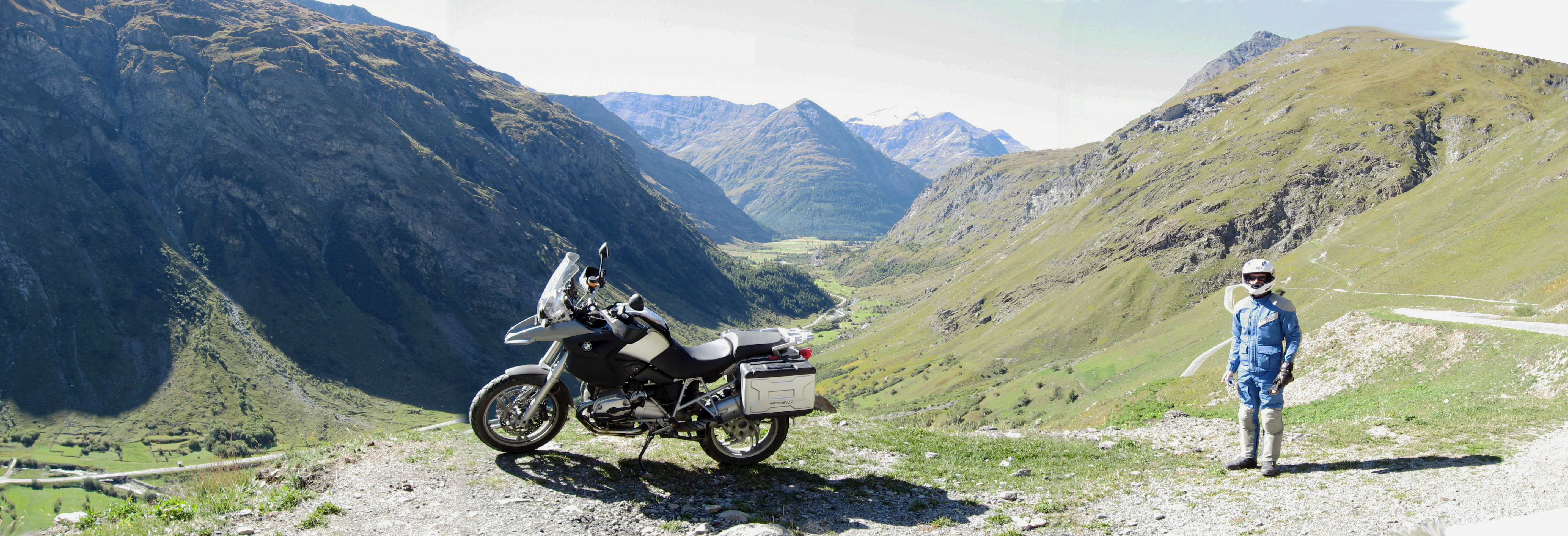
A different angle.
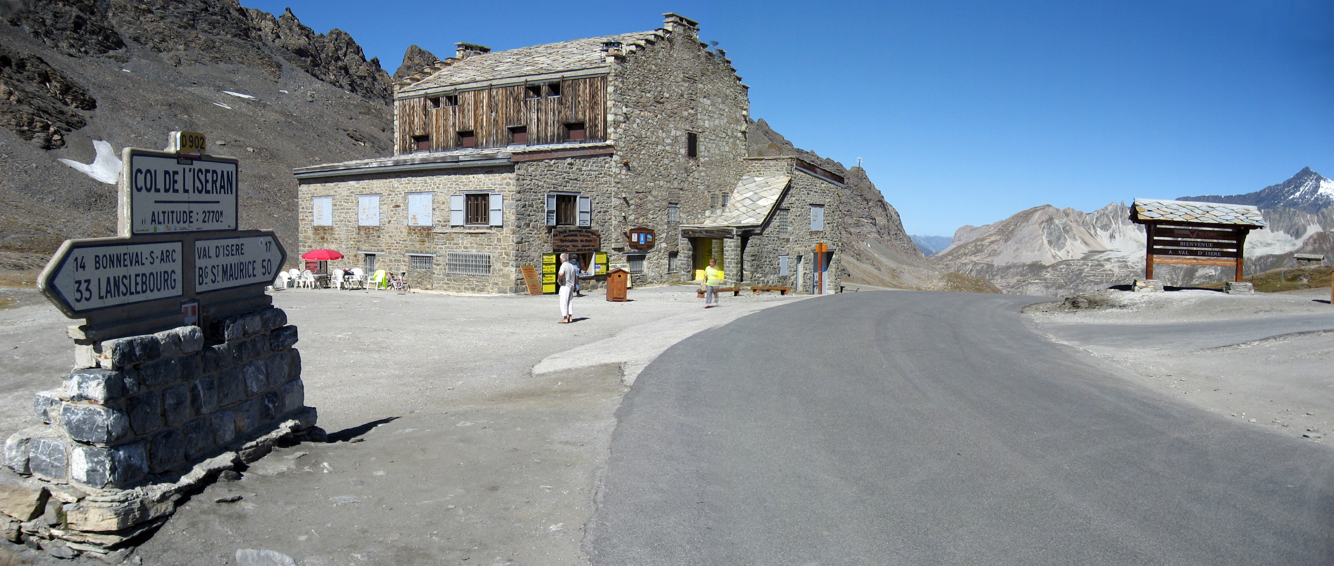
Coffee break at Col de L'iseran, France.
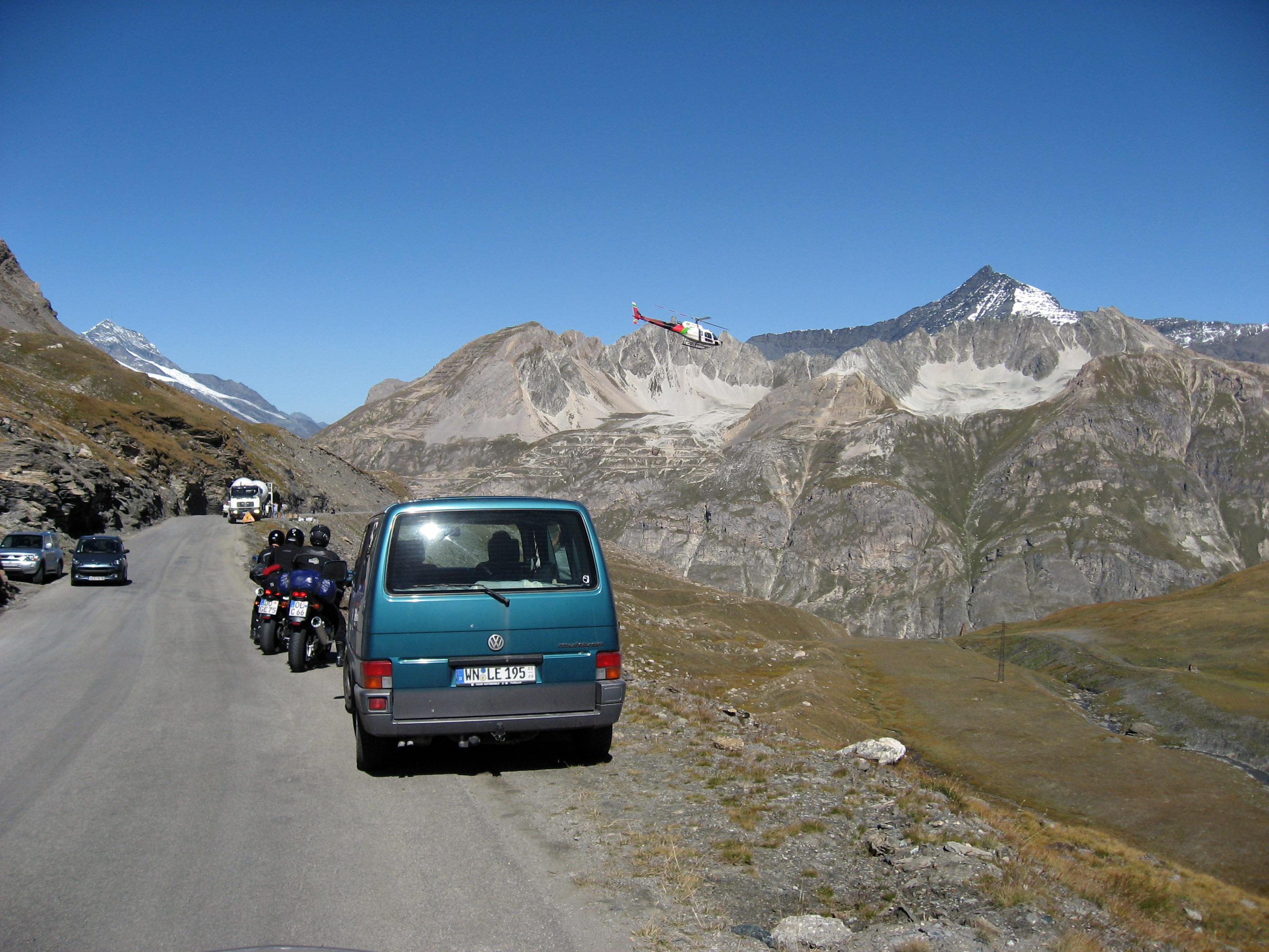
They were building a new ski lift or gondola at the ski area of Val-d'Isčre, France. The helicopter in this picture was whizzing back and forth between the cement mixer truck in this picture, and the top of the mountain to pour more concrete.
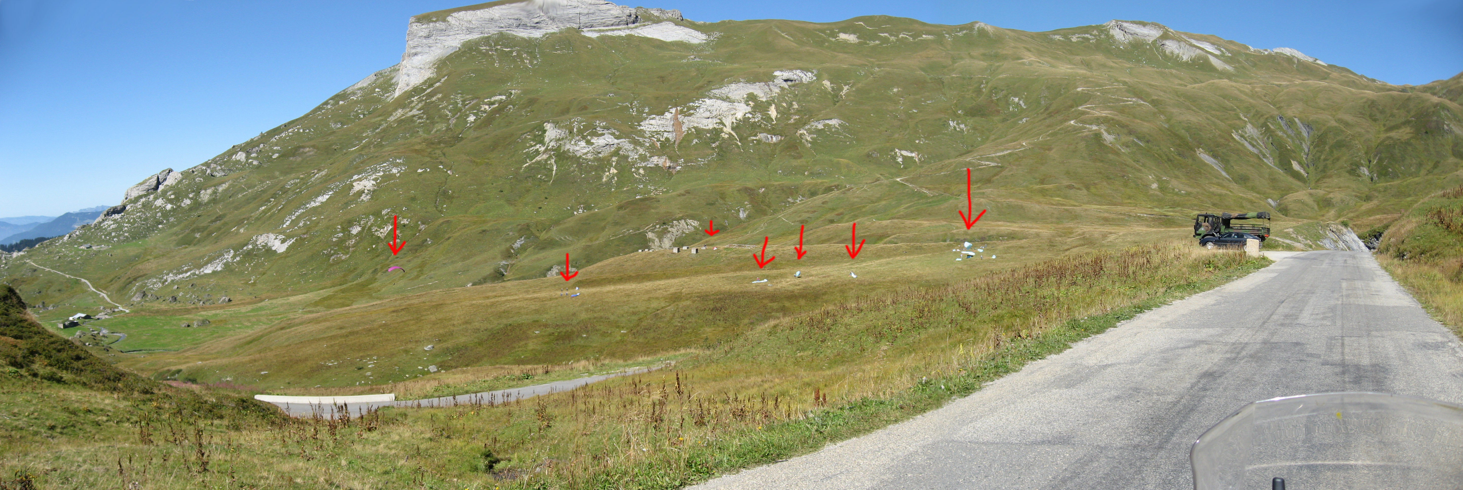
Up near Beaufort, France we came across this paragliding school. It's hard to see the students so I point them out with red arrows. They would get a little airborne, then fall back to earth.
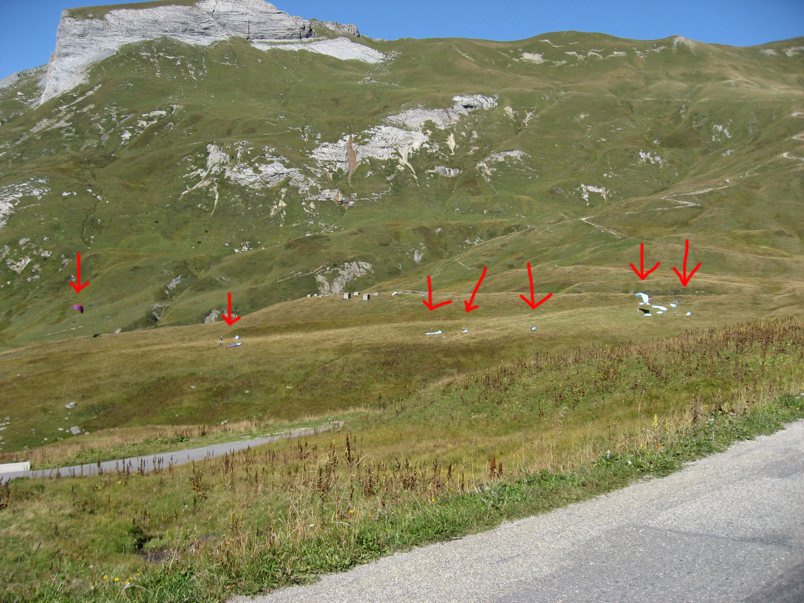
Same shot as above, just a little wider.
We took this CRAZY little tiny road loop near Boudin, France. This shot is pointing straight down the hill to see the switchbacks we just navigated up.
I liked these happy, relaxed looking French cows at Col du Pré, France. This is on a tiny little road that loops through Boudin, France.
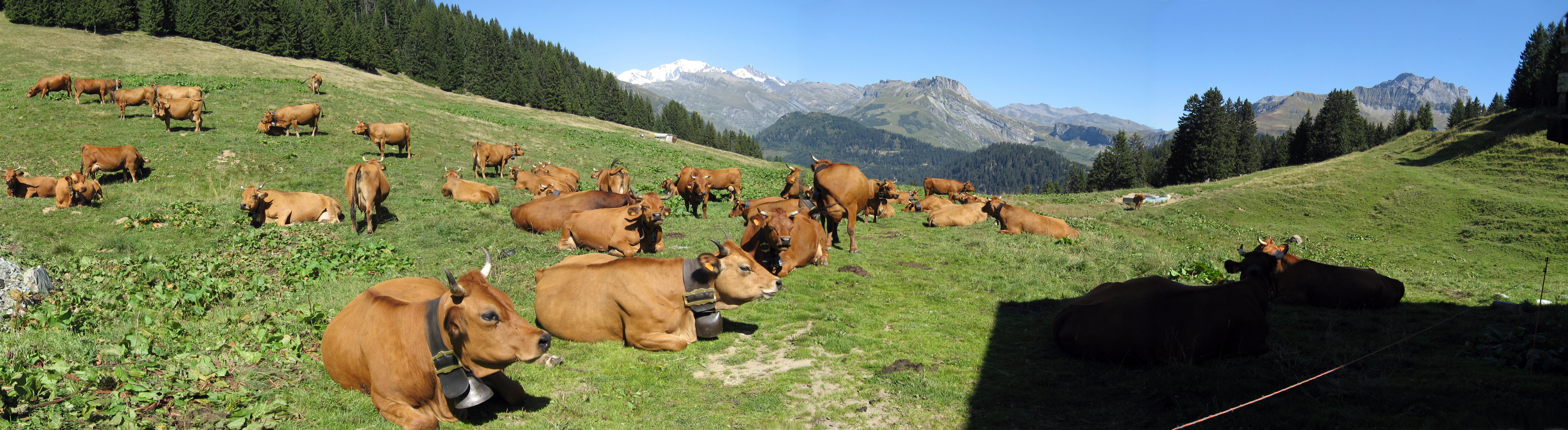
Here is a picture by BrianB I found later that shows me (BrianW) taking the above picture of the cows. :-)
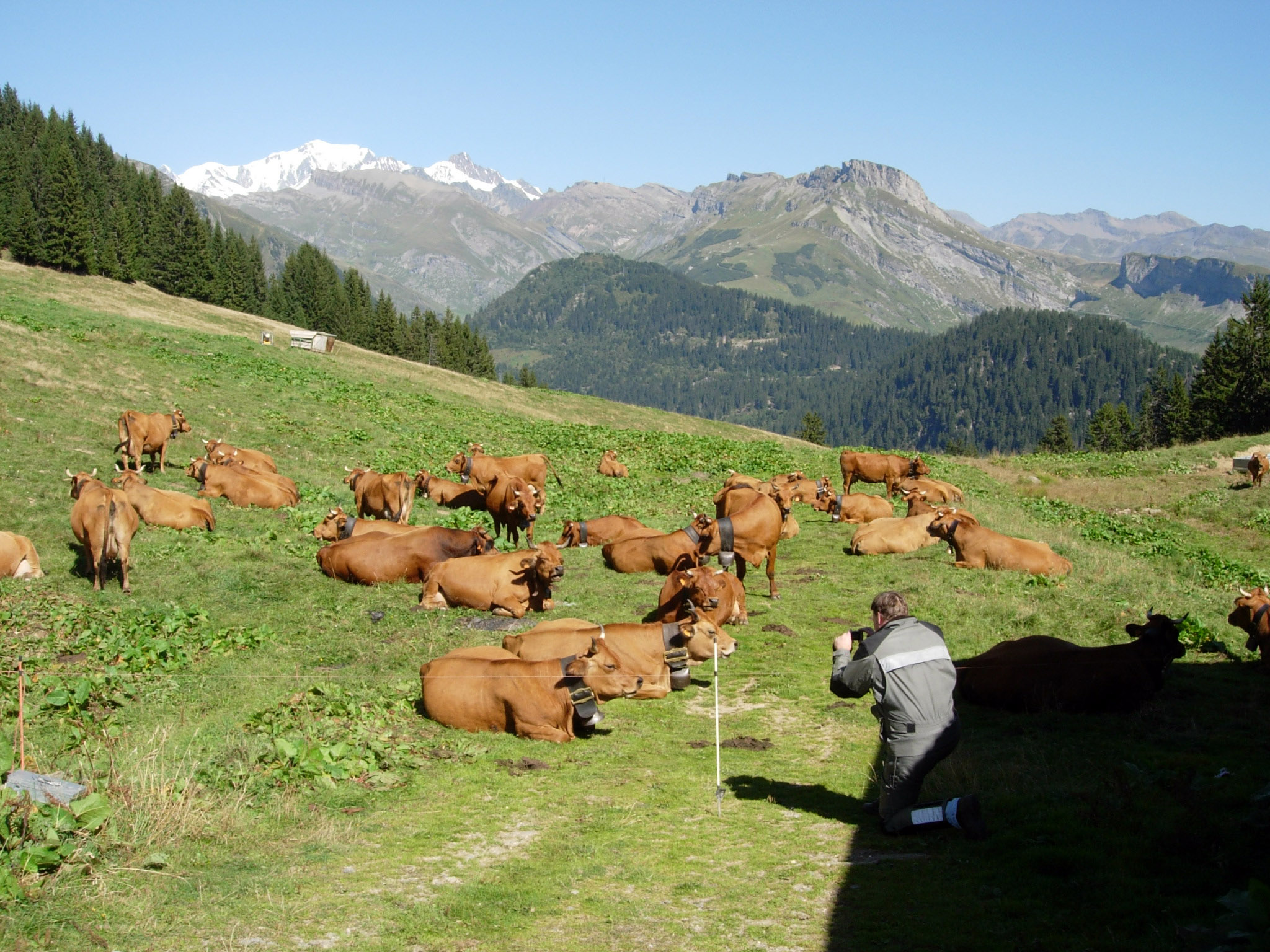
I only took this next photo to remember where the heck the happy cows were.

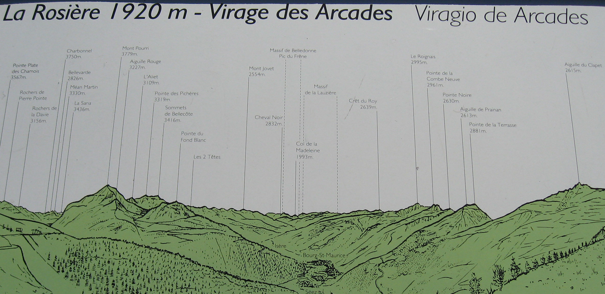
Onwards, we cross over the "Petit St Bernard" pass.

Some views either just after, or just before the Petit St Bernard pass in France.

Explanation of the above picture.
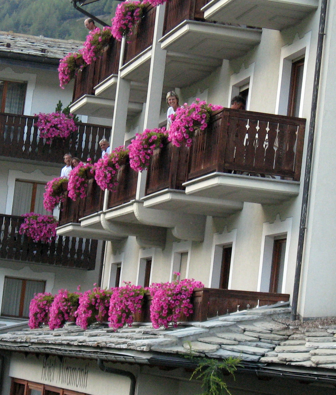
Arriving in Cogne, Italy, as we looked around for the hotel we heard shouting and looked up to see many from our group sitting on their balconies waving to us. That is hotel Miramonti, Cogne, Italy.
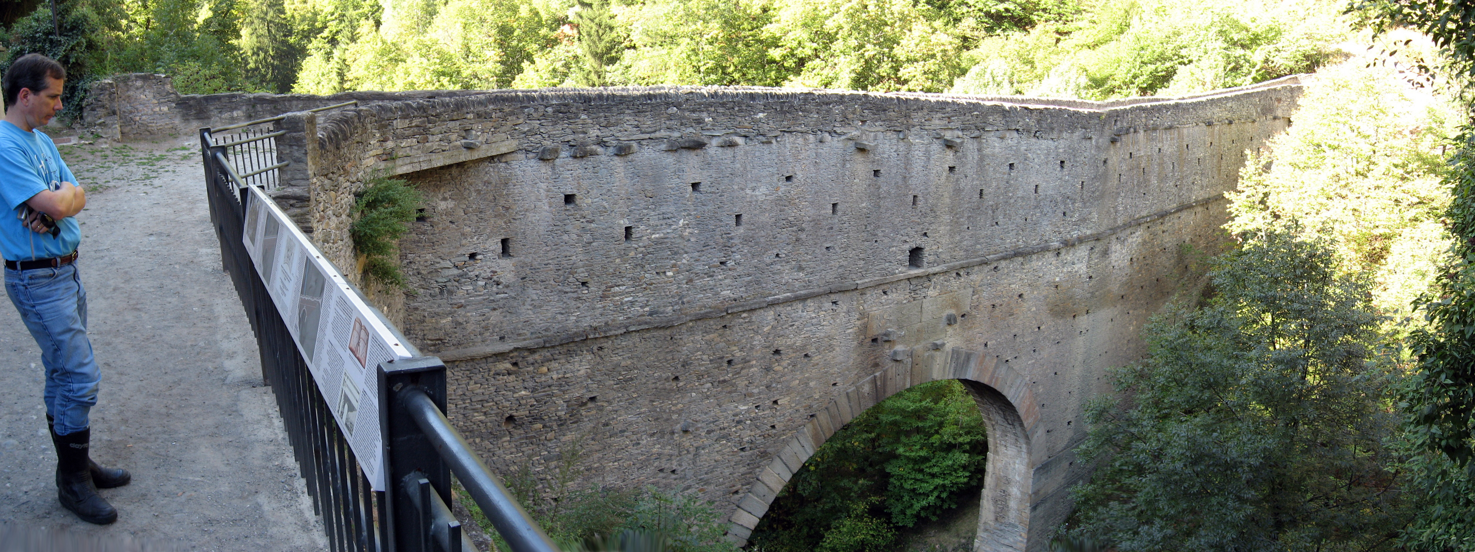
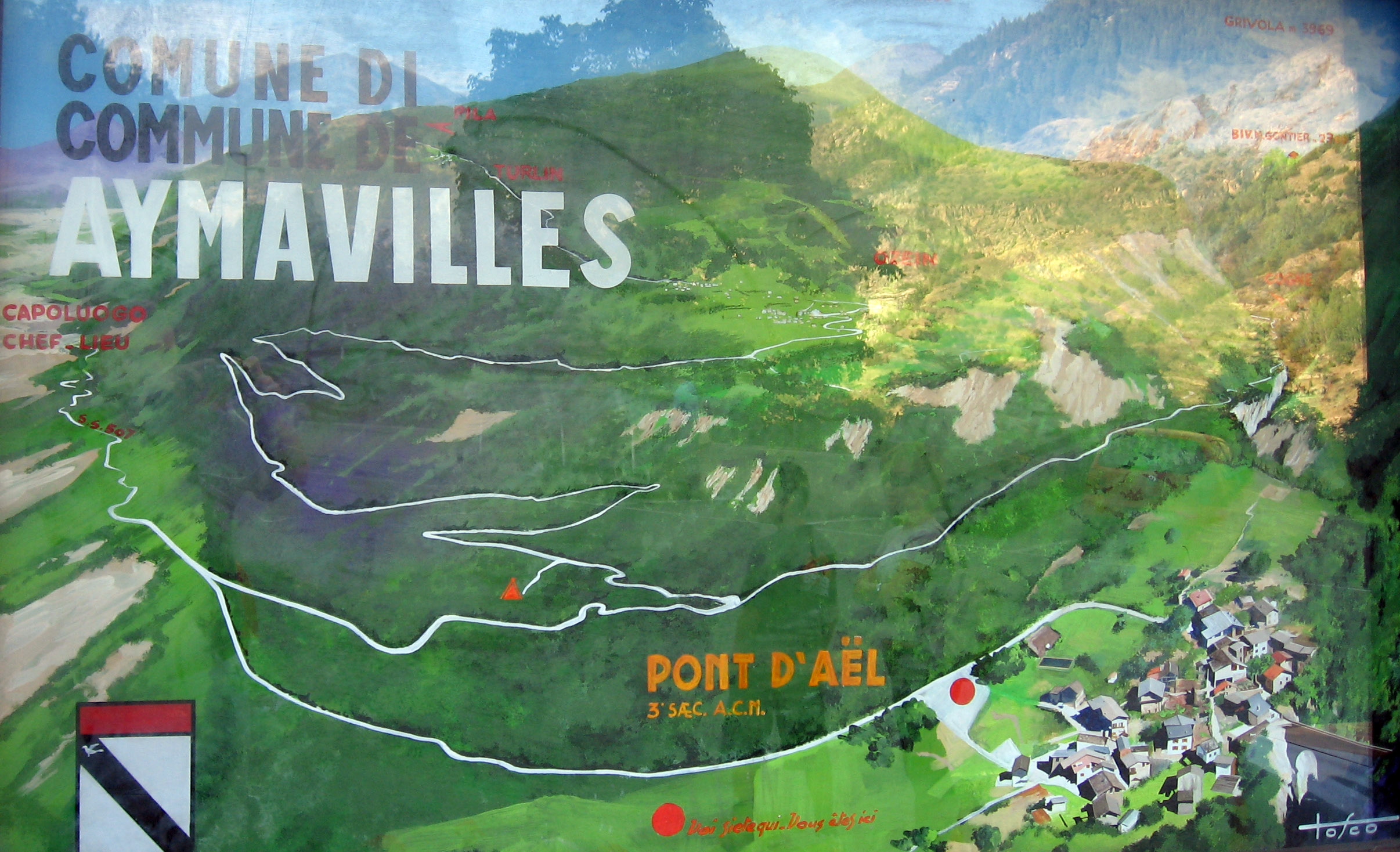
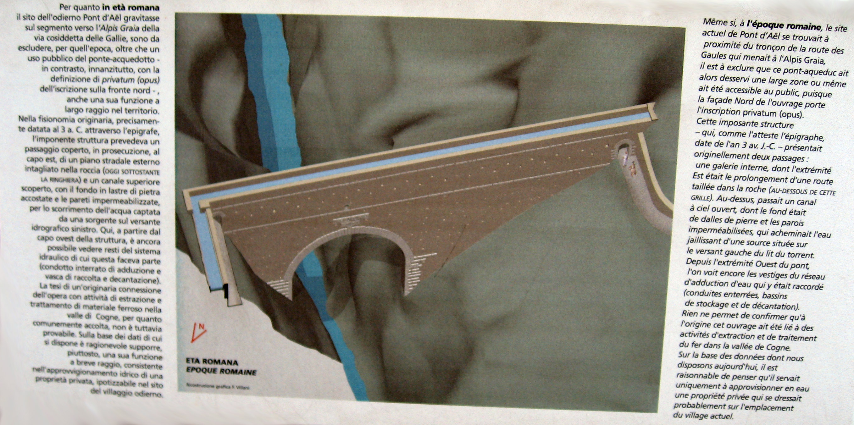
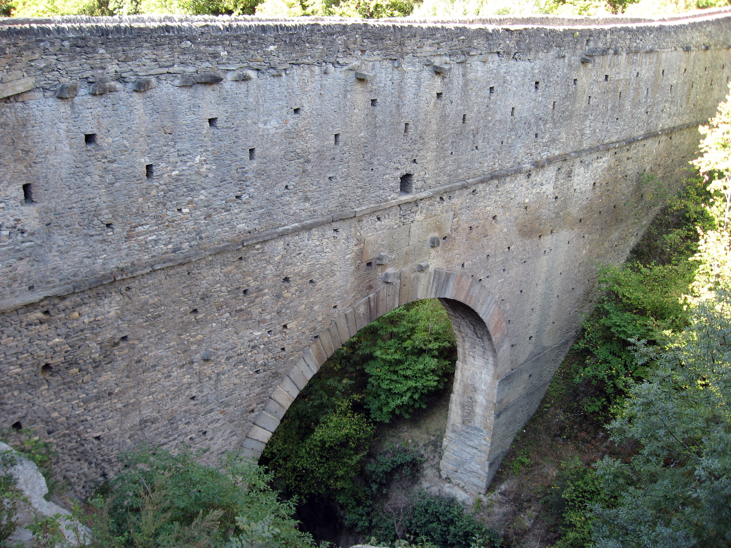
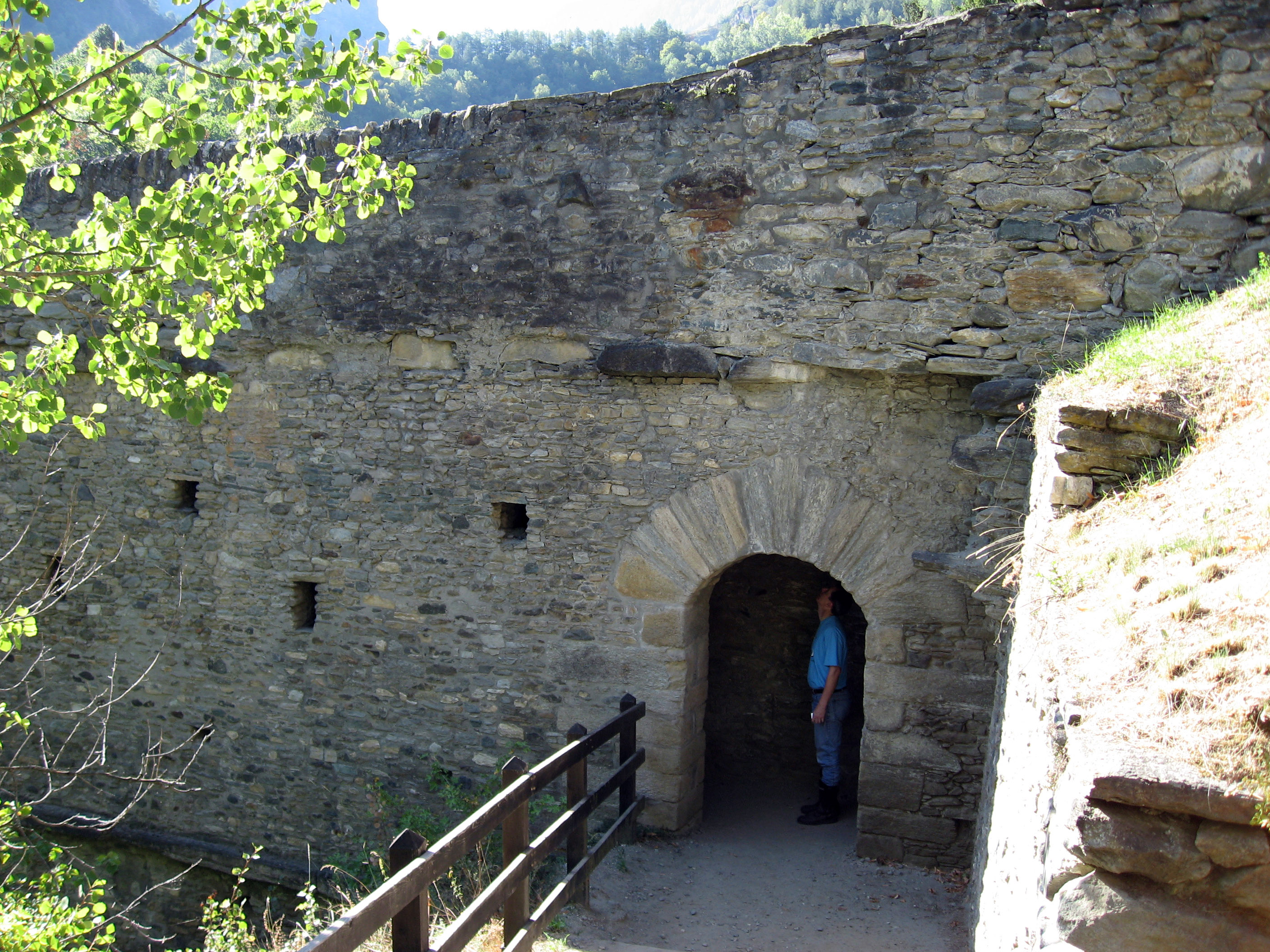
We got up in the morning of Wednesday, 9/6/06 in Cogne, Italy and drove through 5 or 6 Italian and Swiss (Switzerland) mountain passes on our way to our next hotel in Verbania, Italy. Ten minutes from Cogne, Italy is the town of Aymavilles, Italy, with a perfectly preserved Roman aqueduct and bridge from 3 B.C. at Pont d'Aël. We stopped to look at this 2,000 year old bridge. It is amazing that the Romans could build an aqueduct that would last 2,000 years and still work and be safe to walk on, is there any current engineering culture on earth that builds anything that solid and long lasting? Below BrianB is deciphering the information plaques (which are all in Italian).
These next two pictures are of the information plaques. Click on them to be able to read the text better (if you can read Italian).
This information plaque is in the town of Aymavilles, Italy at Pont d'Aël and describes information about this aqueduct and bridge that was built by the Romans in 3 B.C.
Another picture of the 2,000 year old aqueduct and bridge built by the Romans in the town of Aymavilles, Italy at Pont d'Aël.
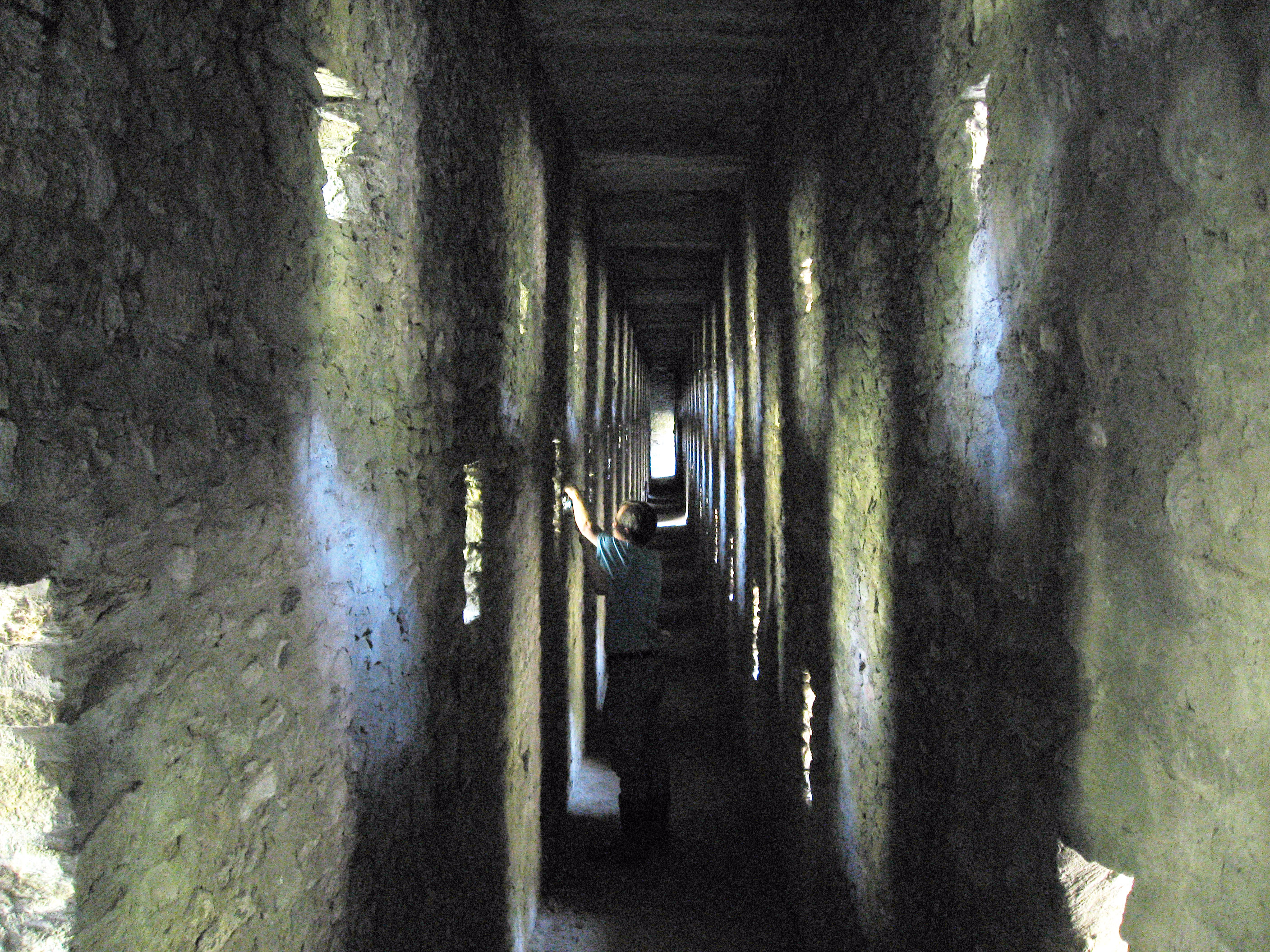
We walked across the top, then you can walk down a few steps and walk inside the 2,000 year old aqueduct and bridge built by the Romans in the town of Aymavilles, Italy at Pont d'Aël.
This is the inside of the aqueduct and bridge built by the Romans. I had to brighten this picture with Photoshop to see more detail, the inside is normally a little darker. The holes in the sides of the structure are to let light in. The roof are planks of solid, smooth rock.
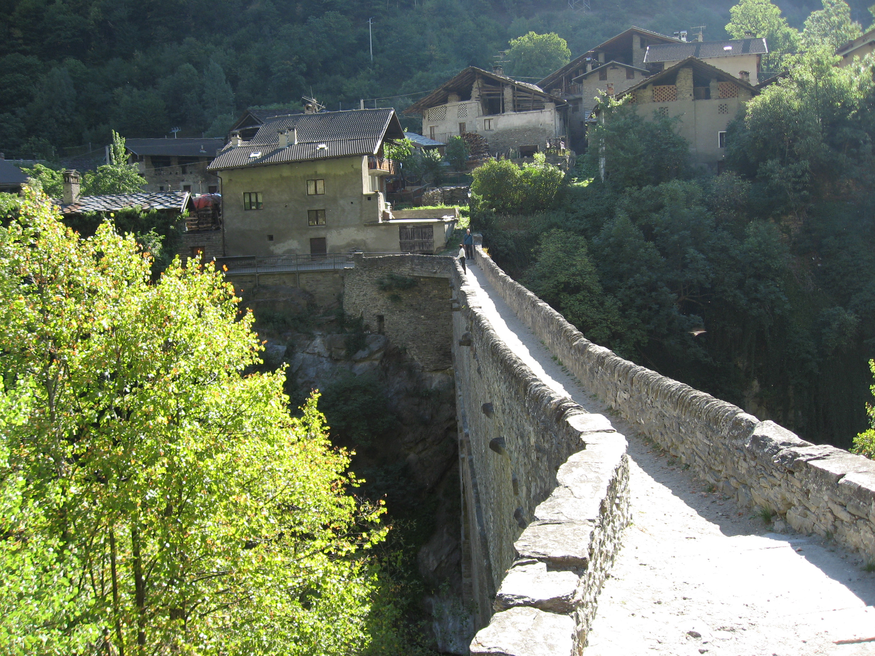
This is a picture from the other side, after we walked across the 2,000 year old aqueduct and bridge built by the Romans in the town of Aymavilles, Italy at Pont d'Aël.
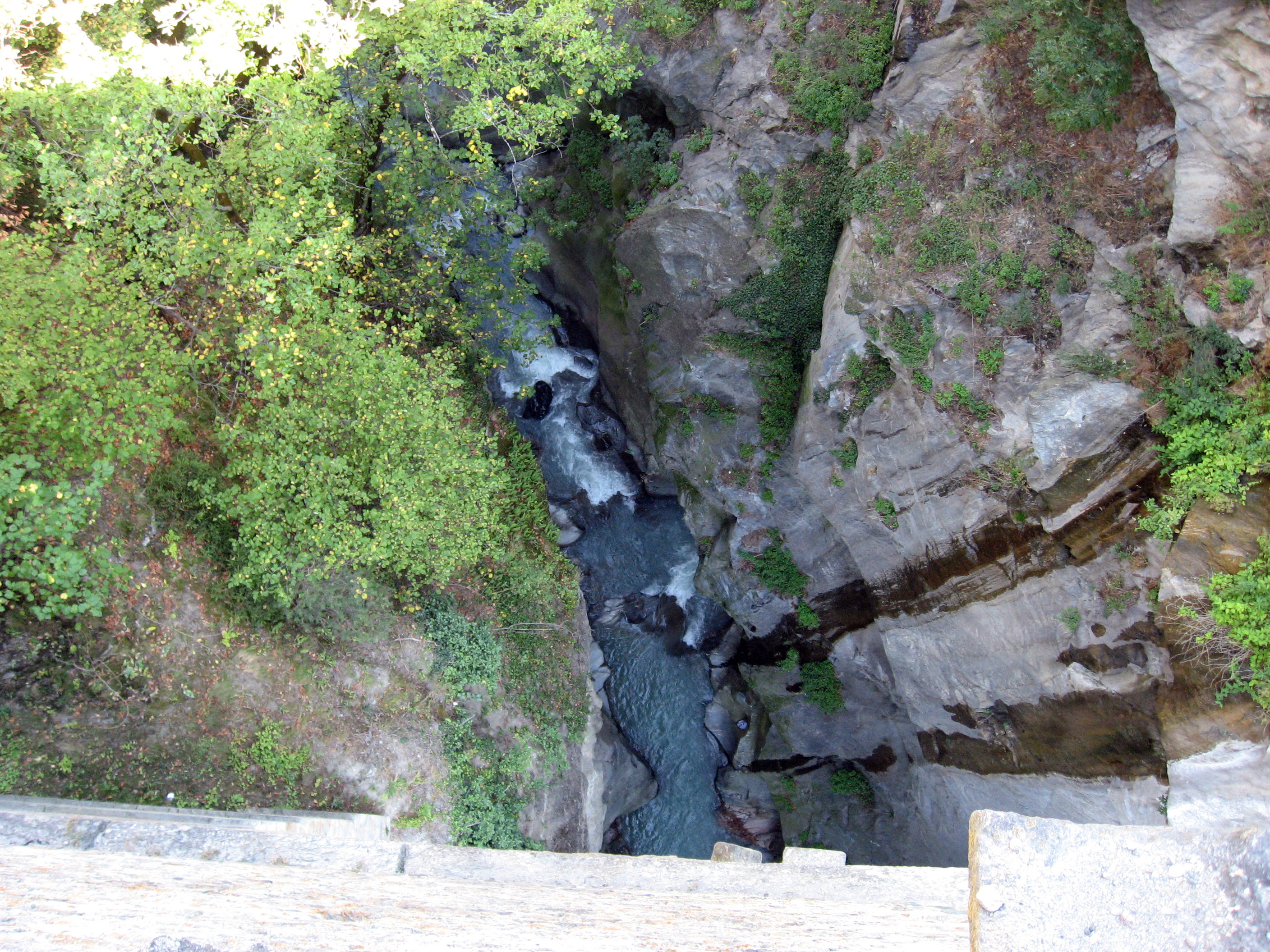
The next picture was taken from right in the center of the aqueduct/bridge, staring straight down into the stream below.
After that little sight-seeing diversion, we continued driving our BMW motorcycles through some mountain passes in Italy and Switzerland. Here we begin climbing up the "Grand Saint Bernardo" pass.
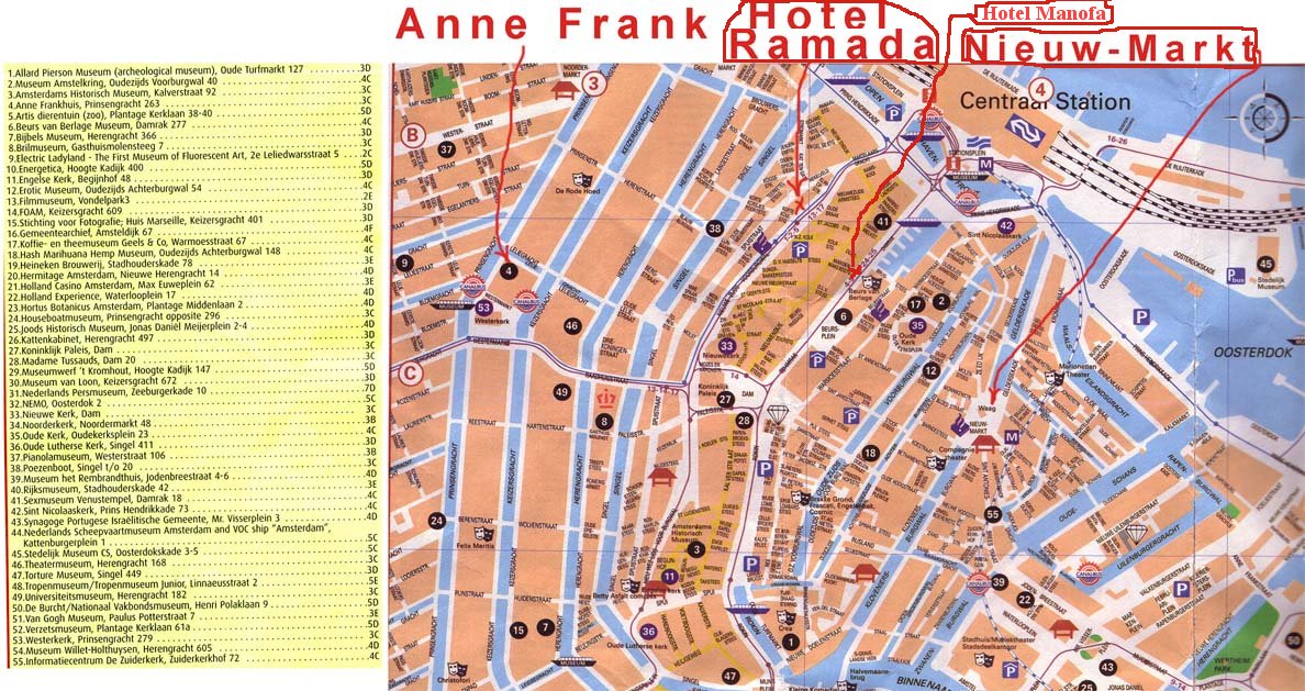
After the Grand St Bernardo, we hit the highway and ripped along at 80 mph over to an absolutely fantastic motorcycling area of Switzerland that is found centered around the town of Andermatt, Switzerland. The symbol "A" on the map below shows where we entered this area around noon on Wednesday, 9/6/06. We went up to the intersection marked "B" near Grimsel pass (Grimselpass), but we turned right with the BMW motorcycles and drove up over Furka pass (Furkapass) marked "C" on the map below. Then we drove the motorcycles over to Andermatt, Switzerland marked "D" on the map below, then we drove over the "Old Saint Gotthard Pass" (Passo del S. Gottardo) marked "E" on the map below. We then ripped along the highway at 80 mph to point "F" on the map below, then drove along the north side of Lake Maggiore (Lago Maggiore) to find our hotel in Verbania, Italy at the spot marked "H" on the map below. We got into our hotel at 7:30pm, so the loop shown on the map below from "A" through "H" took 7 and a half WONDERFUL motorcycling hours including stops for lunch, Italian espresso, and a few pictures.
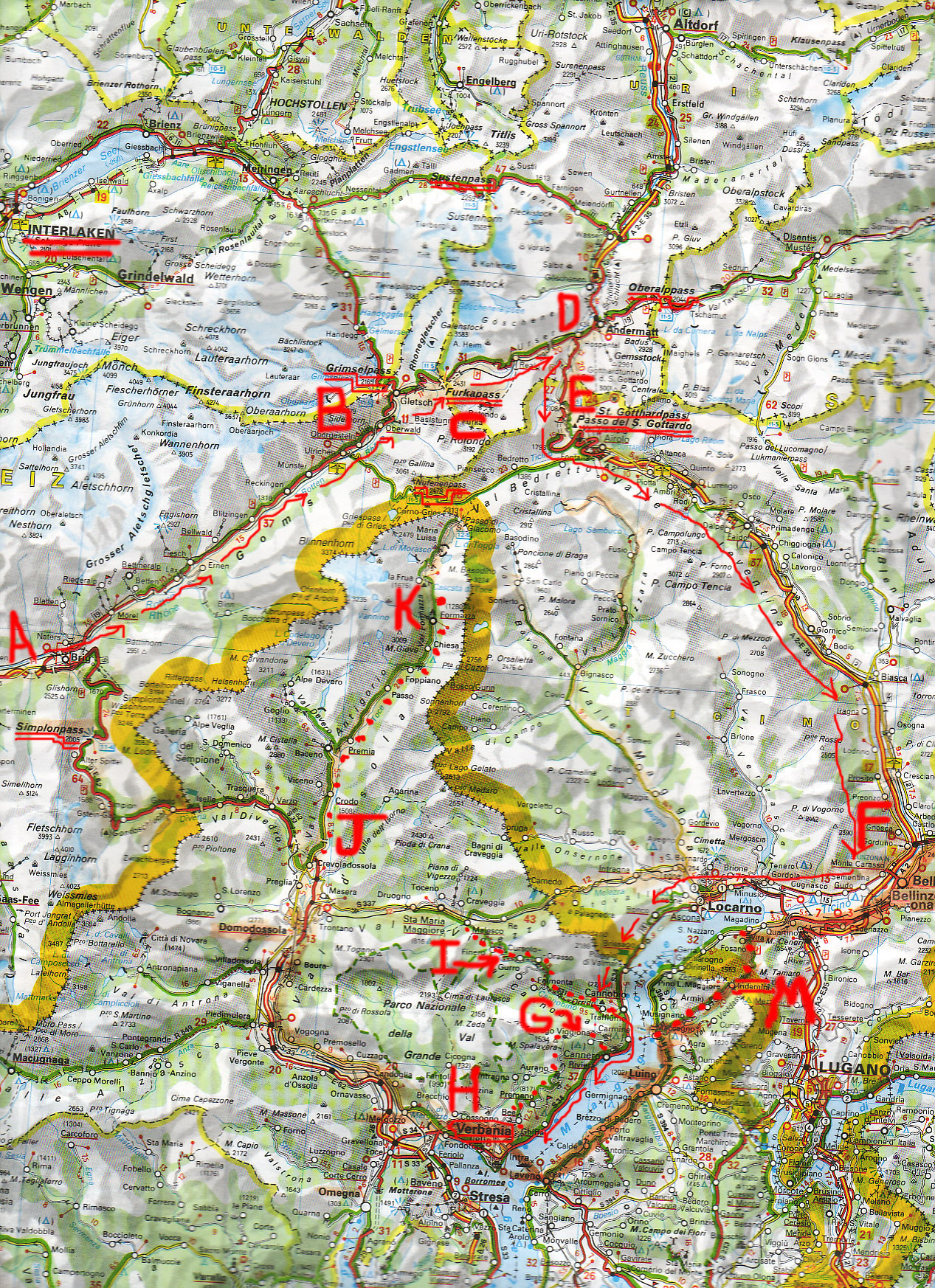
We stopped for lunch at the intersection marked "B" on the map above, where we could either ride our motorcycles up Grimsel pass (Grimselpass) or Furka pass (Furkapass). You can see the road up Furkapass in the middle of this photo, which is the route we chose for today. This picture was taken from the parking lot of our lunch spot.
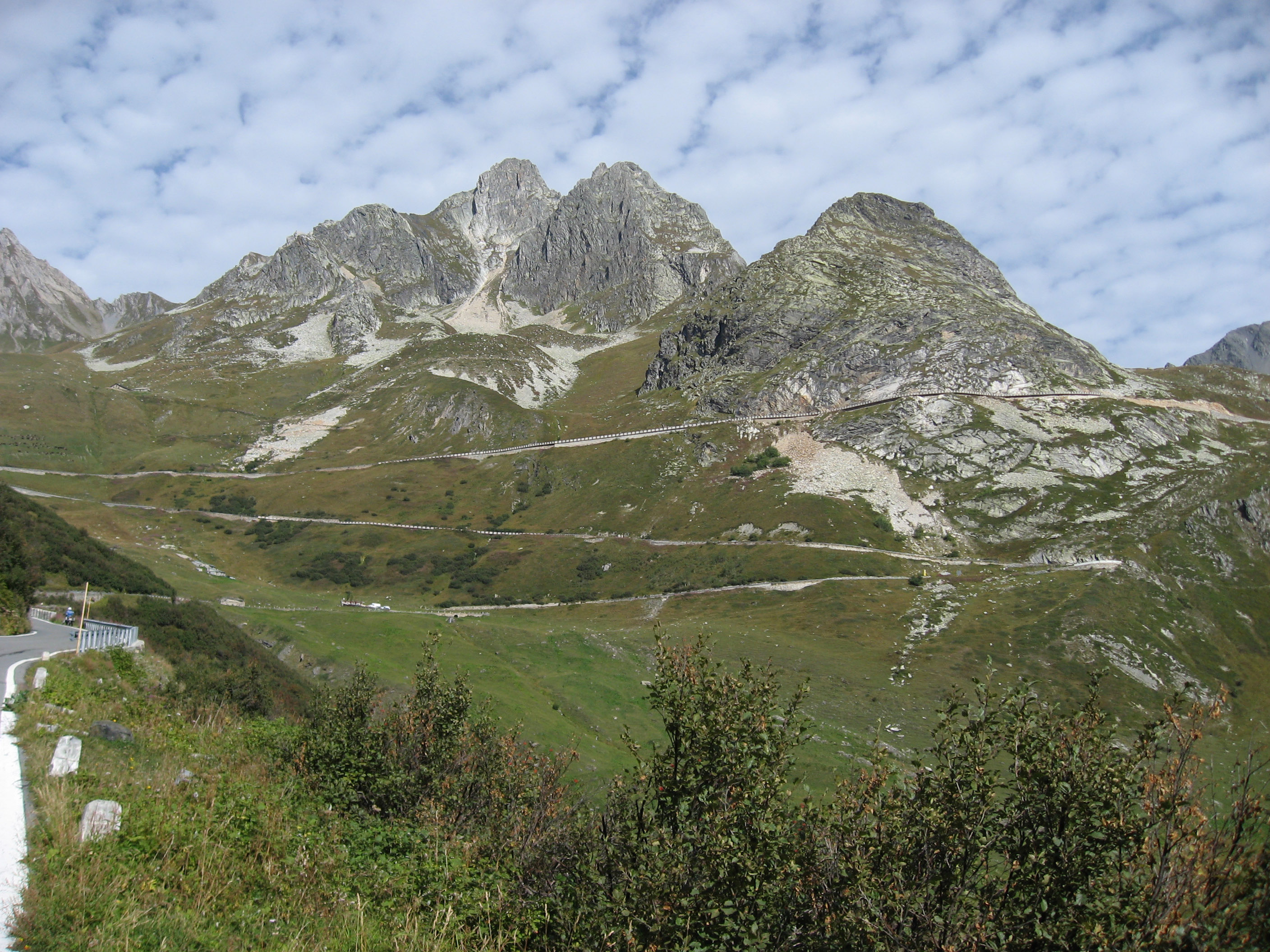
A little way up the Furka pass (Furkapass) we stopped to look back down the valley. At the very lowest point where the river intersects the road is where we had lunch. The road leading up the right side of the picture into the distance is Grimsel pass (Grimselpass). We drove our motorcycles up the road you see mostly horizontal on the left.

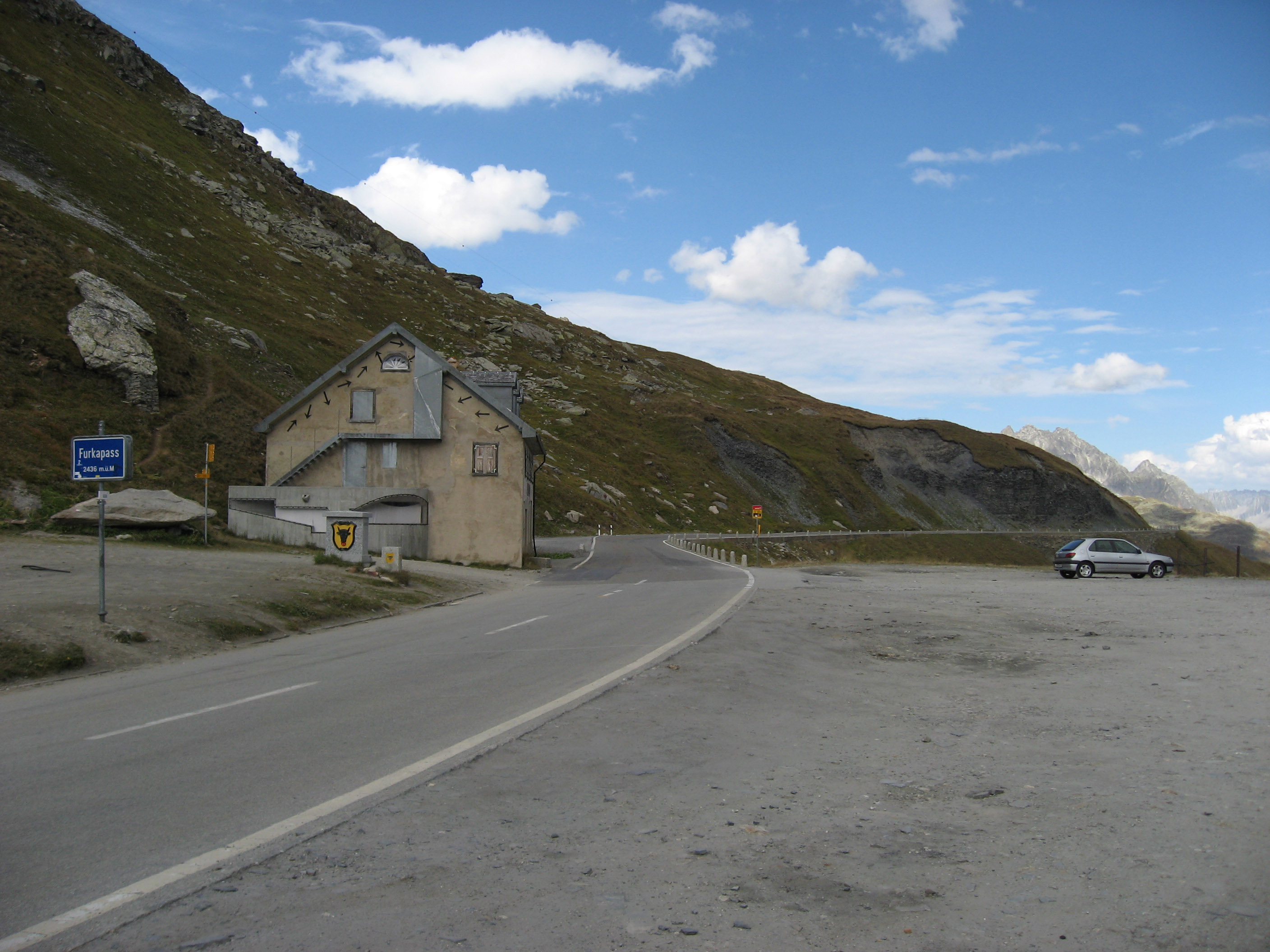
A quick picture to remind me this was the top of Furka pass (Furkapass) Switzerland.
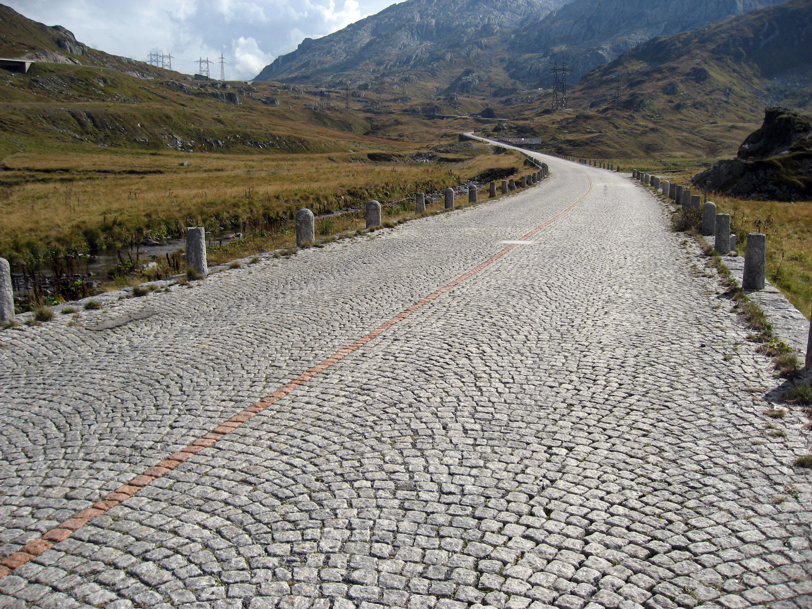
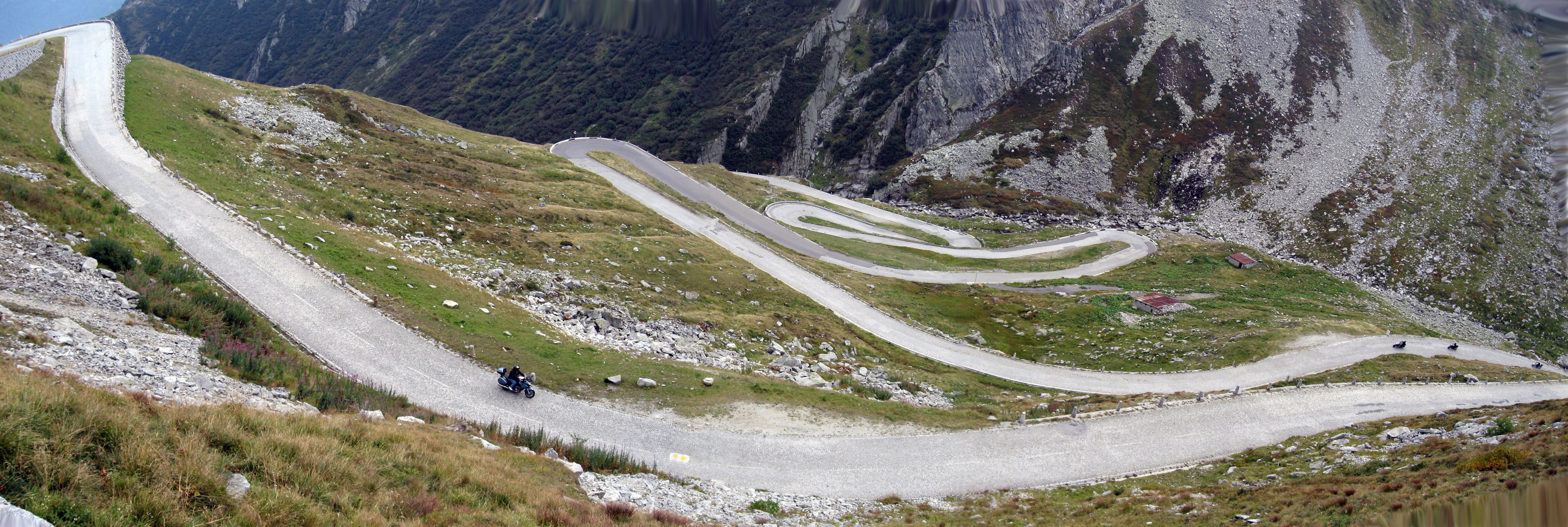
Down the back side of Furkapass, then we chose to drive our motorcycles through the "Old Saint Gottard Pass Road". There is a new fast big highway, but the old highway is all cobblestones (shown in the picture below) and very scenic and old.
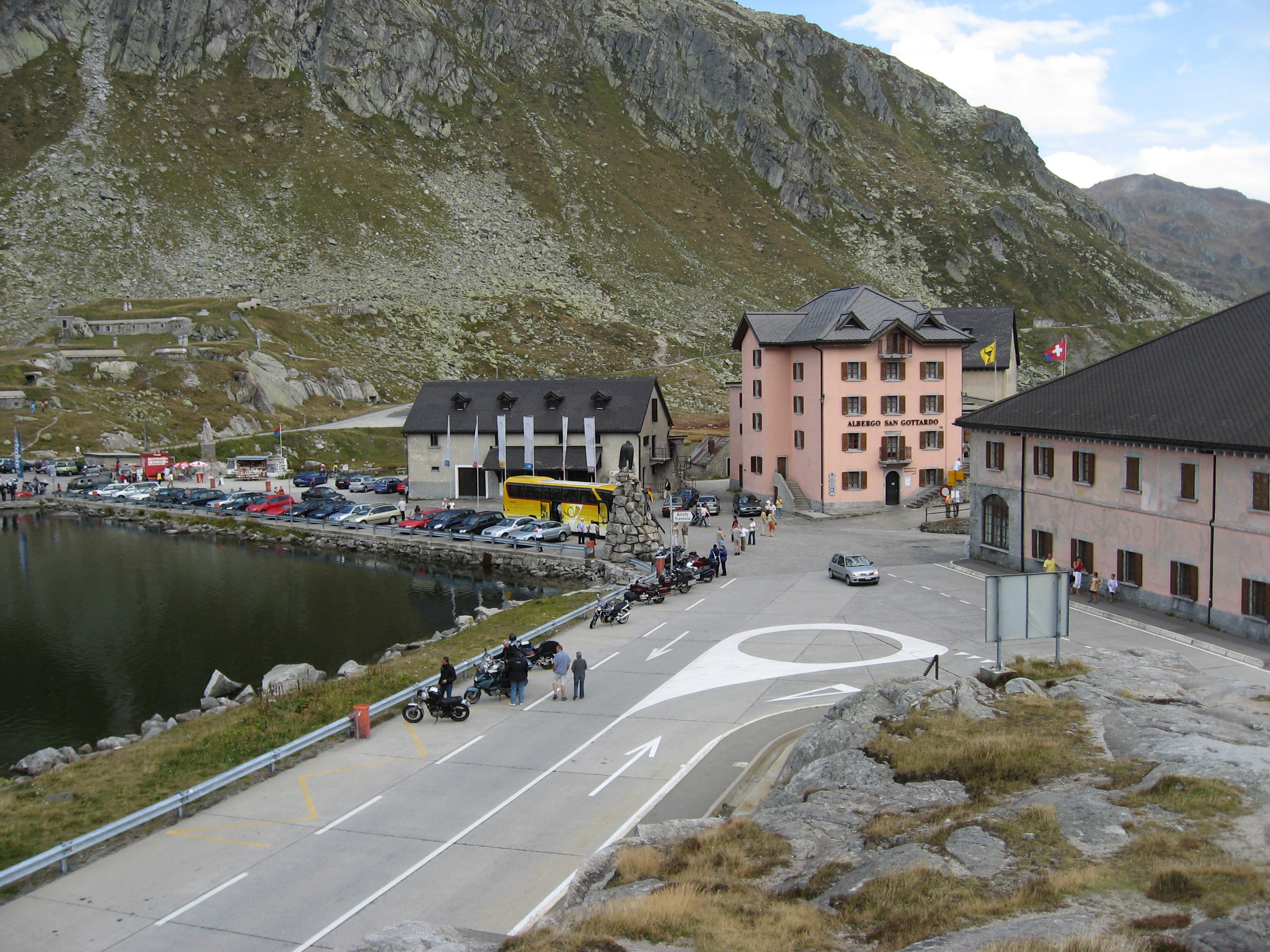
Here we are at the top of Saint Gottard Pass.
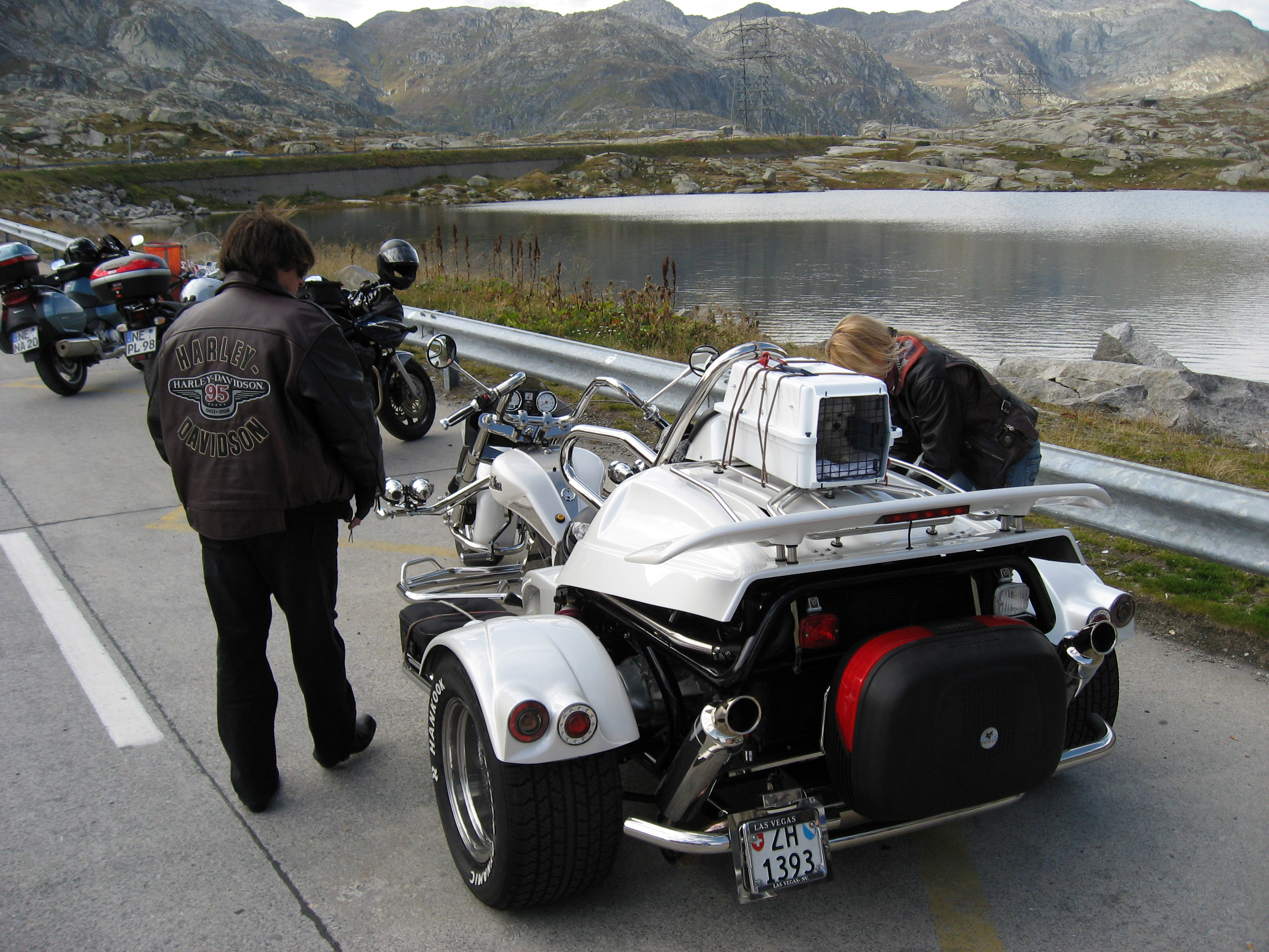
At the top of Saint Gottard Pass, I saw this motorcycle trike with a little doggy in a pet carrier on the top! How neat, I wish I could bring a dog along on all my motorcycle rides!
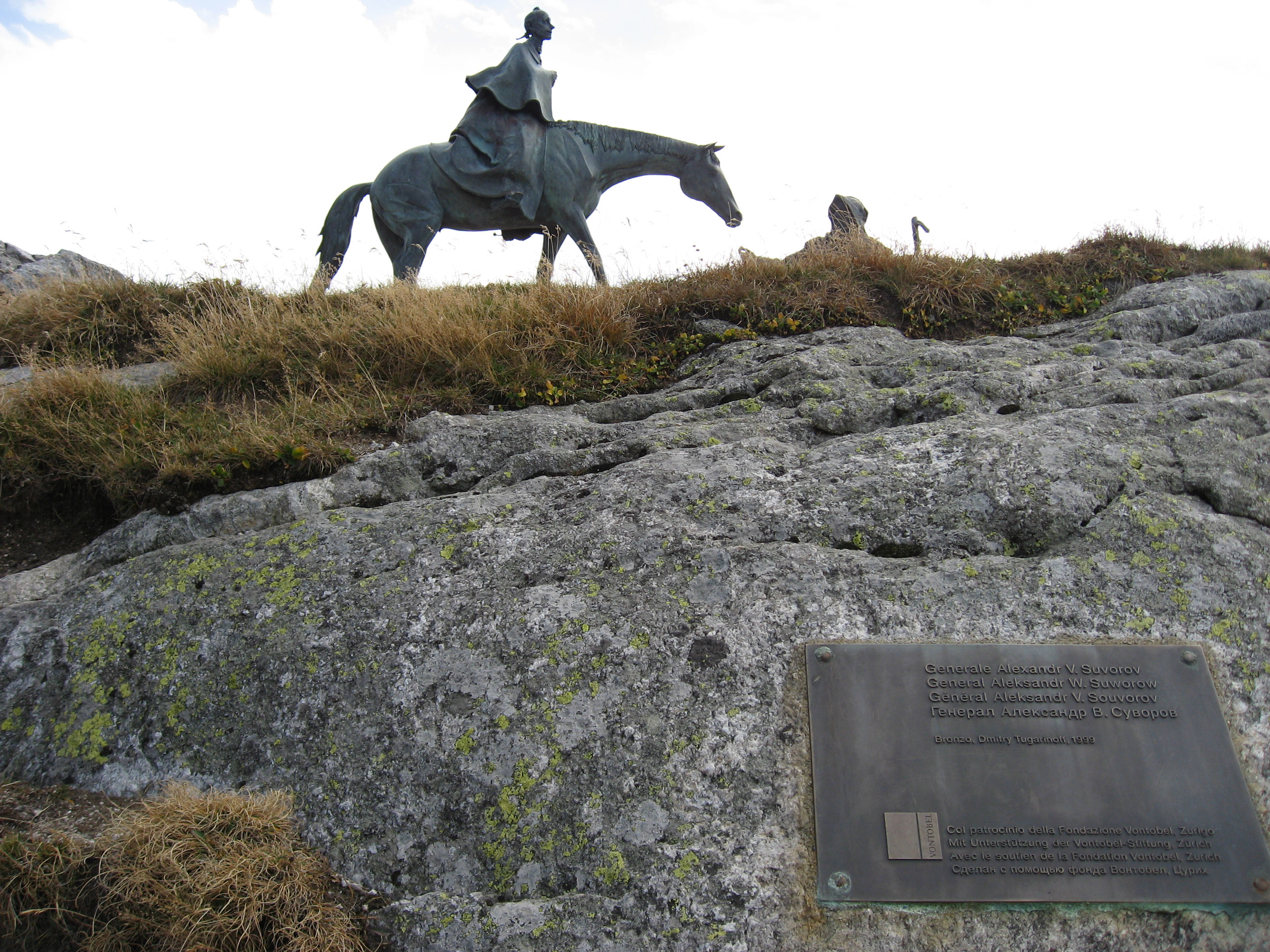
Random statue at the top of Saint Gottard Pass in Switzerland.
This picture was taken dropping down the other side of Old Saint Gottard Pass in Switzerland. We are about to descend with our motorcycles on this road, which is all cobblestones and notice the switchbacks.
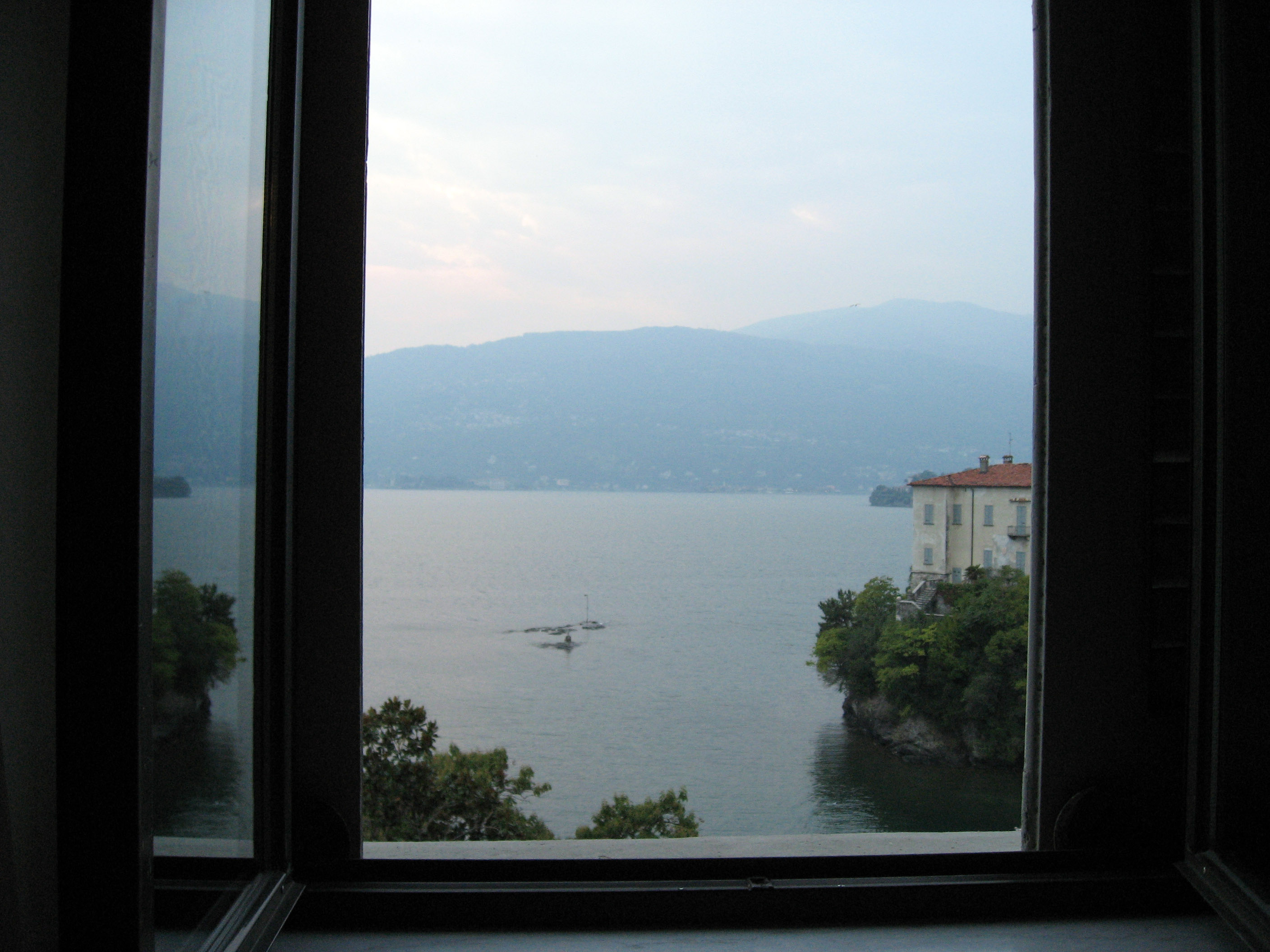
A few hours later, checking into the hotel in Verbania, Italy. This is the view out the window in my room, which is overlooking the Lake Maggiore (Lago Maggiore) in Italy. The hotel is called "Grand Hotel Majestic", and it was very, very nice.
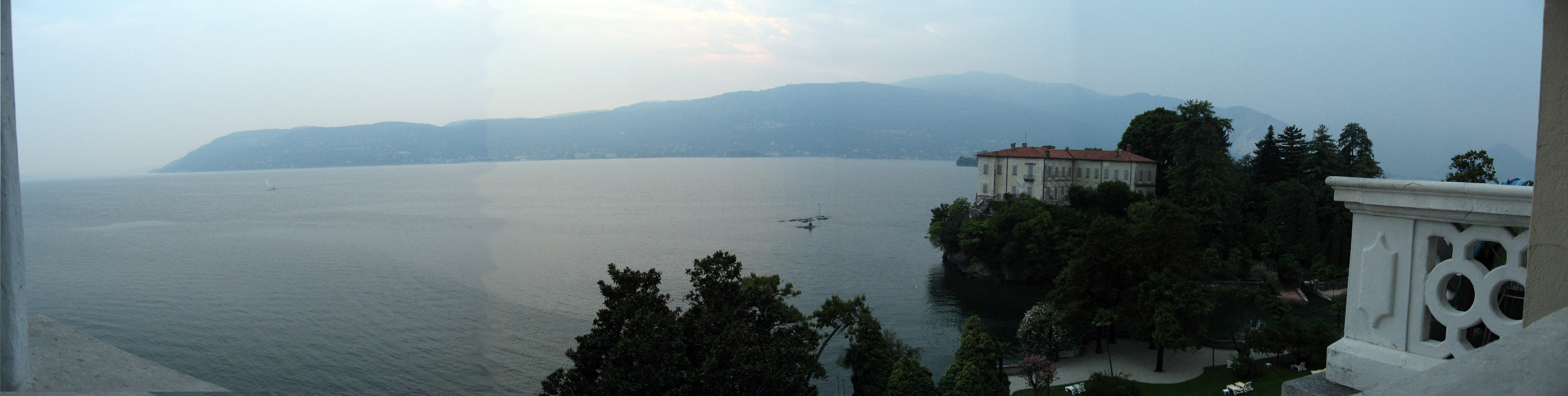
Leaning out the window and taking a panorama of the view from my hotel room out over Lake Maggiore (Lago Maggiore) in Italy.
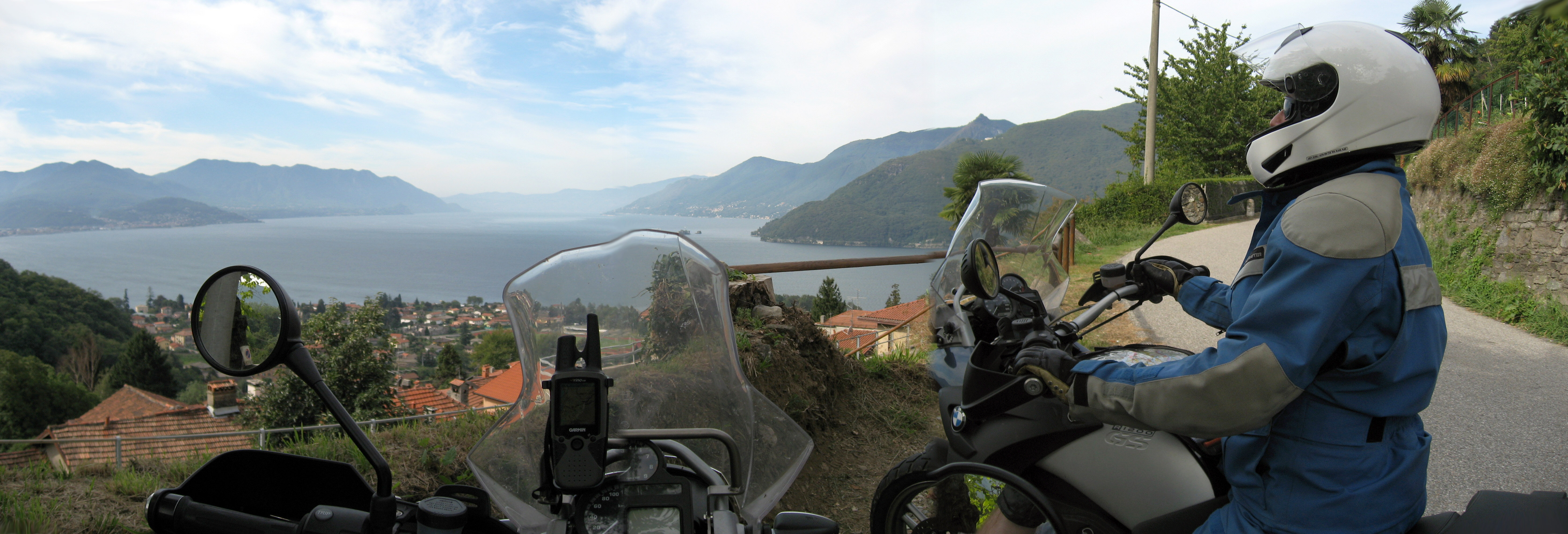
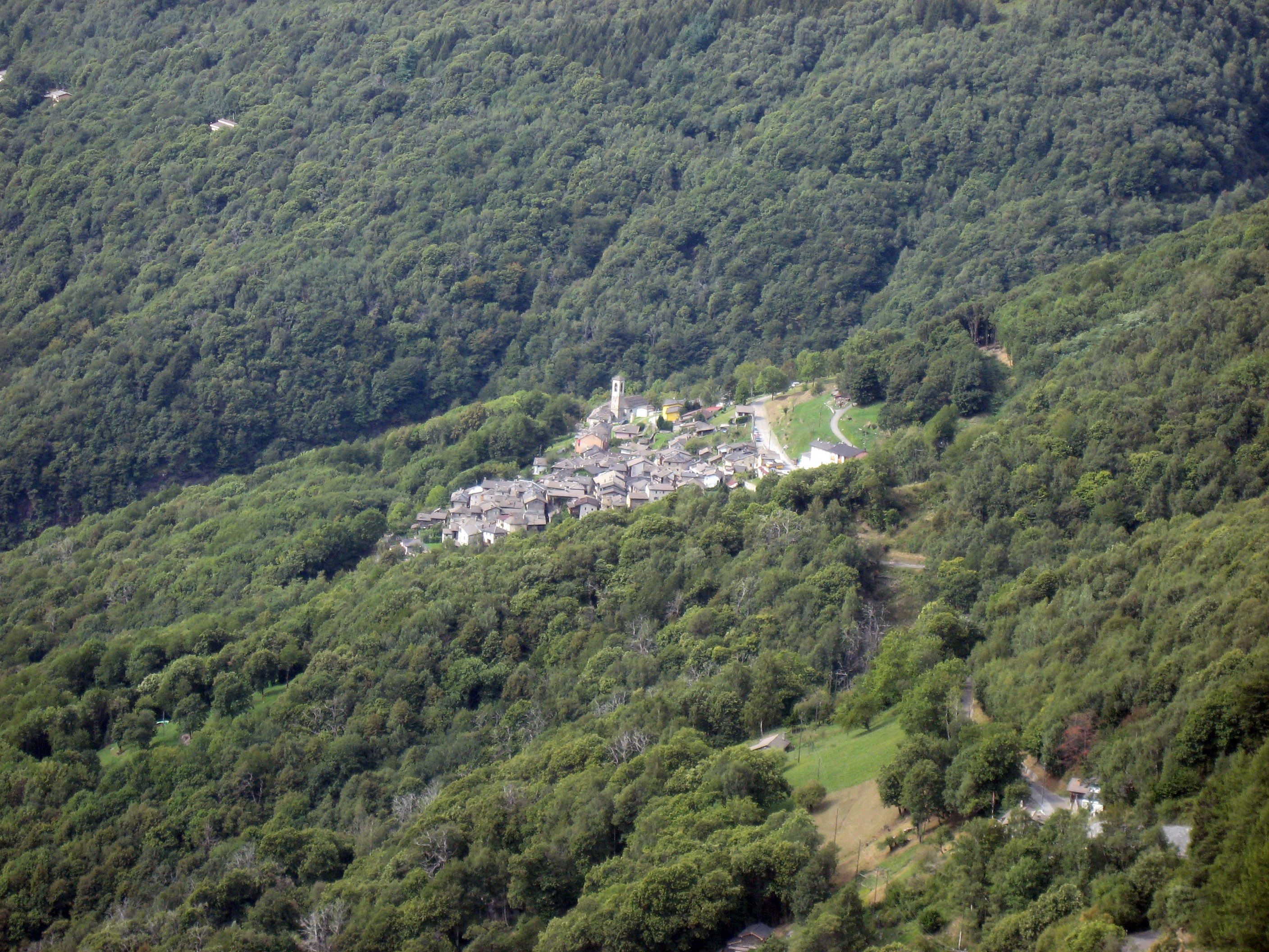
The day of Thursday, 9/7/06, was an optional day (two nights in the same hotel), so BrianB and I went exploring a few new roads on our motorcycles. On the map above, we started the morning at the hotel in Verbania, Italy (marked "H" on the map above), went up the small road from "J" on the map to "K" on the map (marked by red dots). The route took us up a steep Italian valley that was ROCKY -> meaning rocks in the fields, big rock walls on the sides of the valley, something that looked like a modern granite rock quarry, ROCKS, ROCKS, ROCKS! Below is a picture of some of the buildings in this valley made of rocks:
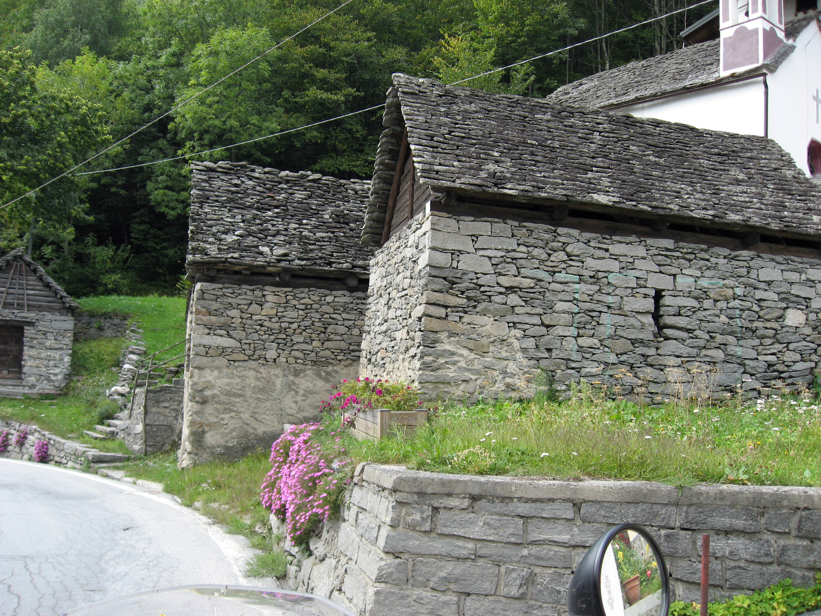
These buildings were everywhere. If you look closely, there is no visible mortar in the rock -> just correctly sized rocks to stack up to make homes. Including the rock roofs! The building below shows a roof that is caved in, so you can see the size of the rocks making up the roof.
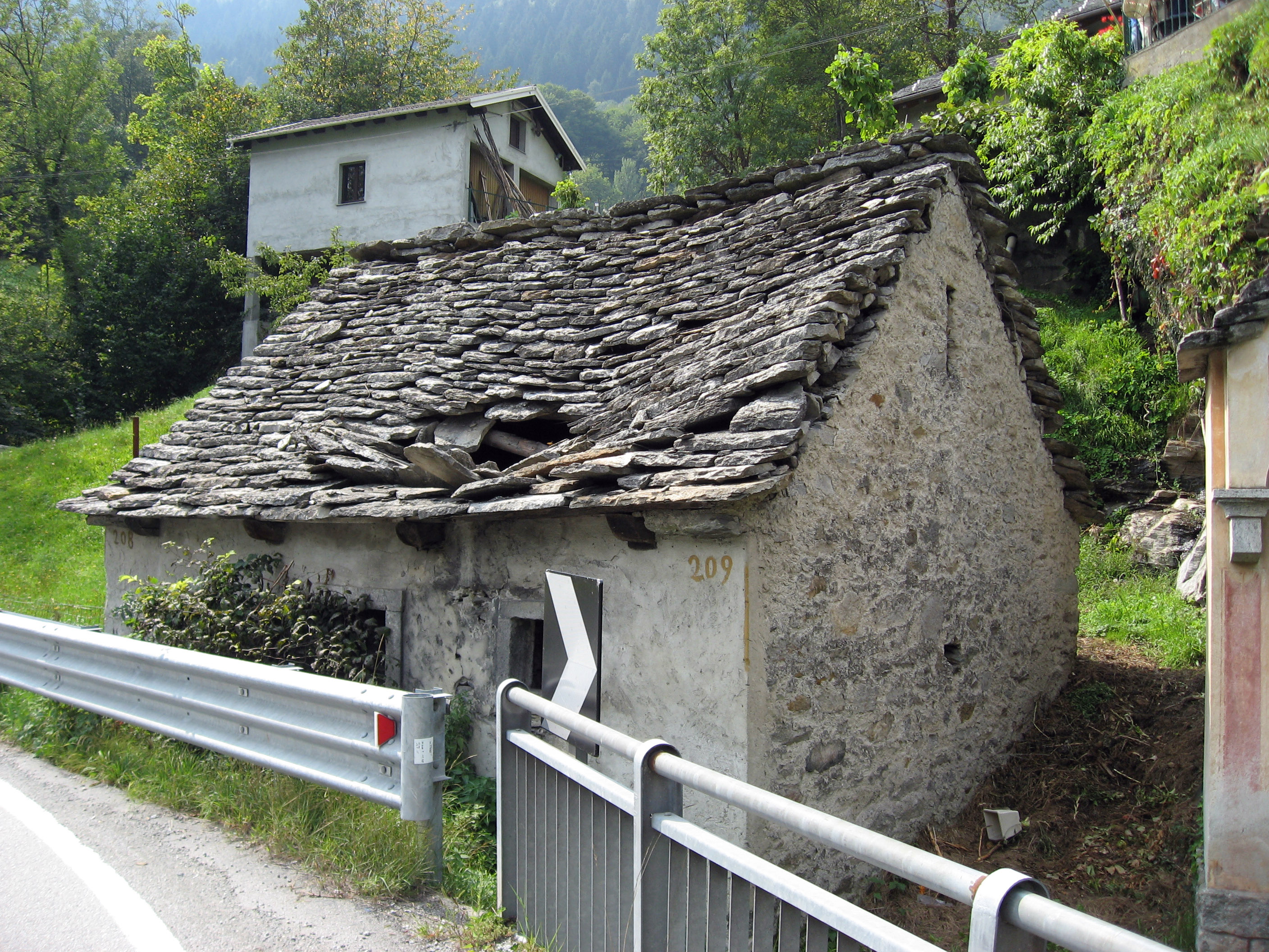
A close up showing the rocks making up the walls and roof of one of these buildings. There were maybe a hundred such rock buildings all the way up this little valley in Italy, I get the idea those rocks all used to be sitting in the fields around the building sites. Look closely at the picture below, and look at the closest wall. No mortar holding the rocks together, just rocks filling all the little gaps and open spaces!

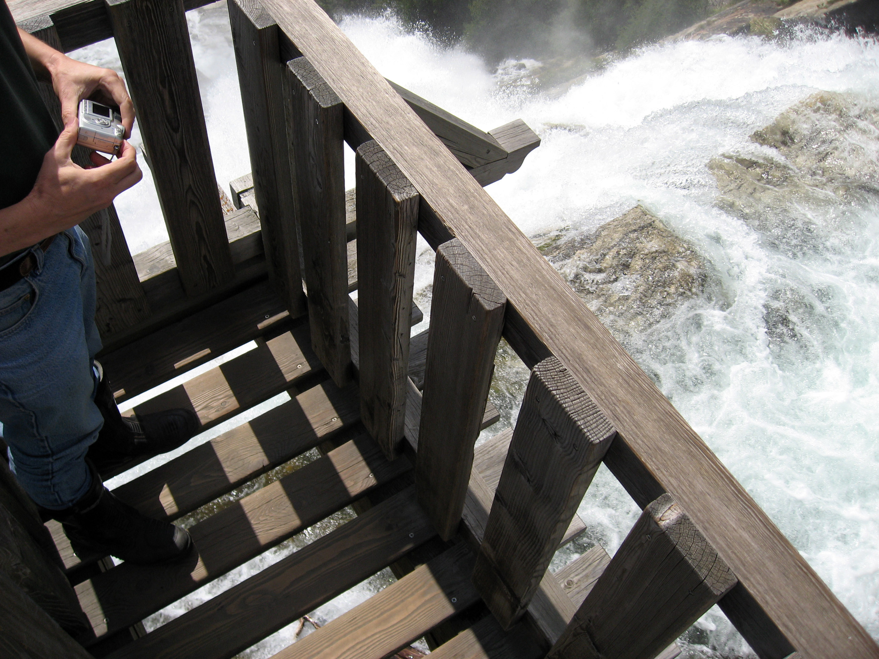
At the north end of the valley, near the "K" red mark on the map above, we came across this little spot with a waterfall and a wood platform to walk out over the waterfall. This place is called "Val Formazza" (Formazza Valley), Italy. I think the wood platform and building are at the town of Formazza, Italy.

The picture below shows the rocky terrain on the left, and scroll to the right to see the wood platform out over the waterfall. We just came up that valley (Formazza Valley, Italy) that stretches back into the distance.

A picture down from the end of the wooden platform.
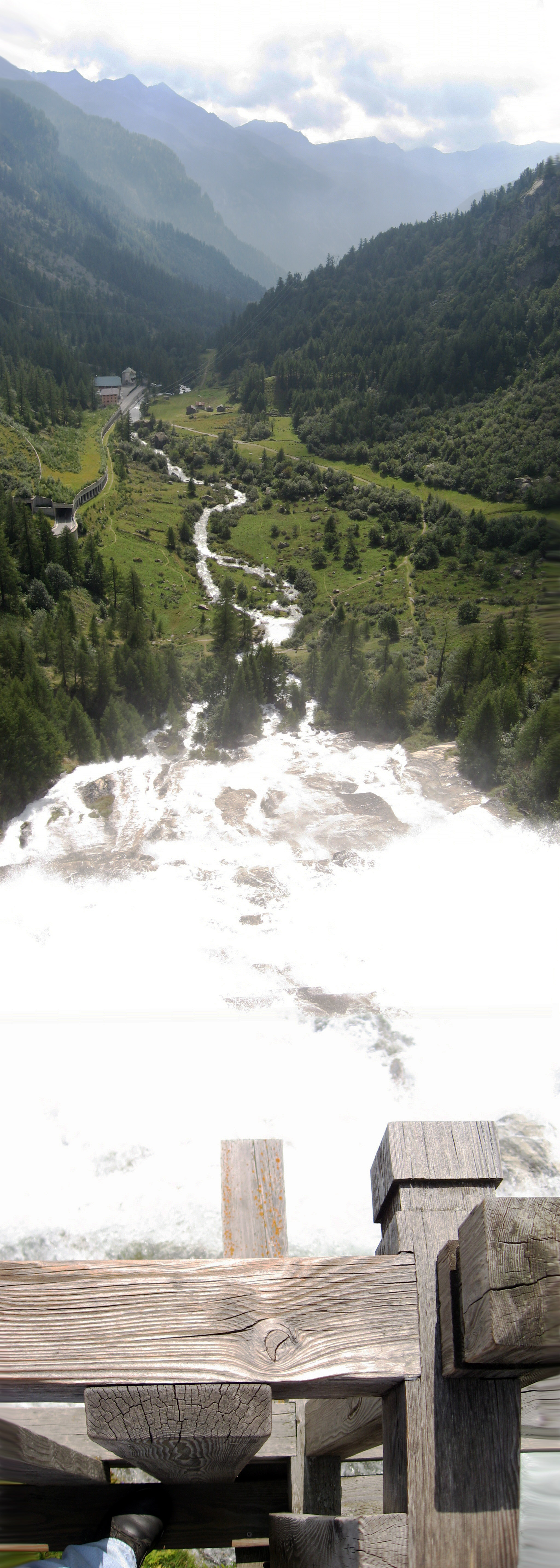
This next picture is a VERTICAL panorama, it starts looking out over Formazza Valley, Italy, then pans straight down to below my feet where the waterfall is.
Later in the day we backtracked to "J" on the map above, then over to the little road marked "I" with red dots on the map. That road is very scenic and fun for motorcycles, yet I have no pictures. :-) The picture below is from the little white road marked "G" with red dots on the map. It seems unassuming on the map and not very long, but that is misleading. It climbs away from Lake Maggiore up into the mountains at an insane switchback rate, up something like 3,000 feet, and takes an hour or more to drive all the way around. The picture below shows a section of the road that detoured through a tiny town at the top, notice the width of the road?!! That is a two way Italian road! Very cute, very pretty, well maintained, paved, just insanely narrow width for a two way road through the mountains.

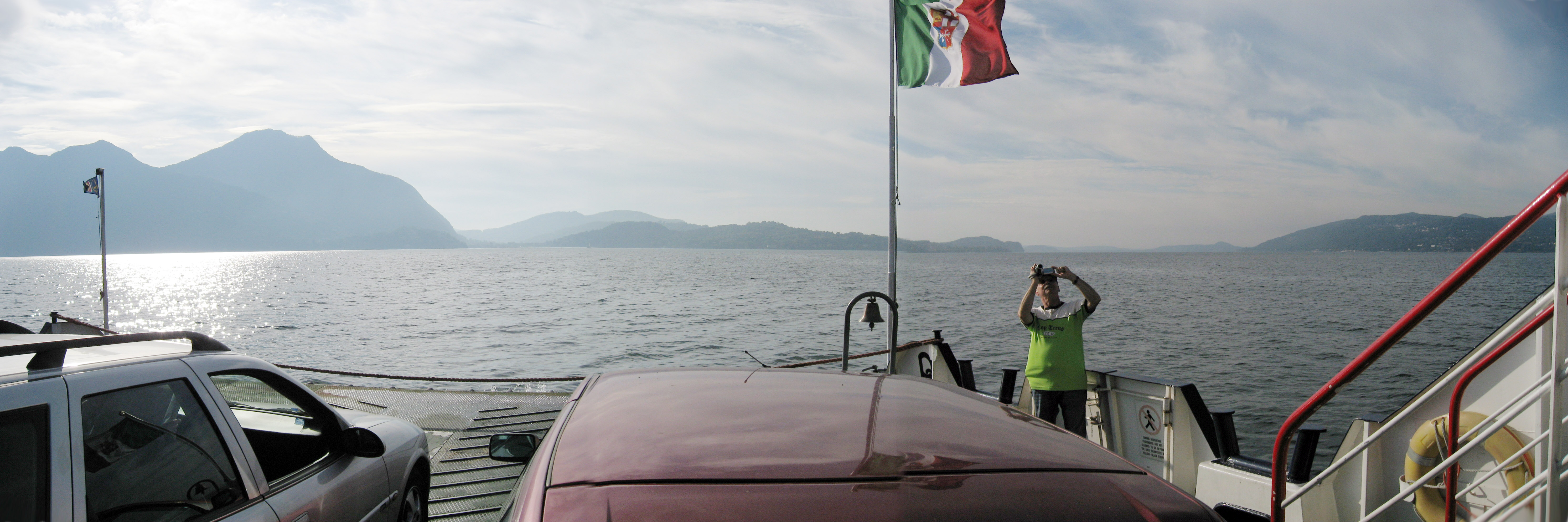
The morning of Friday, 9/8/06, we started out on the motorcycles in Verbania, Italy. We first took the Verbania Ferry to cross over to the south side of Lake Maggiore, Italy. We then took the tiny road up to the Italy Switzerland border at a tiny little town called Indemini, Italy (or Indemini Switzerland?) We ran several Switzerland mountain passes, then crossed over into Austria and stopped at our hotel in the town of Feldkirch, Austria. The picture below is taken on the ferry ride first thing in the morning. My BMW R1200GS is in front, and BrianB's is next, and then some other members of the tour caught up with us just for the ferry ride and they are behind us in this photo.
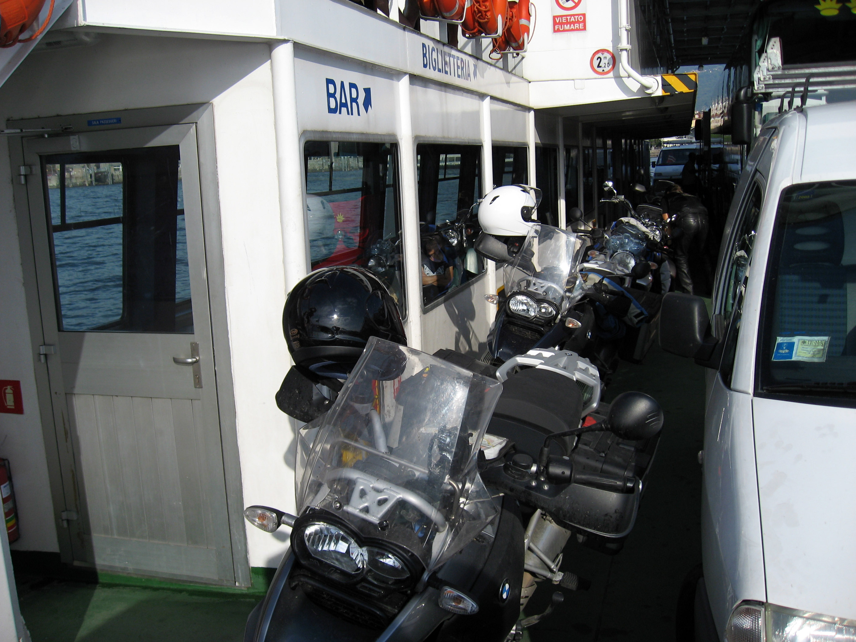
Crossing Lake Maggiore, Italy on the ferry with our motorcycles. We are crossing from north (Verbania) to the south-east side of the lake to the town of Laveno, Italy). This picture facing forward on the ferry.
A last picture of the upcoming coast of Lake Maggiore, Italy as we ride the ferry into Laveno, Italy for our upcoming day of motorcycle riding.

The next part of the ride is a small road looping away from Lake Maggiore, Italy to the north-east leaving the lake at the town of Maccagno, Italy and then across the Italy Switzerland border at a tiny town called Indemini, Italy (marked near the red "M" on the map above) then back to Lake Maggiore, Italy hitting the lake at the small town of Vira, Switzerland. The route is marked on the map above near the big red "M" as red dots. This road is very scenic and very strange, and takes a couple hours to drive (it doesn't seem like it would, but the going is slow and there are more turns and therefore distance than the map indicates). Below is a photo of Lake Maggiore, Italy as we look back just as we begin our climb to Indemini, Italy. That's my buddy BrianB on the right.
The road to Indemini, Italy is very strange and scenic. The picture below is taken after about an hour of driving. The red arrows point out little towns that look hundreds of years old. We passed through each town on the way up, so you can kind of see the route we took getting to this spot. I can't figure out how the townspeople survived hundreds of years ago, it doesn't look like they could farm (there are no farms, only steep wooded areas), and the towns are too remote for craftsmen or trade.

A zoomed in shot of one of the little enclaves near Indemini, Italy.
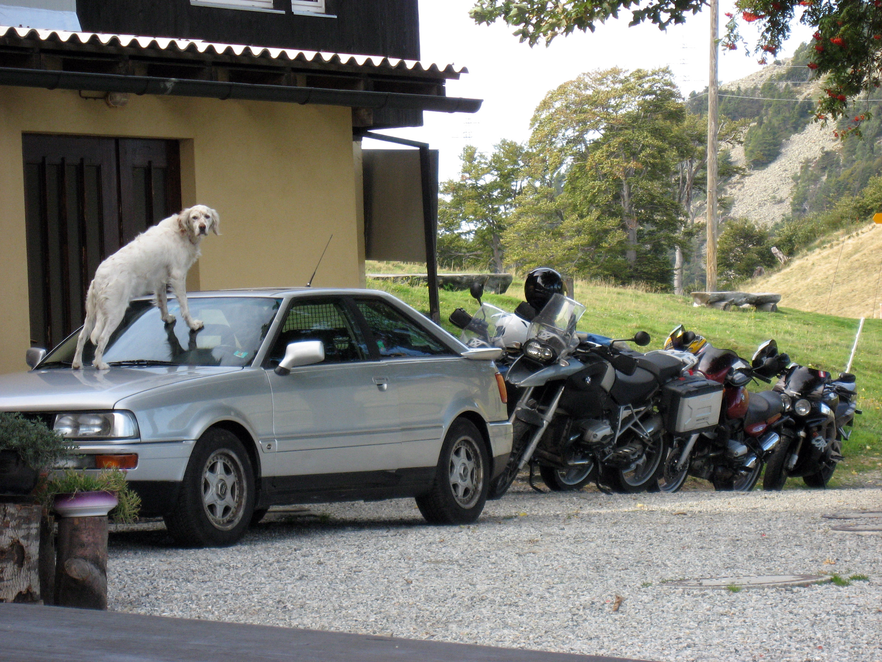
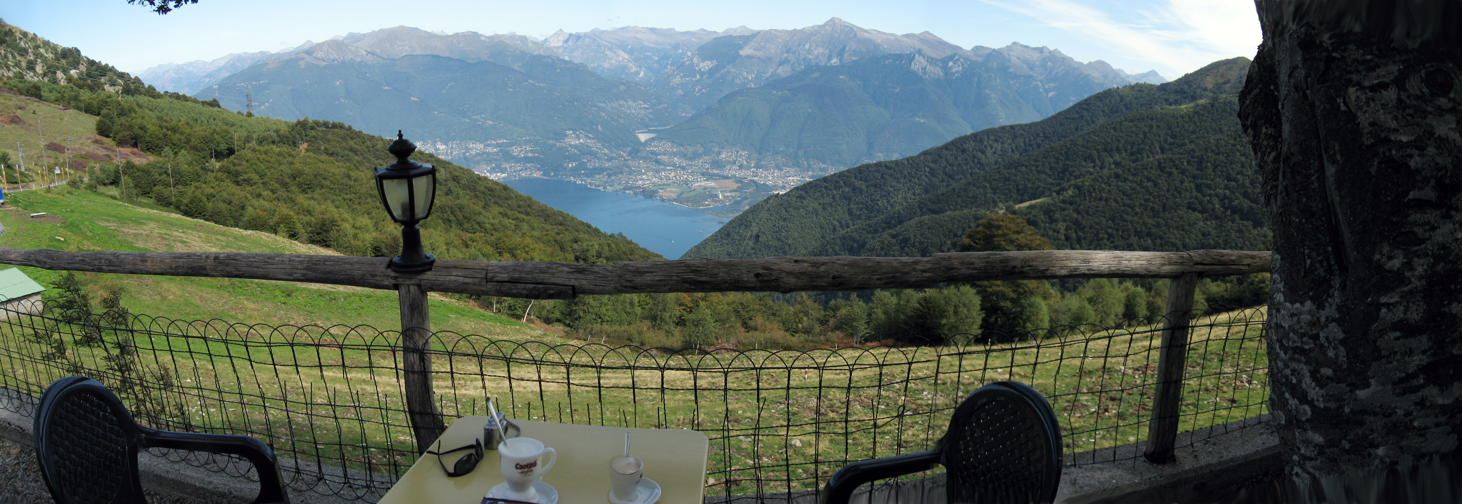
We passed through the Italy Switzerland border crossing, went a little farther and arrived here at the very top of the mountain pass near Indemini, Italy (or Indemini, Switzerland). It is an AMAZING little place to sit and get a cappuccino. When we parked the motorcycles, the dog in the picture below jumped up on that car and stared at the motorcycles wagging his tail.
This is the cappuccino we had, and the view we had while drinking it. This picture was taken about 11:30am, more than 2 hours after we left the hotel, but that is the same lake (Lake Maggiore, Italy) that we started at! We can almost see our hotel from here after more than 2 hours of driving!
Below is a picture taken by BrianB of me (BrianW) in the spot
above waiting for the coffee to arrive.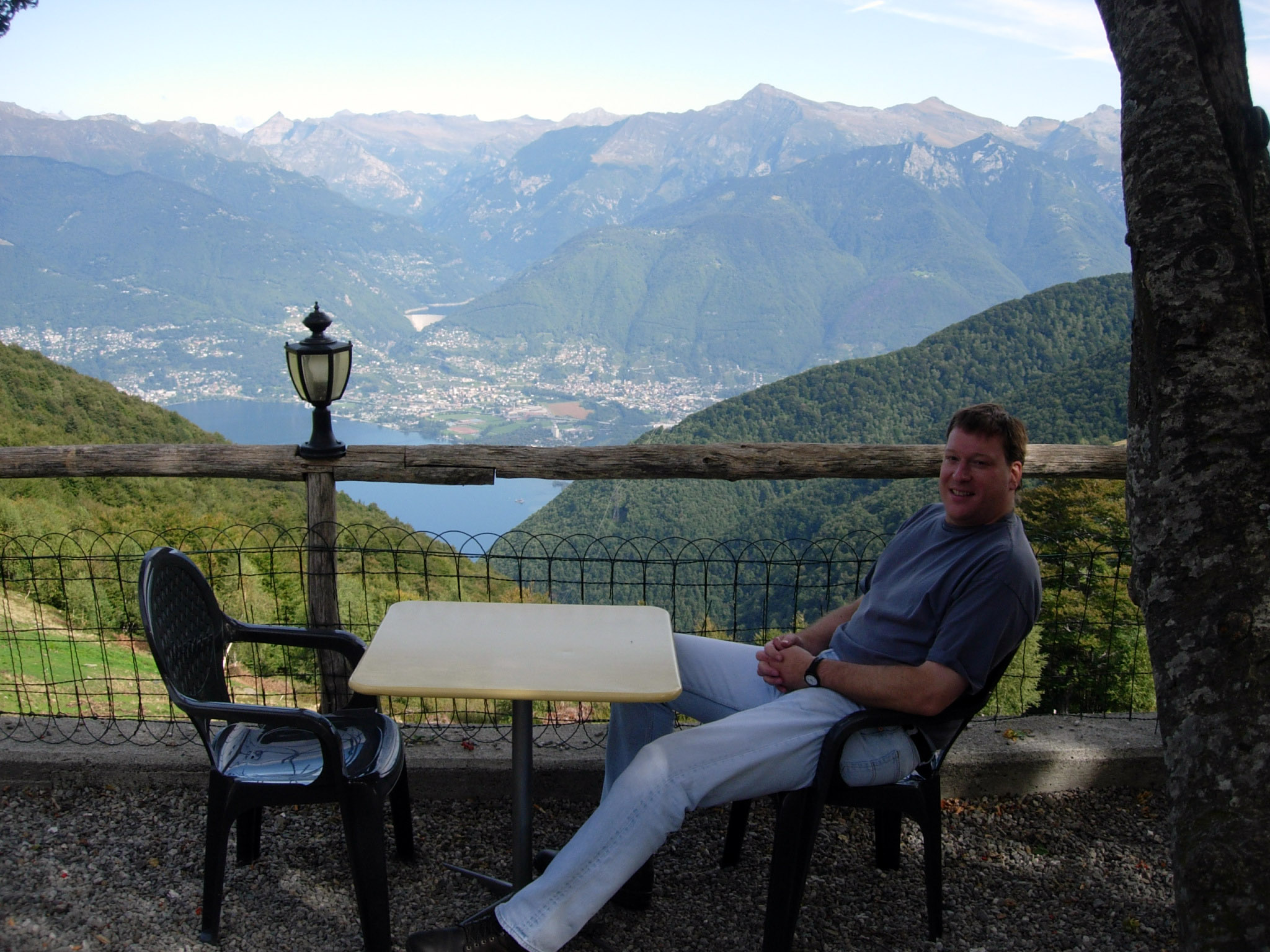
Time to drive our motorcycles through some more Switzerland mountain passes! :-) If you look at the map above, we go straight up from mark "M" to south of mark "E" and turn left across Nufenen pass (Nufenenpass), Switzerland, then on to red mark "B" on the map above.
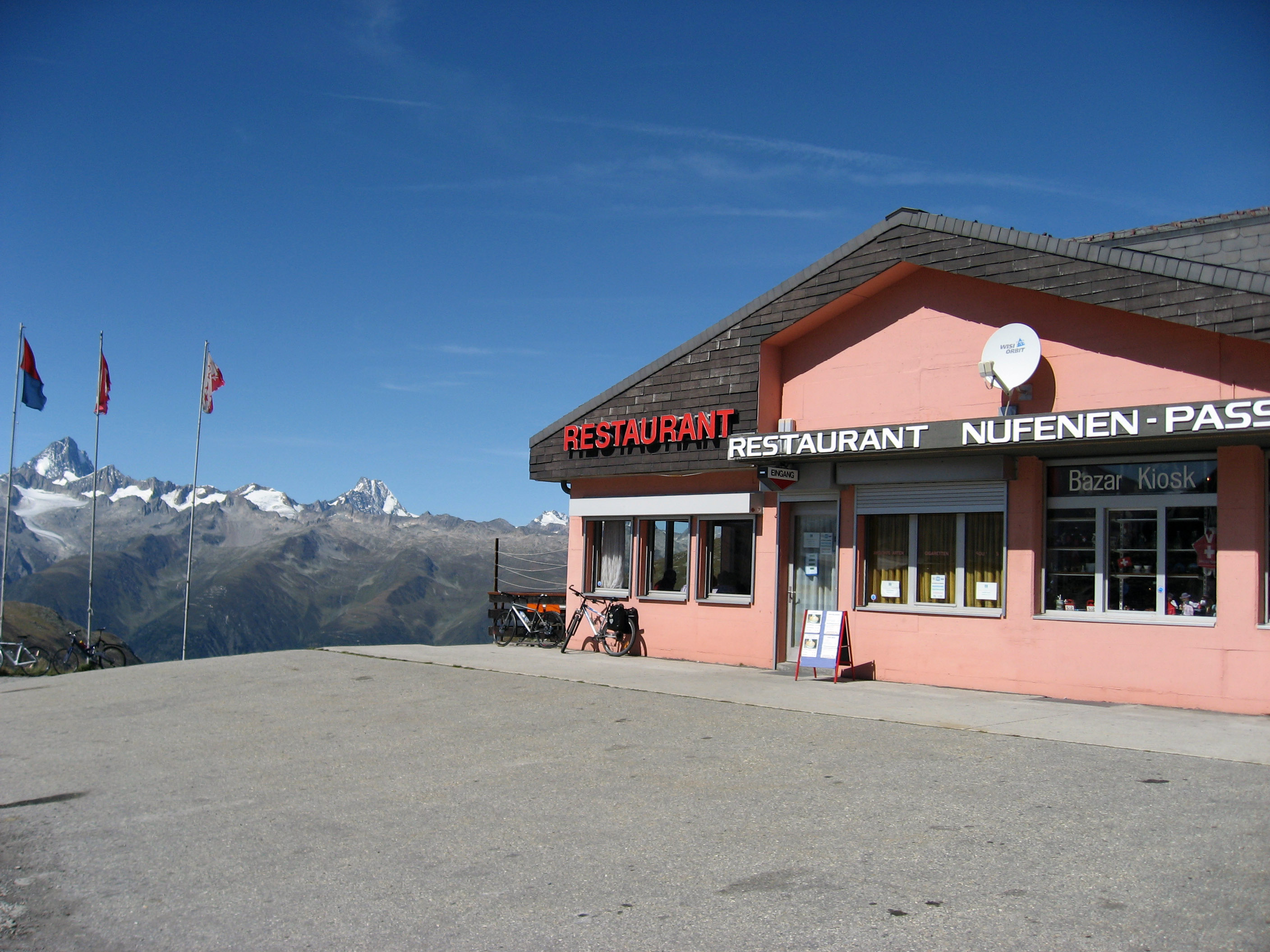
The view from Nufenen pass, Switzerland. We ate lunch here.

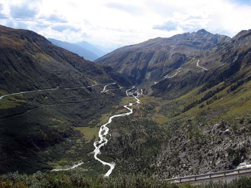
After lunch, we drove the motorcycles on, passing a spot we drove through 2 days before, and then up across Grimsel Pass (Grimselpass) Switzerland. In the picture below, what you see in the middle of the photo is actually the road up Furkapass that we drove up two days ago. To see the picture we took 2 days ago standing on Furka looking back at the spot we are standing now, click here.
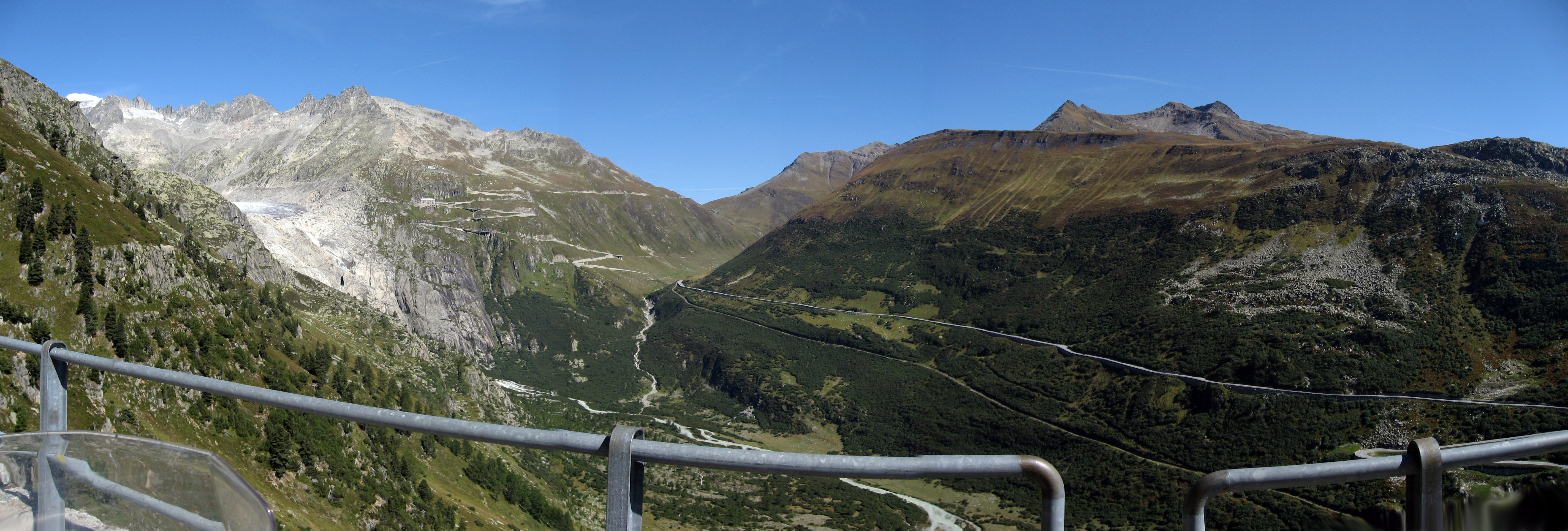
This is taken standing on Grimsel Pass, Switzerland, but the picture is a zoomed in close up of the road up Furka Pass, Switzerland.
At the top of Grimsel Pass, Switzerland.
This was just another 100 yards down the road in Grimsel Pass, Switzerland.
Down into a foggy valley, then back up through the Susten Pass (Sustenpass), Switzerland. The sign has the URL http://www.sustenpass-hospiz.ch/ if you are curious.
We drive our motorcycles down into the foggy valley near the town of Andermatt, Switzerland marked with a big red "D" on the map above. Then we rip up some great Switzerland mountain roads on our motorcycles through Oberalp Pass (Oberalppass), Switzerland. I took this picture as soon as we cleared the fog to show you what we were just driving in.

The top of Oberalp Pass, Switzerland.

We get up on Saturday, 9/9/06 for the LAST DAY of motorcycling in Europe for this trip. :-( So sad! But off we go... in the picture below are Robert and Lois Wilthew, getting ready for their day of riding.
An hour down the way, and our first small pass, which is Furkajoch Pass, Austria. Here is a picture of the sign at the top. :-)
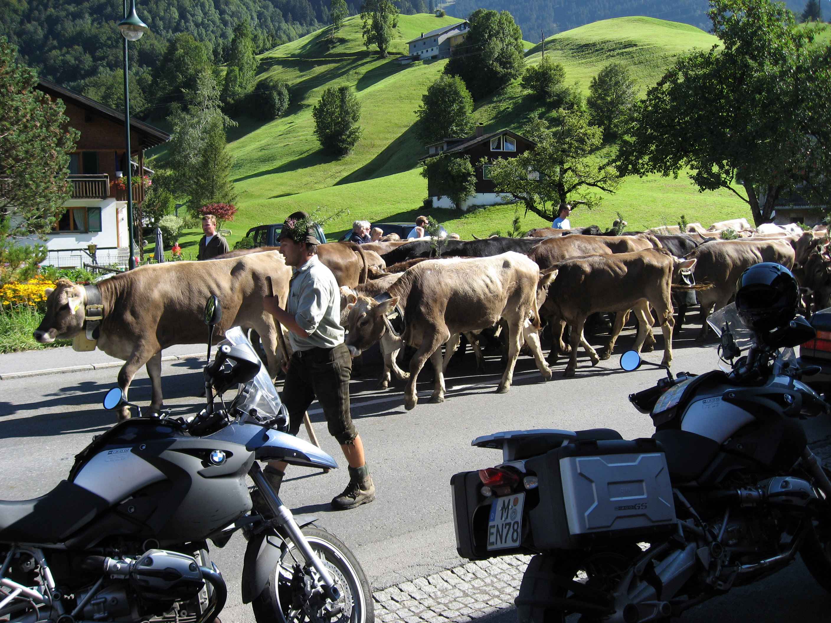
A little further on, maybe 11am, we ran into an annual Austrian festival where they celebrate bringing the cows down from the summer pastures down lower into the winter pastures. We had to pull off to the side of the road to let a bunch of DRESSED UP COWS and goofy Austrians saunter by. Below are the cows approaching.
The kids and the grownups who are herding the cows are wearing hats made out of flower and green leaves, and their dress is fairly uniform in those slightly longer than knee shorts.
We pulled off the road right as they passed, here are the motorcycles in a picture with the cows.
If you want to watch a VERY SHORT movie, make sure your sound is turned on to hear the racket of the cow bells, and click on the movie below. You will need to download and unzip it before playing it.
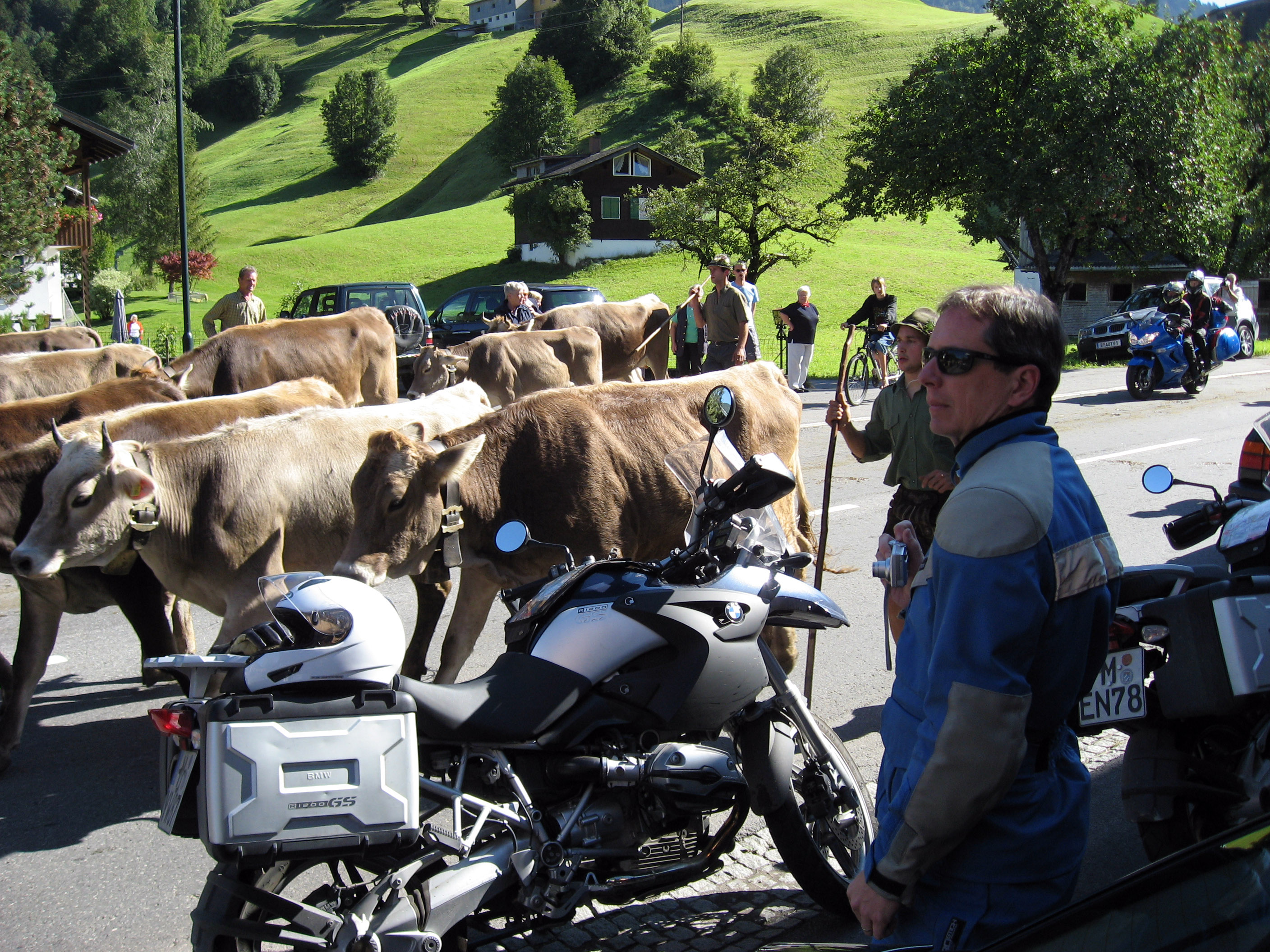
BrianB watching the cows.
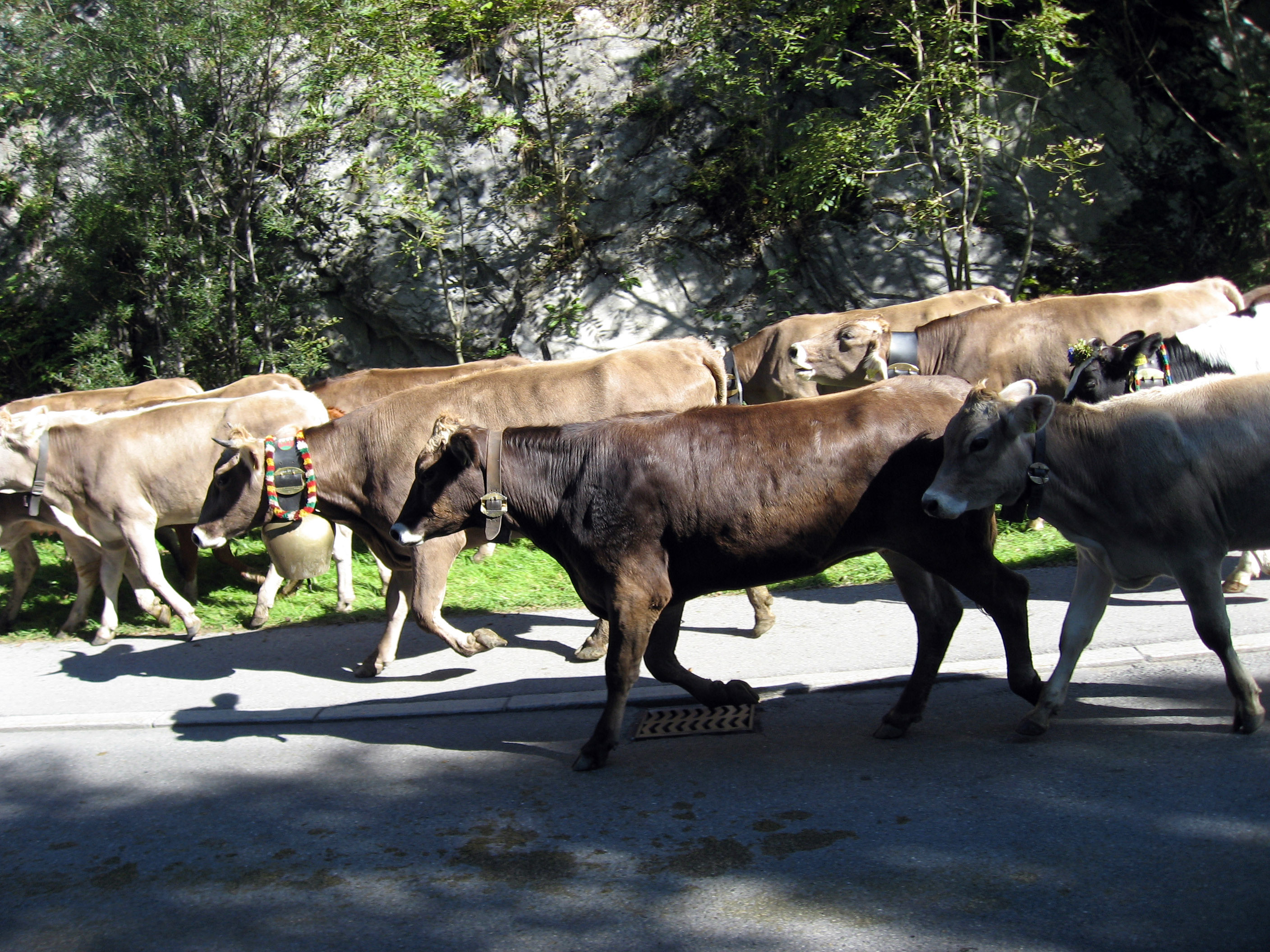
Look, they even decorate the cows! This one has flowers on her head, and a big decorated cow bell.

Look at the enormous cow bells some of these have on. I didn't even get pictures of the largest ones, this was just an example.
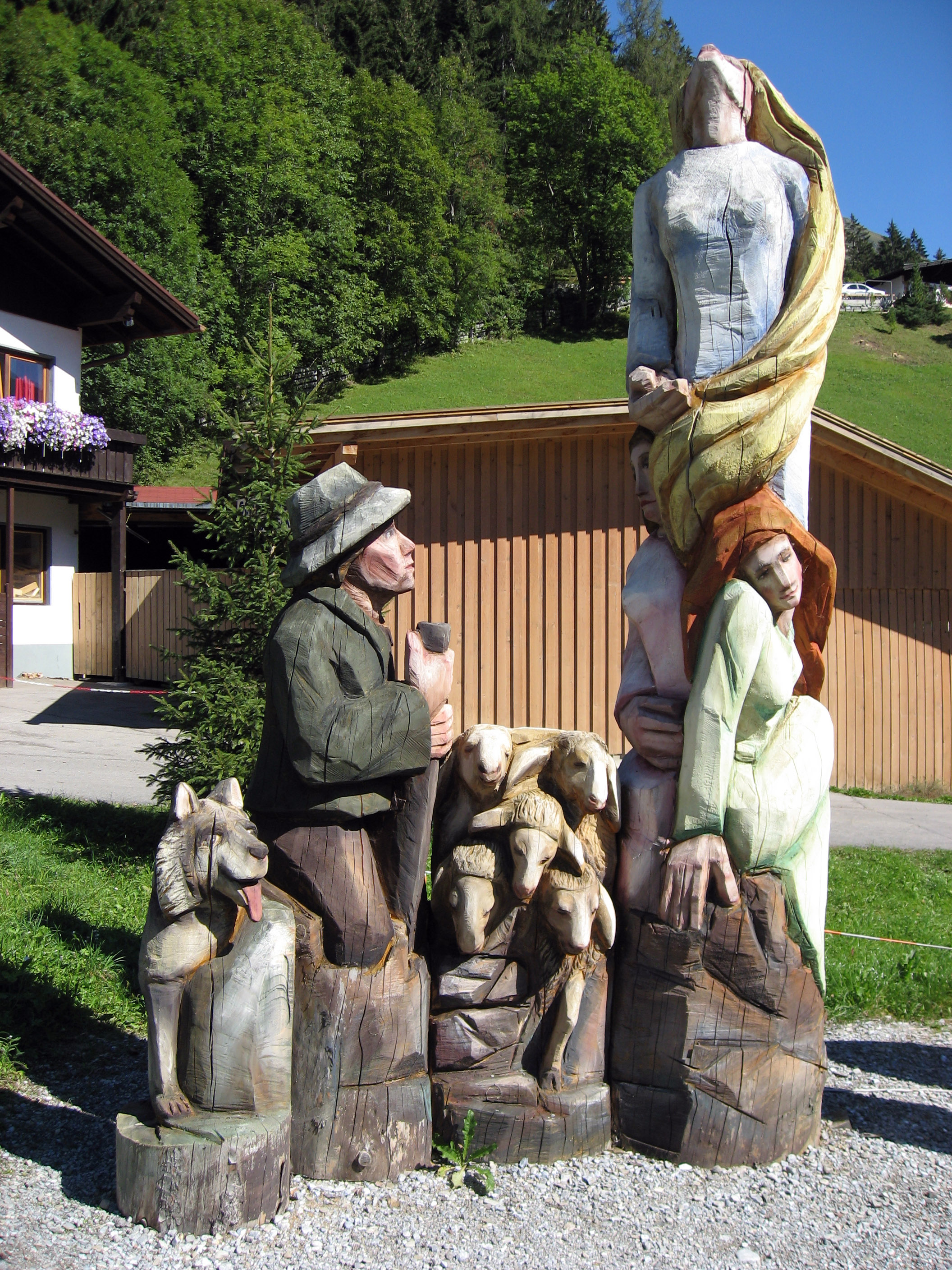
Back on the road, a little further on in Elbigenalp, Austria, there is a tradition of wood working. We stopped at one wood working school. I saw a sign that said "Fachschule für Kunsthandwerk - Bildhauer, Vergolder und Schilderhersteller" so maybe that is the school name? Anyway, there were some big pieces of art in the front yard, here is a picture of some of it.
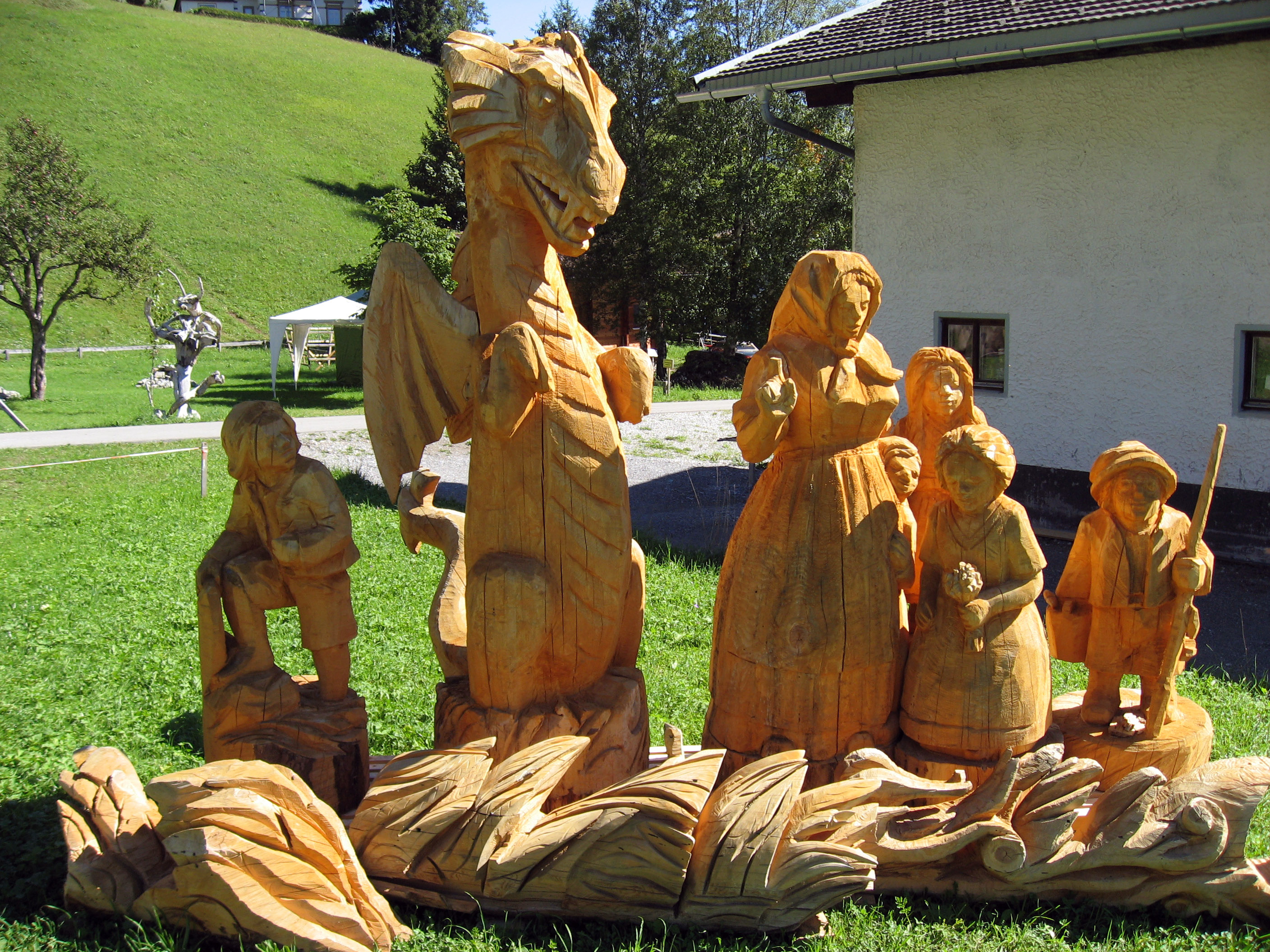
Another piece of wood art there in the front yard.
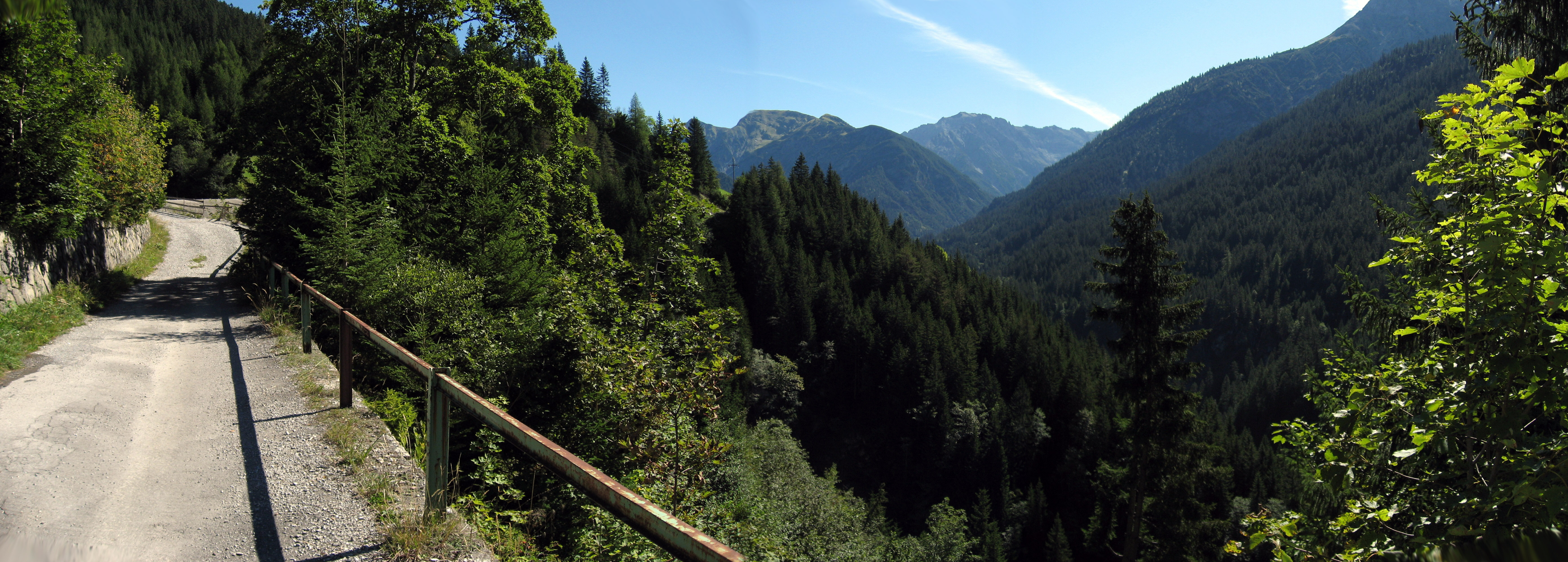
This is a side road that was closed, but it is off of "Hahntennjoch Pass, Austria" which is very scenic. We just stopped for a break here.
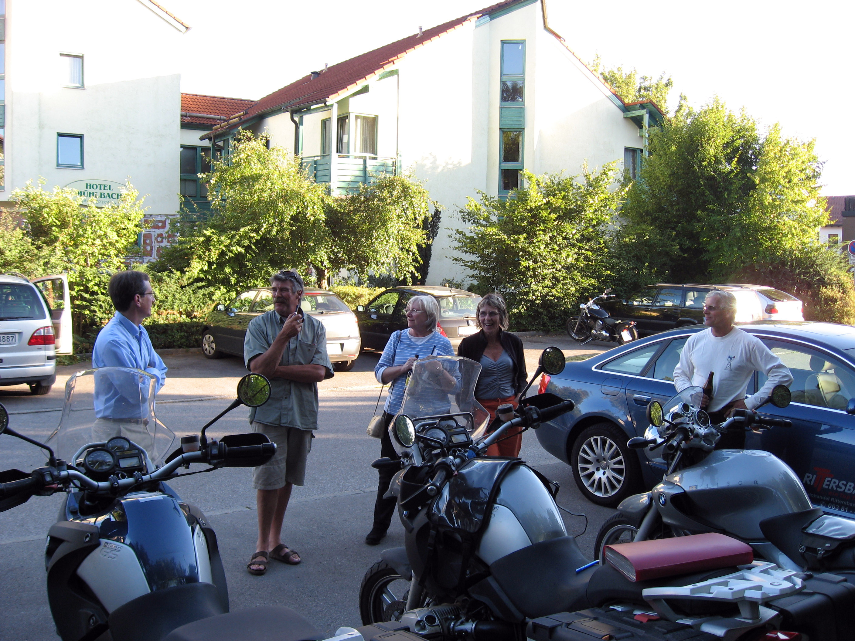
And the driving is finished! Here we are back in Olching, Germany, the tour is over. We are standing around having a beer in the parking lot talking with the other tour members and waiting for the final tour members to come home safe.
All of the motorcycles that are home, all lined up.

Rob Beach, the tour owner, and "The Red Devil" (1989 BMW GS 80?). Another successful tour, nobody hurt in the slightest, no damage to any motorcycles worth worrying about!

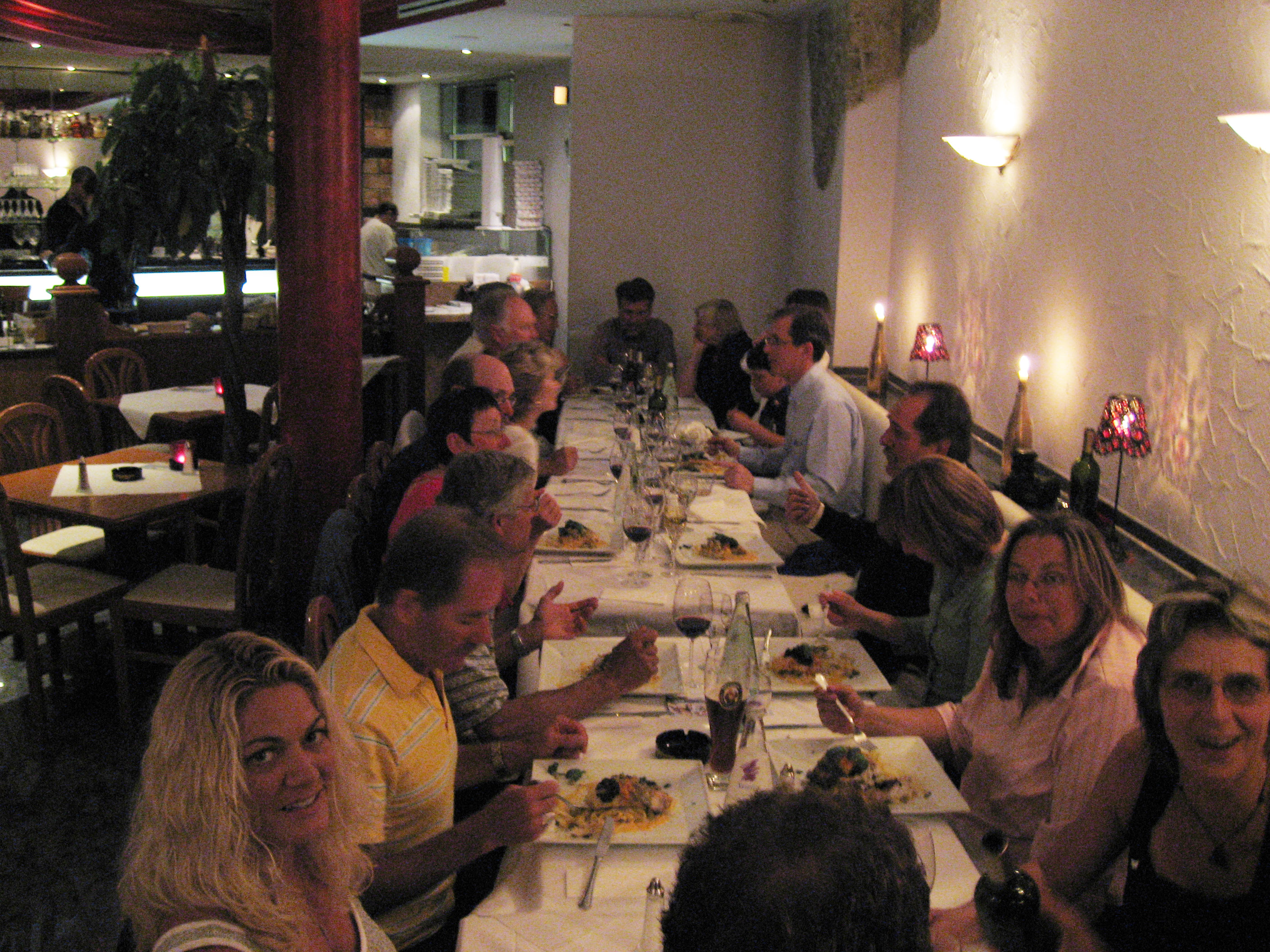
Here we all are at the final tour dinner. I had to brighten this photo to bring out the details.
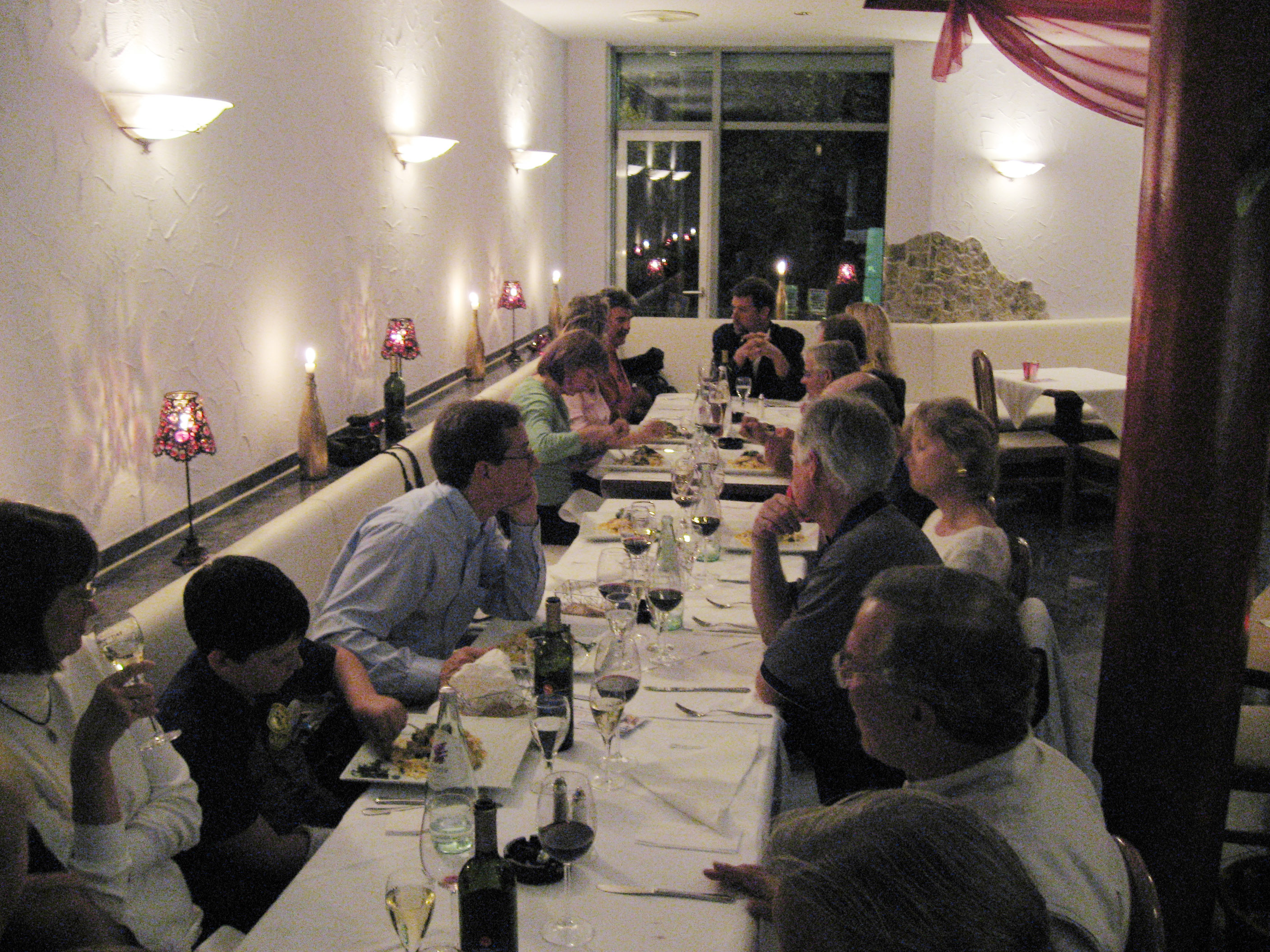
A picture from the opposite end of the same table.
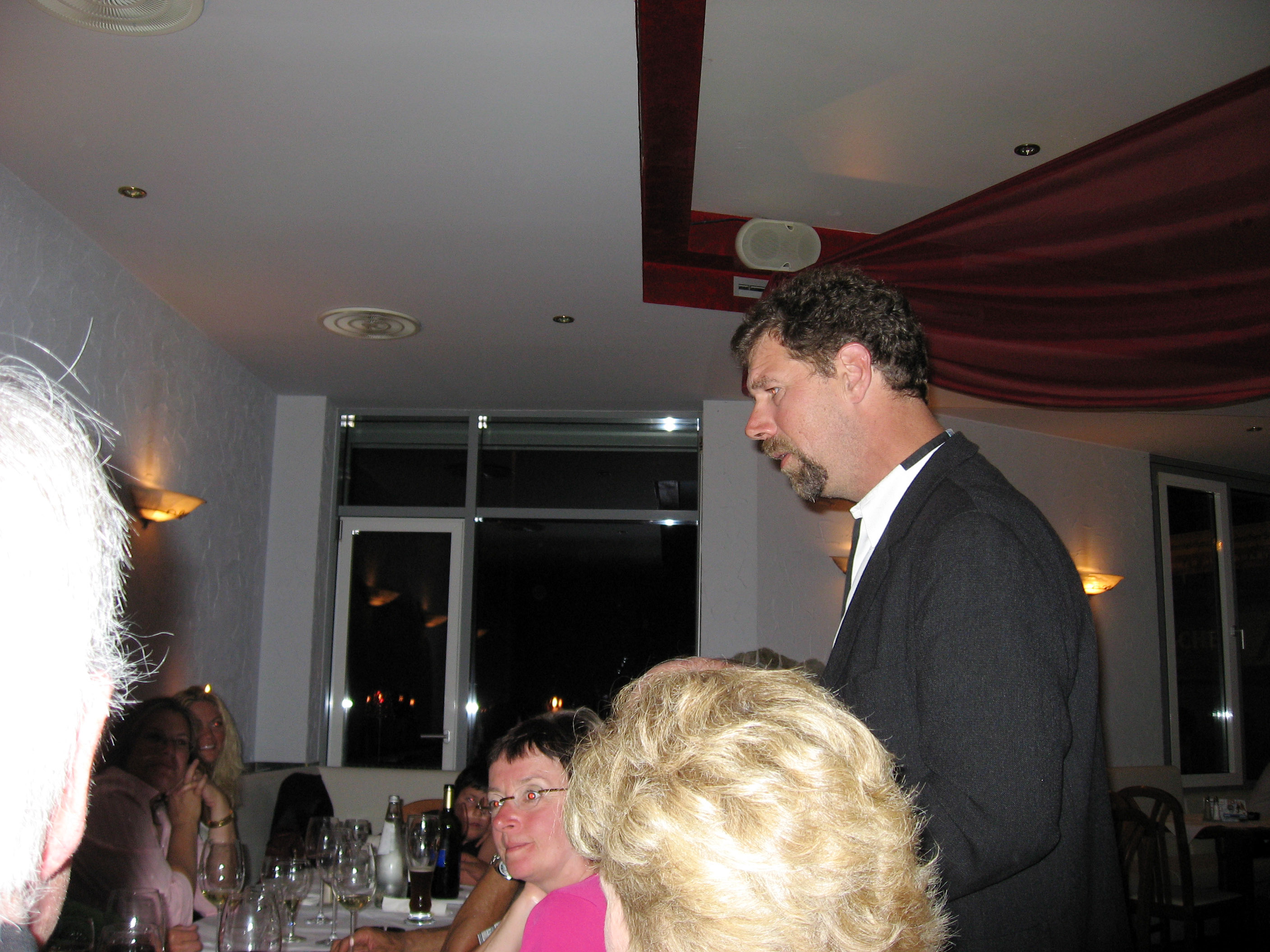
Sarah, Alex, and Al Walker. Al is the tour mechanic.

And Rob Beach gets the final word to his guests.
On Sunday, 9/10/06 I traveled to Amsterdam, then I spent a couple days in Amsterdam, Netherlands *AFTER* a very fun motorcycle trip through Europe. You won't find any pictures of motorcycles any further down on this webpage.
On Monday, 9/11/06, I went for a walk that my "Eyewitness Travel Guide - Amsterdam" (a guide book) recommended which wandered around some of the canals and pointed out interesting architecture and sites along the way. Below is a typical scenic canal in Amsterdam, Netherlands. It is a VERY pretty city to walk through. To see a map of all the canals, click here. All the blue areas on that map are canals.
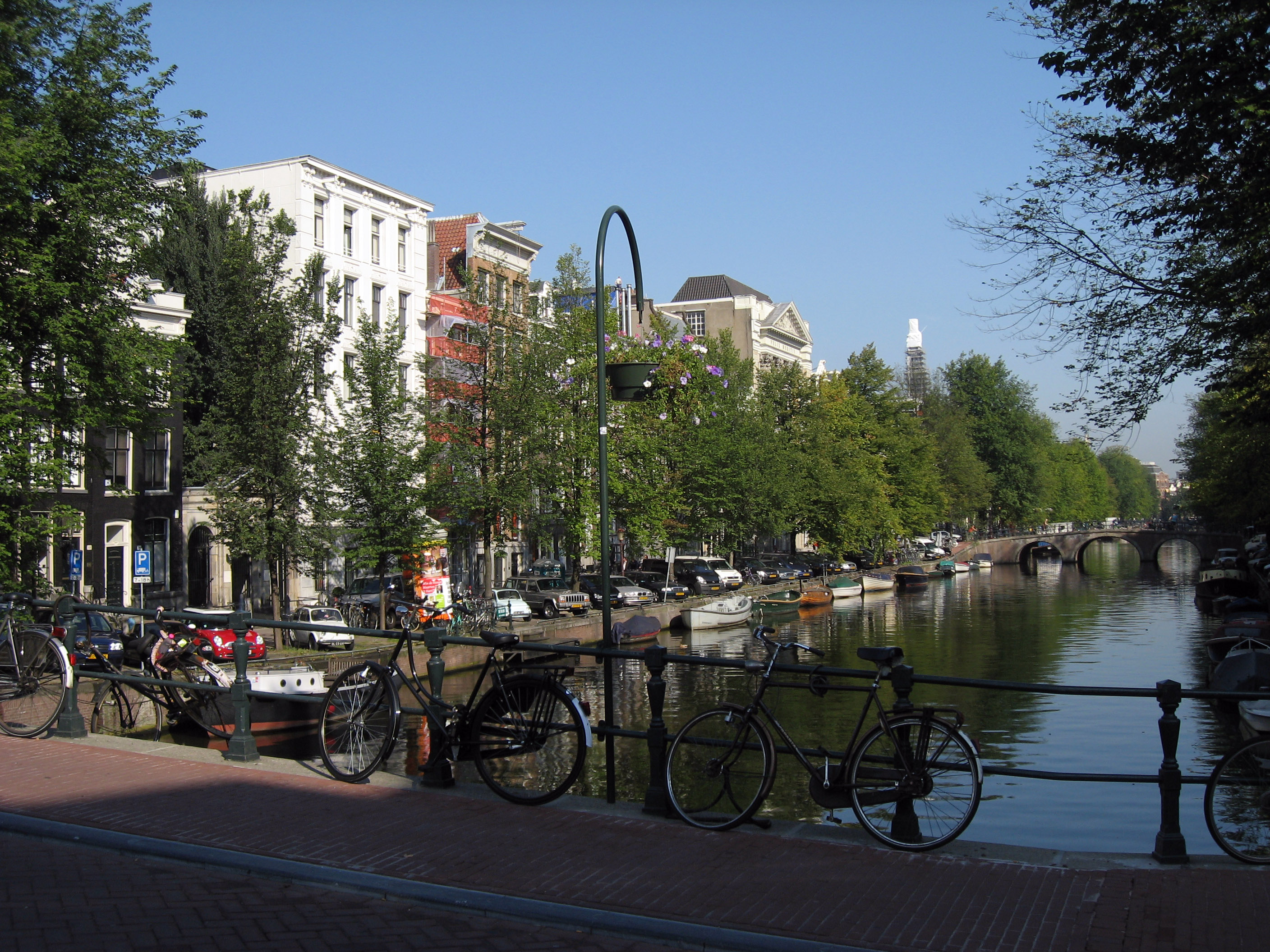
Another typical view from one of the hundreds of bridges across the canals in Amsterdam.
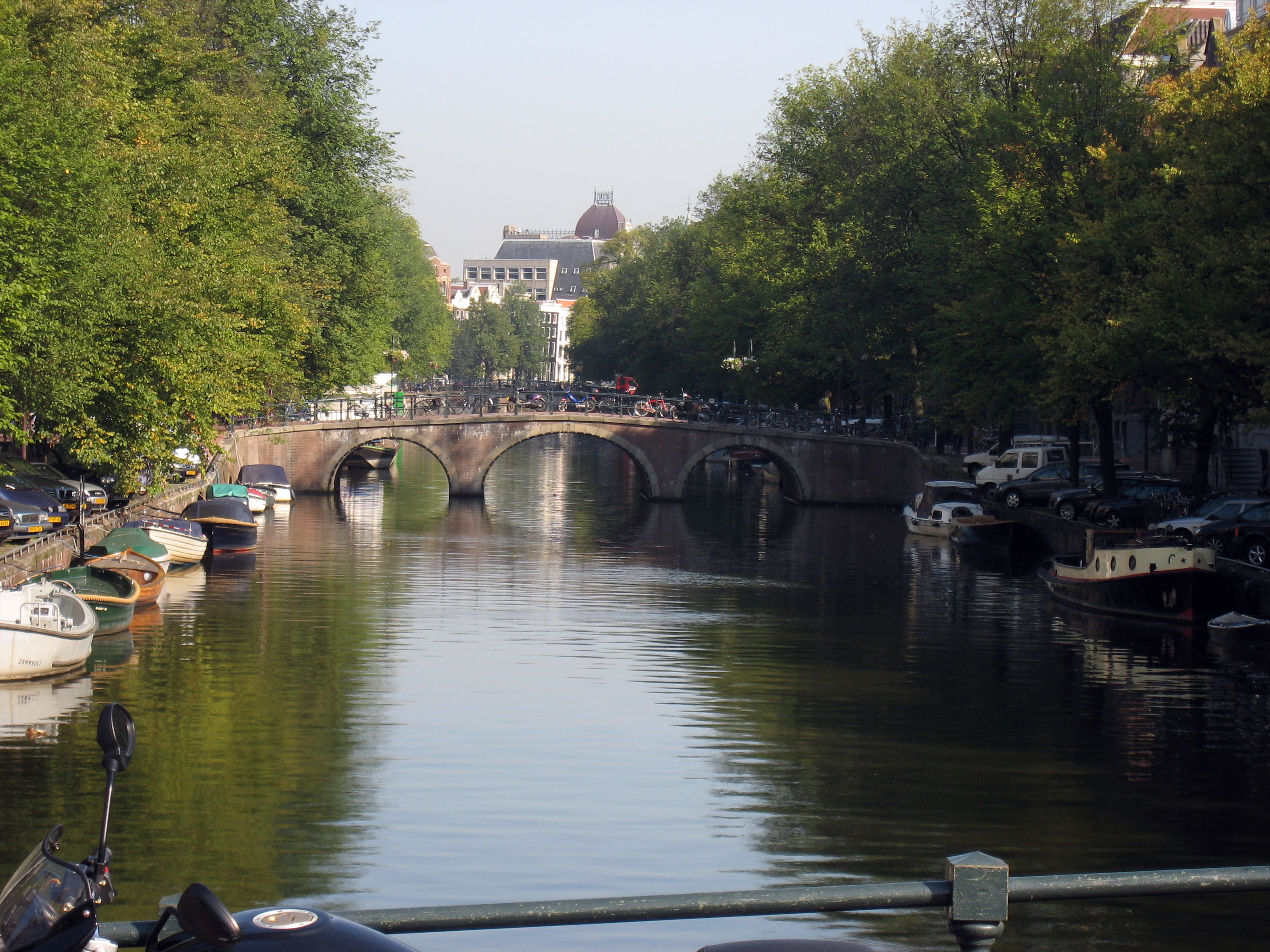
Use your horizontal scrollbar on your browser to pan to the right and see this very pretty canal intersection in Amsterdam, Netherlands.

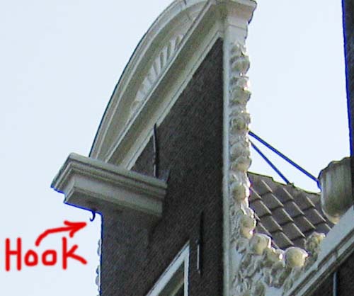
I took the next picture to point out the "Amsterdam Moving Hooks" that are hanging above *EVERY* 3 story house and apartment in Amsterdam. There are no elevators in any of these homes, and the stairways are very narrow, so when somebody wants to put a dresser or couch on the 3rd floor, they winch it up using the hooks that are always there waiting, and bring the large furniture through the windows. See the next picture for a zoomed in view.

Below is a picture of one of the "Amsterdam Moving Hooks" that are above all multiple story buildings in Amsterdam.
The picture below shows that several of the houses have tilted and shifted around in the hundreds of years they have been here. When you get closer, you realize the homes have CUSTOM WINDOWS shaped to the size of the warped window frames, and the houses are mortared and bricked in at these angles. The implication is they shifted 50 or 100 years ago or more, and have been stable ever since.

My "Eyewitness Travel Guide" book says the famous draw bridge pictured below is called "Magere Brug", originally constructed in 1670 but the current bridge was built in 1969. The Magere Brug is a "traditional double-leaf Dutch drawbridge".
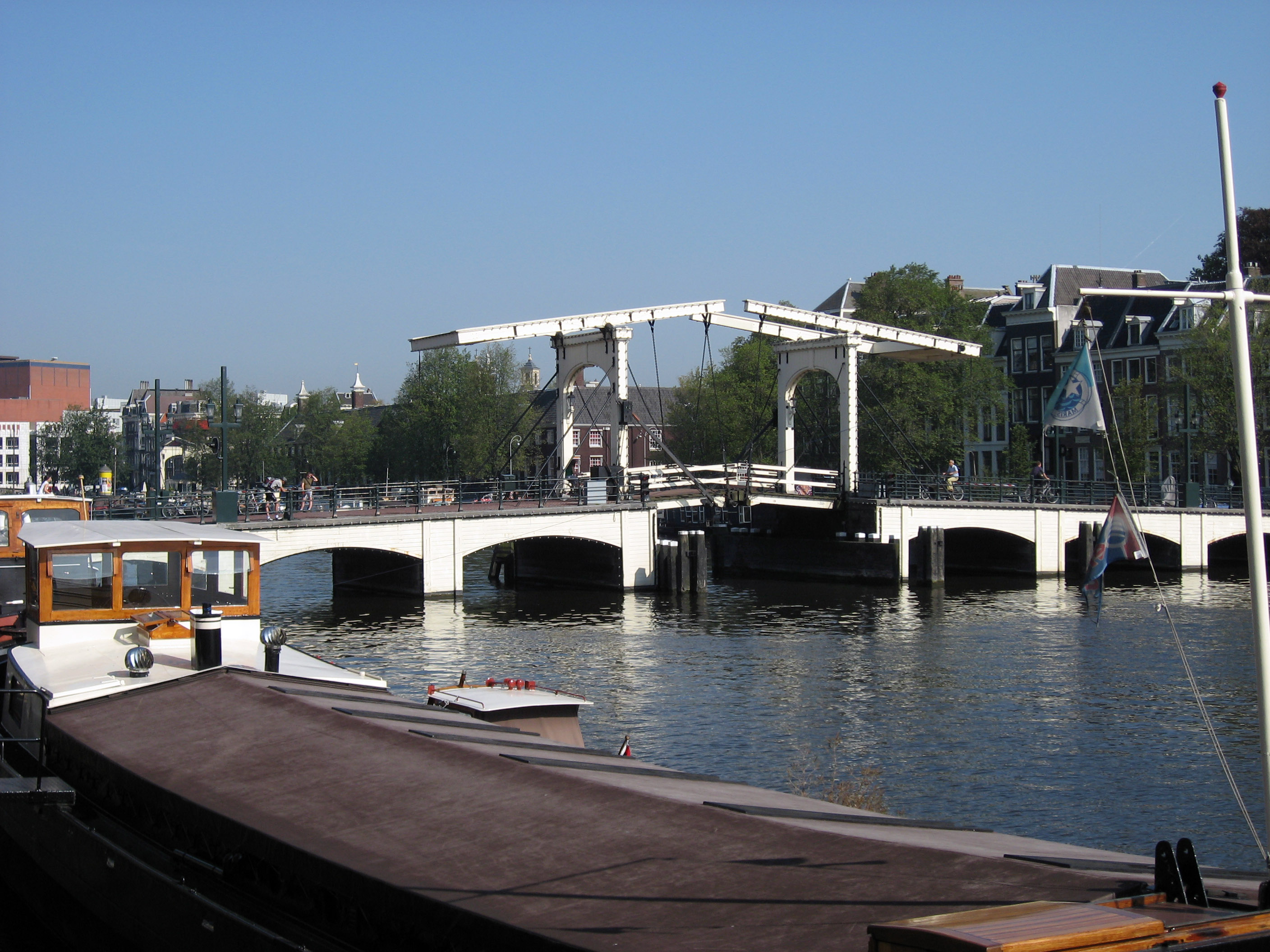
The boat approaching the bridge will not use the drawbridge span-> instead, like most boats in Amsterdam, this boat is designed to shoot under the lower spans of the canal bridges.
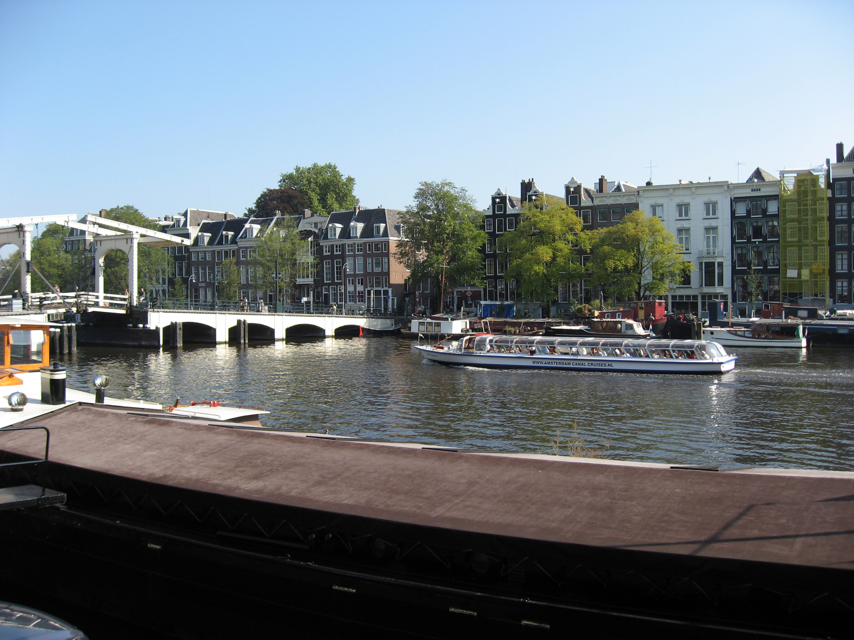
A different and closer picture of the Magere Brug drawbridge in Amsterdam, Netherlands.

This next picture makes me happy to think about. It is taken from a cafe called "Villa Nieuwmarkt" in the famous and scenic "Nieuw Markt Square" in Amsterdam, Netherlands, which is a nice place to spend a relaxed afternoon reading a book, or like in the picture below, having a Heineken beer. :-)
Below is a panorama of Nieuw Markt Square in Amsterdam, Netherlands. In the center of the square is "The Waag" which was a Gatehouse built in 1488 as a gateway through the city wall, which makes it a Medieval structure. People have been walking these streets right here for over 500 years, and it has been CIVILIZED with military and churches and city planning for that long.
Another big famous square in Amsterdam is pictured below, which is "Dam Square", Amsterdam, Netherlands. It is also a good place to spend a few hours reading or just people watching. One of those large buildings has the sign "Madame Tussaud" (hard to see unless you click the picture below to zoom in. It is a wax museum I wandered through, mostly to get a good view of the square from up on high.
Of all the weird touristy silliness in Madame Tussaud's wax museum, I thought this was the worst -> The Spice Girls in wax. :-) Very cheesy stuff.
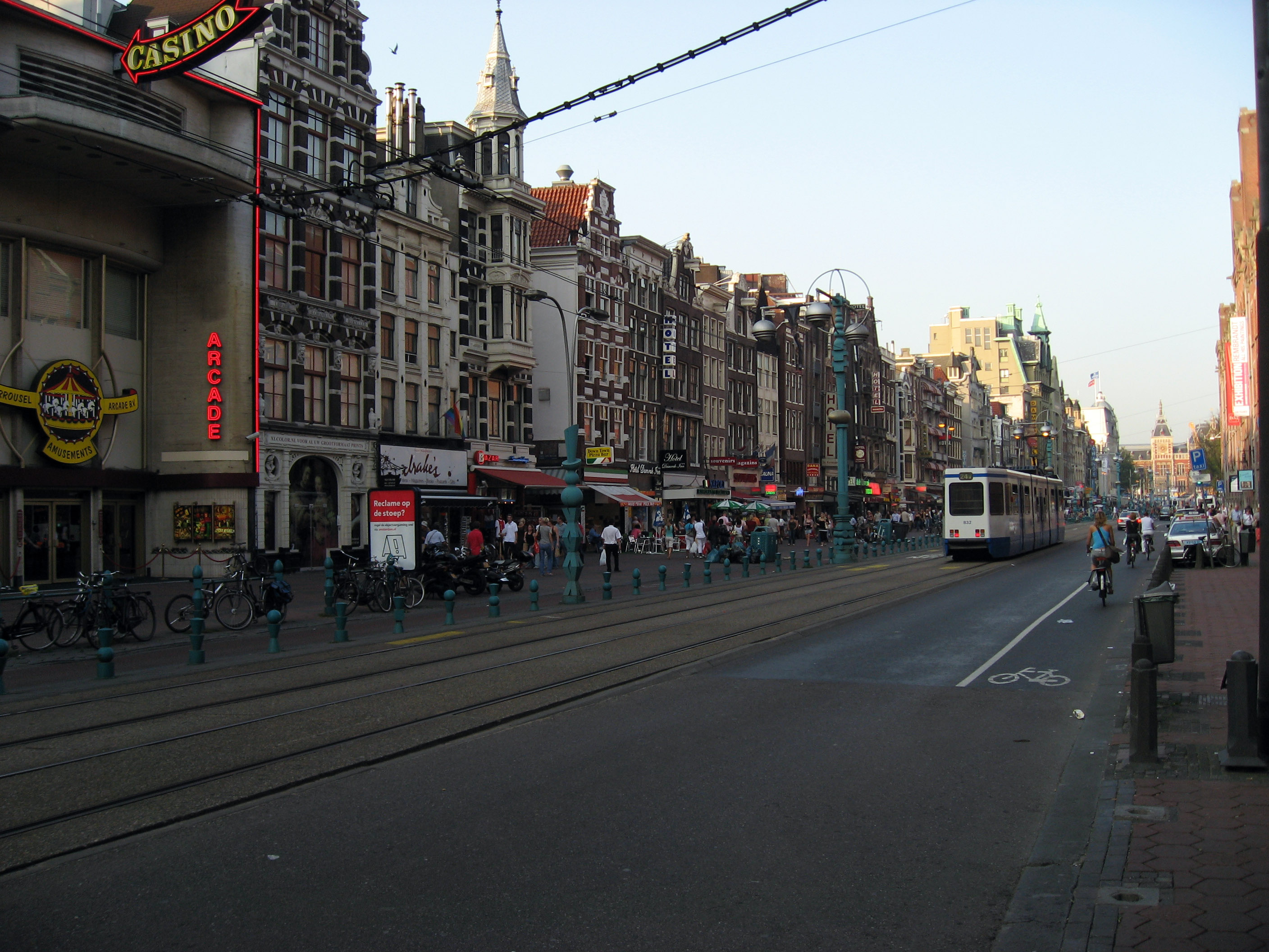
Below is a picture of Damrack Street in Amsterdam, Netherlands. My hotel is on this street, which is near Central Station and walking distance to most interesting historical parts of the city.
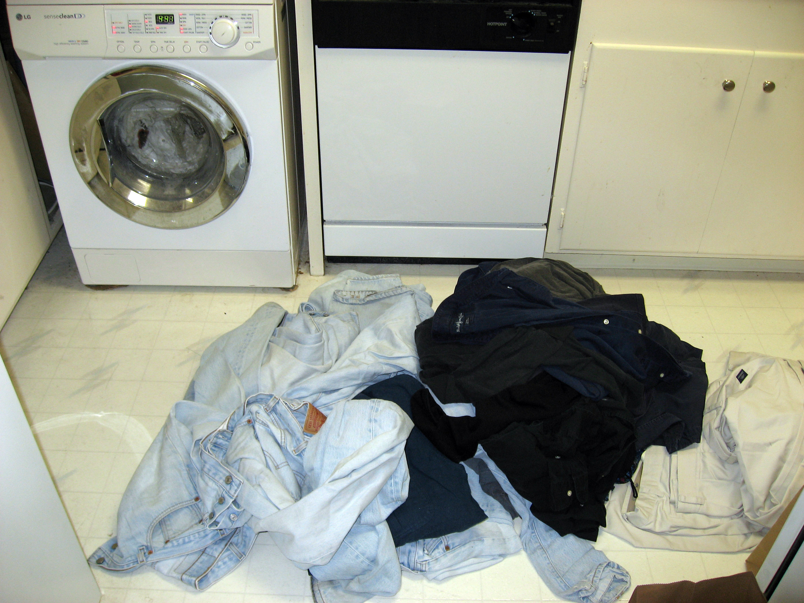
And finally, a flight home on Wednesday, 9/13/06. Time to do 3 weeks of laundry in my home. And that is the end of my vacation! I hope you can find something useful or entertaining from these pages.
If you want to see a few pictures of me (BrianW), click pics_of_brian_wilson which are all taken by BrianB. Also click Amsterdam_Bicycles to read about lot of Bicycles in Amsterdam, Netherlands. I took these pictures while on this trip.
This webpage, and all of http://www.ski-epic.com are yours to enjoy. Feel free to use any pictures found here for any purpose you like, with or without credit. I grant you full rights, for free, forever, to do anything you want, including redistribute the pictures with or without any credit to me. This isn't my job, it's just my vacation website. Enjoy!
(Read
a personal
description of Backblaze here.)
END OF NEW ADDITION
Return to 2006 Europe Motorcycle Trip Top Level
![]()